SWCP Walk Part 2, Day 3. Westward Ho! to Clovelly.

Sunday 12 June 2016 – Clovelly, Devon.

Day three of three, almost over already. However, today was what the last two days were building up to. No more tar seal, no more flat wide paths, just up hill, down hill, mud and rock. All accompanied by the sound of the sea. Yes!

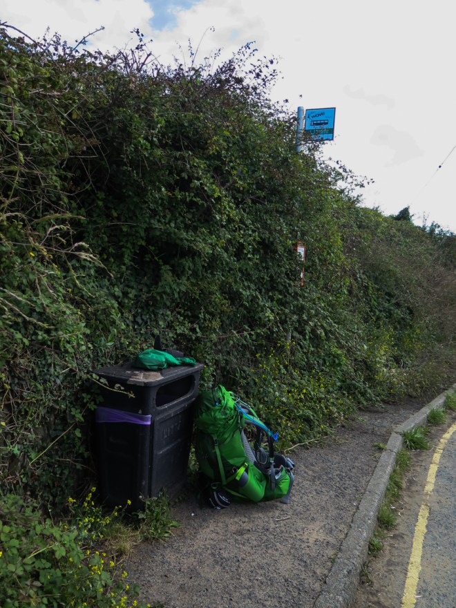
I was awake fairly early and out for breakfast at the agreed time of 8:30. It was nice to have breakfast with other people after a couple of days on my own in B and B’s. Jilly the Air B n B hostess had family staying, we had all travelled extensively at different points in our lives so had some common and interesting experiences. It also helped me delay my departure until after the first shower of the day had passed.

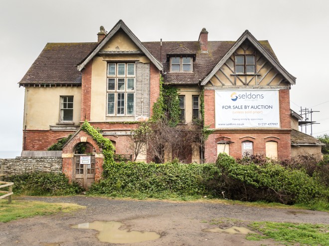
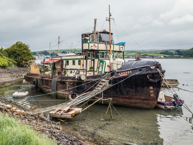
I left as soon the rain stopped and got down to the waterfront just as the next shower arrived. Westward Ho! has its own haunted house on the edge of town, I wonder how long it has been for sale? Right next to a massive, and expanding holiday camp; I wouldn’t buy haunted or not, though it is right by the beach. I had to stop to put on my jacket and pack cover. They stayed on for quite a while. My jacket is hopeless, it keeps the rain out well, but it is not designed for warm weather walking. I was wetter inside than out, no breathability at all, I am going to have to invest in a new summer jacket before I start my next stage of walking.

IMG_4290

IMG_4291

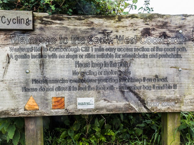
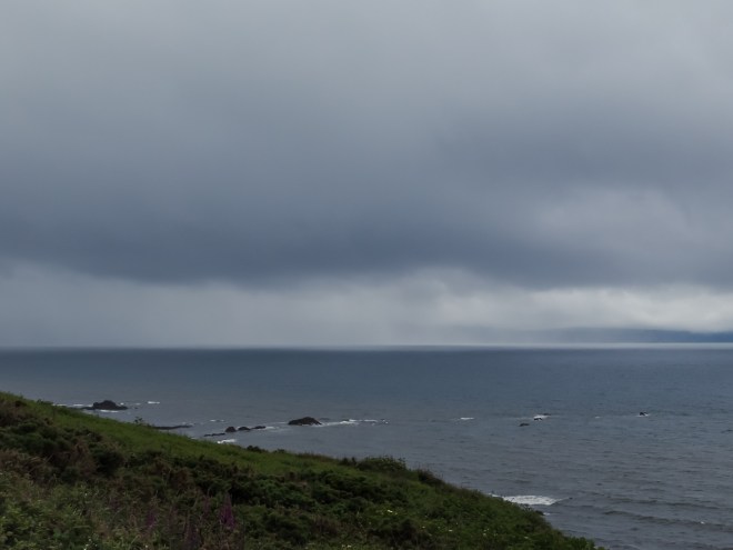
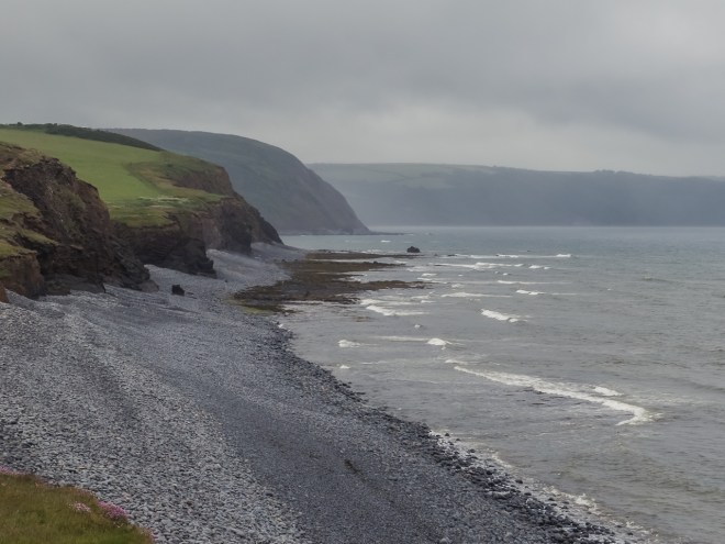
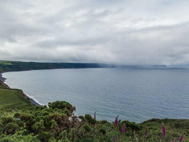
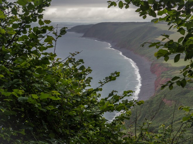
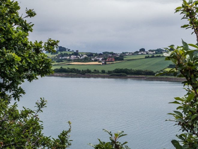
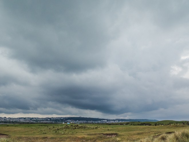
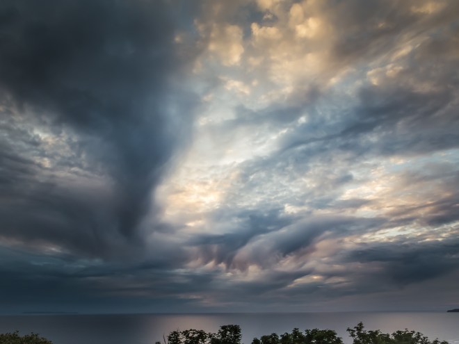
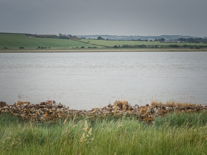
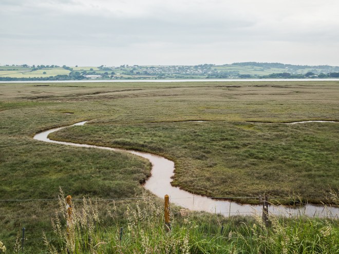
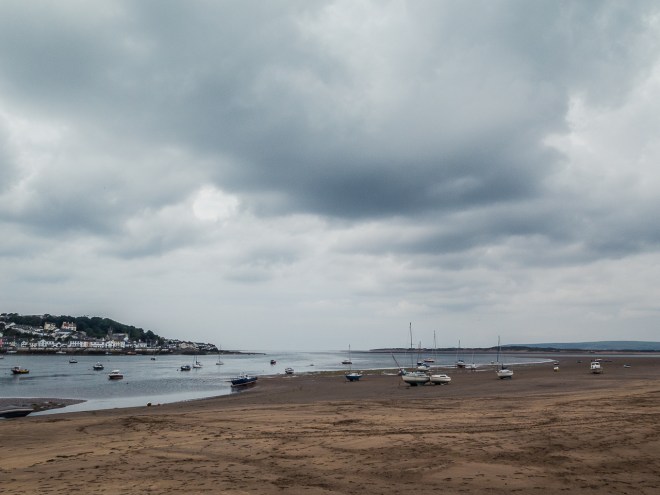
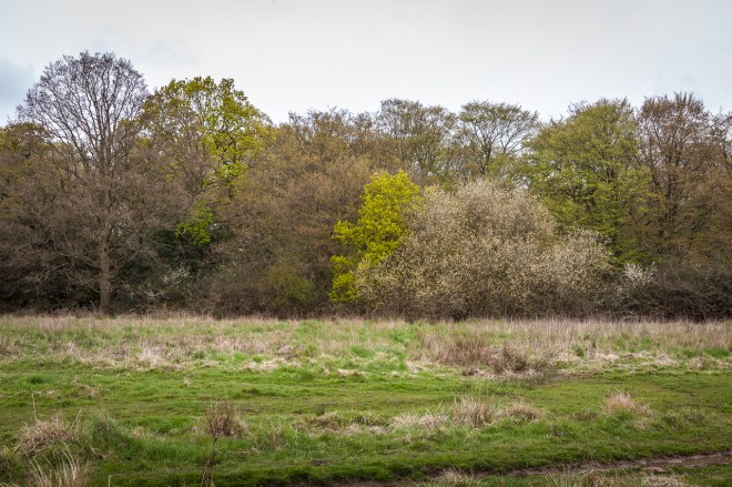
The first kilometre out of Westward Ho! follows a cliff side path that seems to be popular with dog walkers, local runners and all sorts of people, there were even two couples that looked to be doing a long walk as well, carrying heavy packs and walking poles. I was hoping it was not going to be that crowded for the entire day. The view towards Clovelly, my destination at the end of this 17 or so KM walk was rather gloomy. I knew it was out there somewhere.

IMG_4293

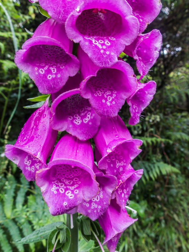
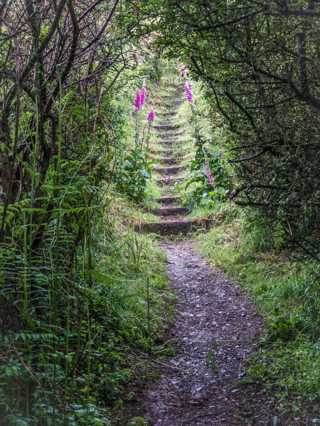
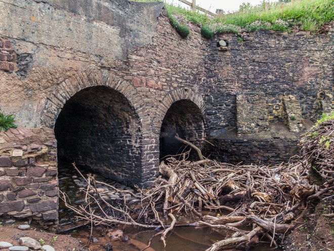
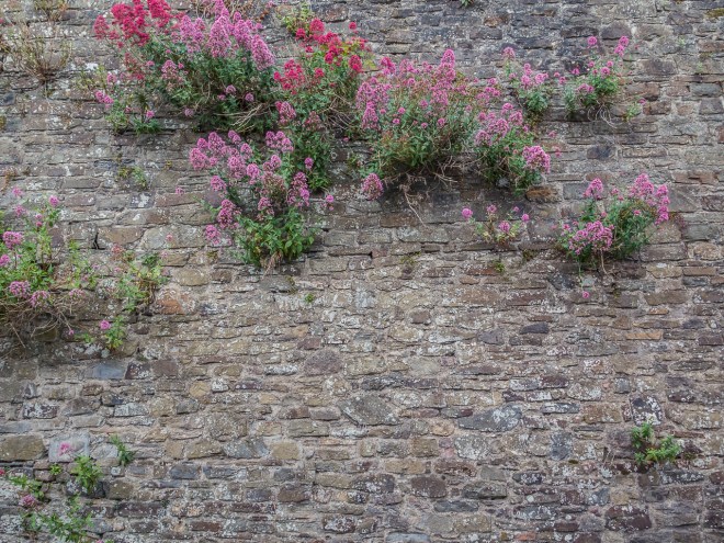
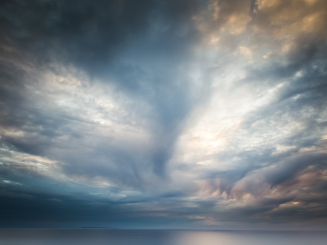
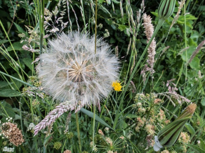
This was to be the toughest of the three days walking, there is a lot of up and down to complete and with a slippery trail underfoot precautions needed to be taken. I will say that I was glad when I did arrive in Clovelly, my legs were done. It is a stunning section of coast, and though the weather did not come to the party and it was a bit miserable out there, I was relishing being out in the ‘wild’ again. I was mostly on my own, there were a couple walking at a similar pace to me and we chatted on the numerous occasions we passed each other. The view, both in front and behind kept appearing and disappearing, along with rain showers all morning, fortunately the rain was light for most of it and I did not get overly wet, but I did have to stop and I took a lot of photos today. The cliffs, the path, the flowers and the old lime kilns.

IMG_4302

IMG_4297

IMG_4304

IMG_4305

IMG_4306

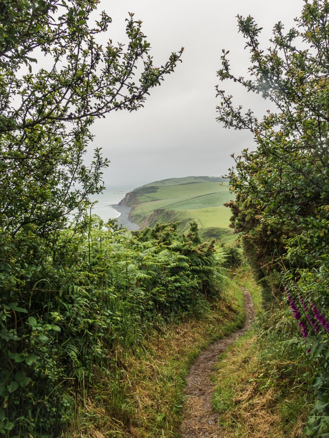
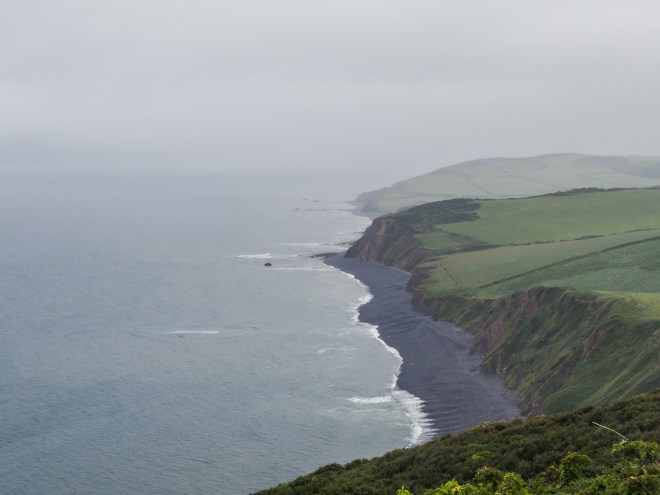
Clovelly still refused to make an appearance, though Bucks Mills was a small dot half way along the cliff side..

IMG_4309

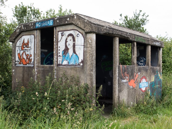
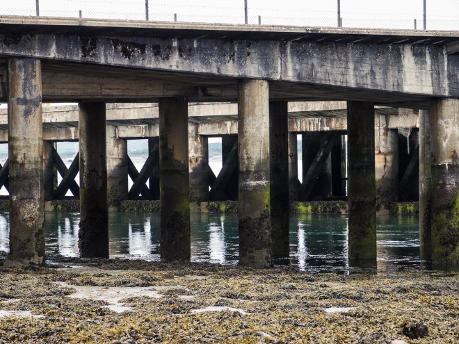
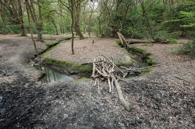
The path dropped down close to the beach in a couple of places, and in both there have been efforts to corral the vast amount of rubbish washed up each year. At this particular spot someone had made a crude shelter and this great seat out of drift wood and netting, nearby there were piles and piles of washed up plastic junk. Well done to the volunteers who go out to clean our beaches and park lands. It started to rain again just as I was taking the picture so I did not linger, much as I needed the rest.

IMG_4314

It was back up hill, yet again.

IMG_4315

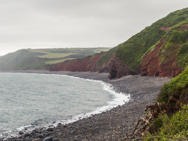
Peppercombe Beach was my next break stop, the red cliffs here are quite unusual so worth the extra few minutes walk down to the beach, though my legs were cursing a bit as I walked back up again.

IMG_4318

IMG_4326

There was still no sight of Clovelly in the distance. I had caught glimpses of it earlier in the day so knew it did actually exist.

IMG_4320

Naturally there was a climb out.

IMG_4331

IMG_4335

Bucks Mills was the next stop point, and where I had planned on taking lunch. As I was coming down the wooded hill in to the village I knew I had been here before and exactly where I was going to pop out. This was one of the stop points where we met Malcolm and Tom when they ran the entire 630 Miles of the path back in 2012 and I was support crew. This was also when my obsession with the path started, I blame them.

IMG_4343

The preceding two days walking had lulled me into an act of complete stupidity, something I am slightly prone to. I had got used to just walking from town to town, picking up water and snacks as I went. Well there was nowhere to pick up food and water on this entire leg. I had almost no water left in my tiny water bottle, though I did pack energy bars so was not completely bereft of food. As I dropped down into Bucks Mills I was hoping there might be something open. There was something. It was just not open.

IMG_4352

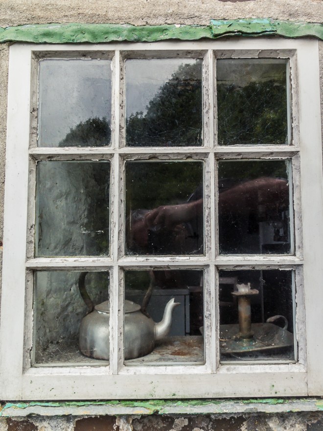
At the top of the path down to the beach sits Look out Cottage a tiny studio used by the artists Judith Ackland and Mary Stella Edwards, it was their cabin and studio from the 20s to the 1970s and is now locked up and empty. I am not sure who owns it but I believe it to be left fairly much as it was when it stopped being a studio. I snuck in through the gate and took a photo in the window. It looked so rustic inside, that candle holder just harks back to much simpler times.

IMG_4351

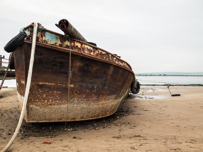
I carried on down to the sea front, even if I couldn’t drink I could at least take a break, east a snack, have a sit down and enjoy the sea for a few minutes. I was so glad I did as there was an old boat shed at the end of the jetty and low and behold there was a tap. Wonderful. I drank two bottles of water while I munched on bars, and then filled up once more before I headed off again. Thanks Bucks Mills!

IMG_4346

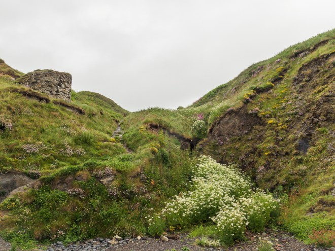
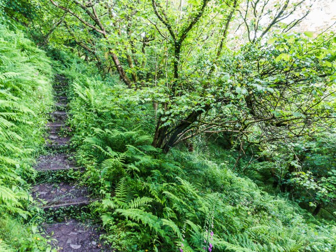
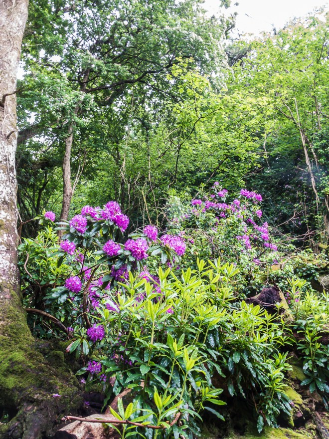
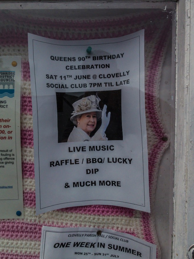
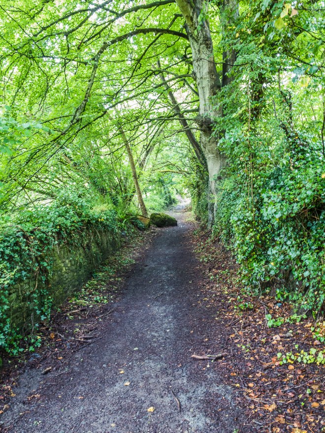
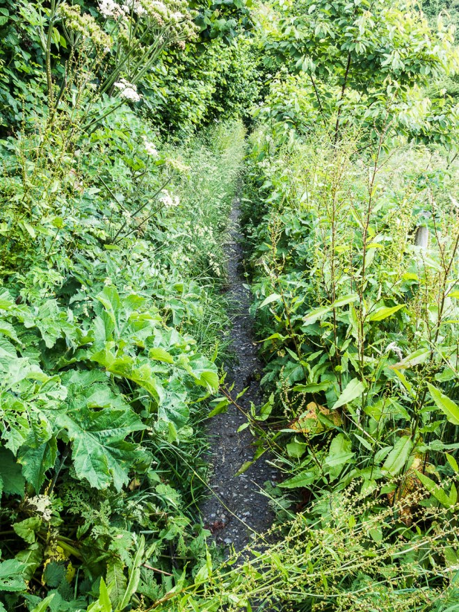
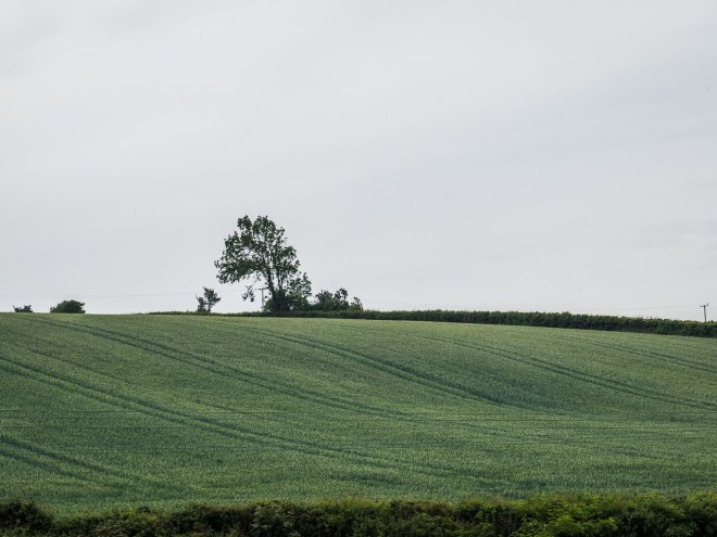
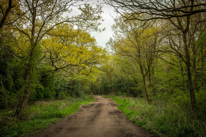
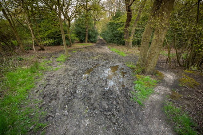
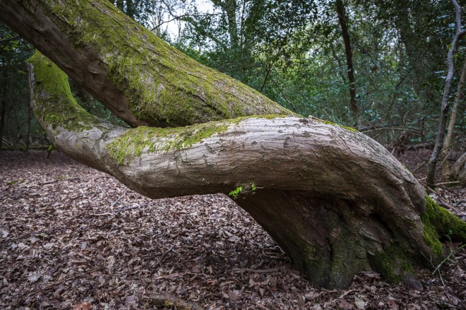
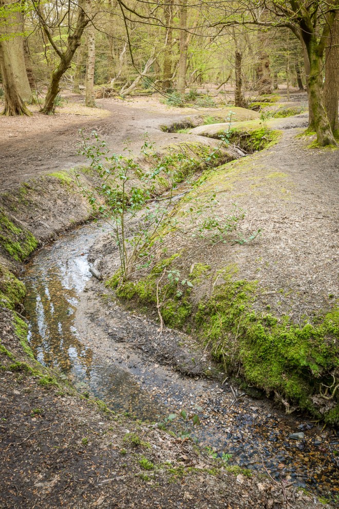
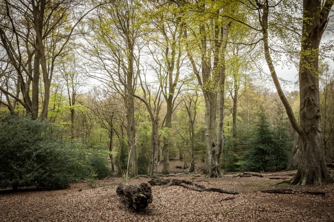
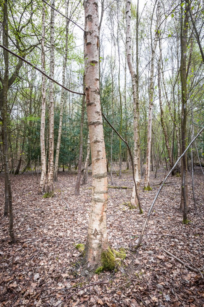
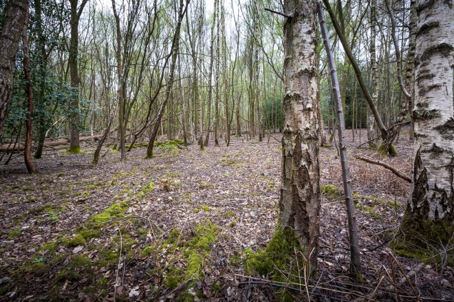
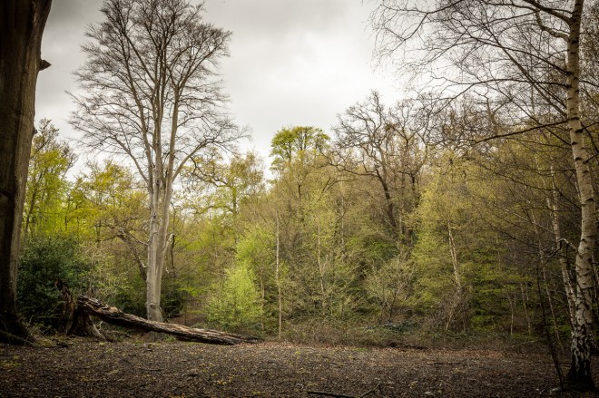
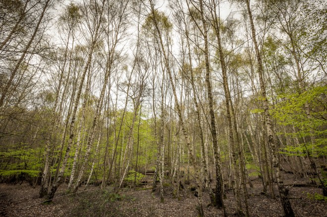
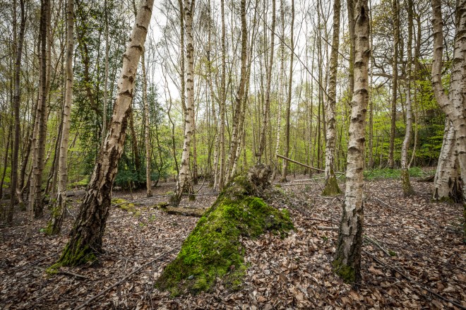
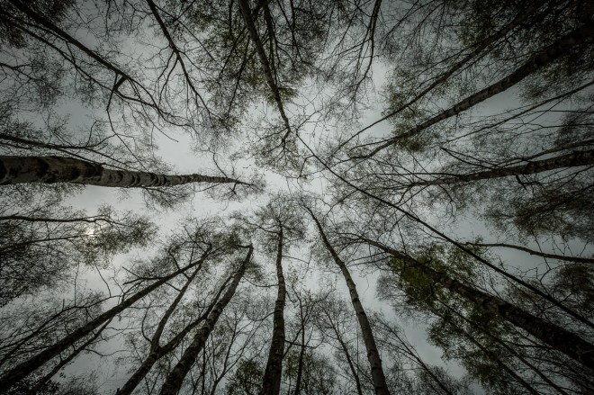
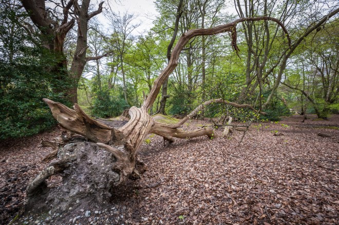
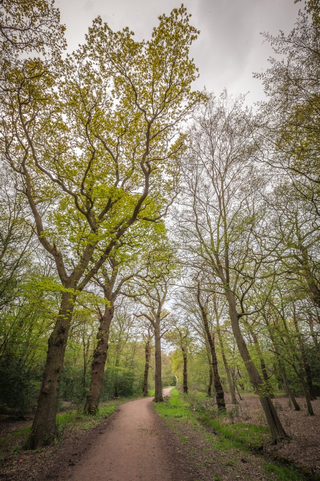
There was a festival (and a party) going on in Clovelly today, I could hear loud music as I walked for most of the morning, I must say it did not inspire me to set a cracking pace, I dragged my feet a bit with the hope of arriving after it had all quietened down. The seaweed festival wasn’t really my thing. The walk from Bucks Mills was lovely, mostly through gorgeous wood lands, with rare and ancient cliff oaks and bizarrely gigantic rhododendron bushes on the way. None of my tree photos were particularly good, so here are some shrubs.

IMG_4361

IMG_4371

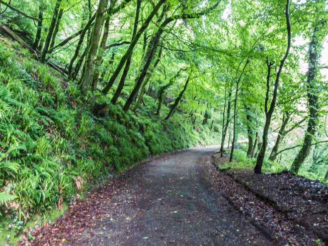
Finally after about five hours of walking I was on Hobby Drive, the roadway into Clovelly. I sort of thought this was going to be a short road way in, but it took almost an hour to walk it. It was not a short walk in.

IMG_4374

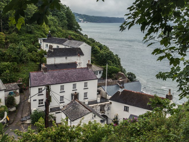
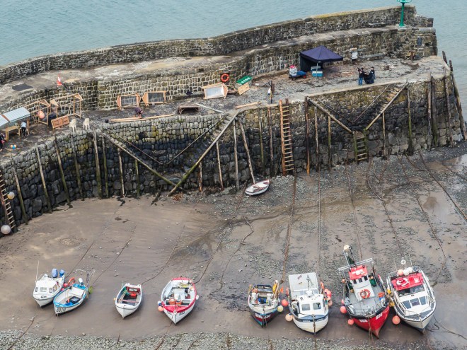
As I approached the cliff top above Clovelly I caught my first glimpse of it through the trees. There were a few walkers up here from their day out in the village and I saw a few more puffing their way up the hill. You can see some of the gazebos from the fair on the wharf, luckily things were quietening down for the day.

IMG_4375

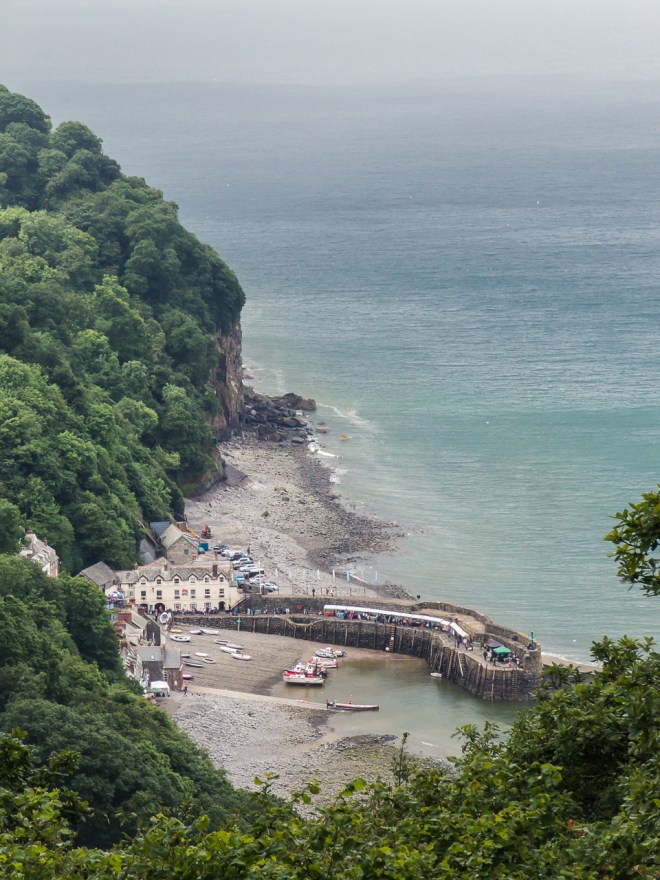
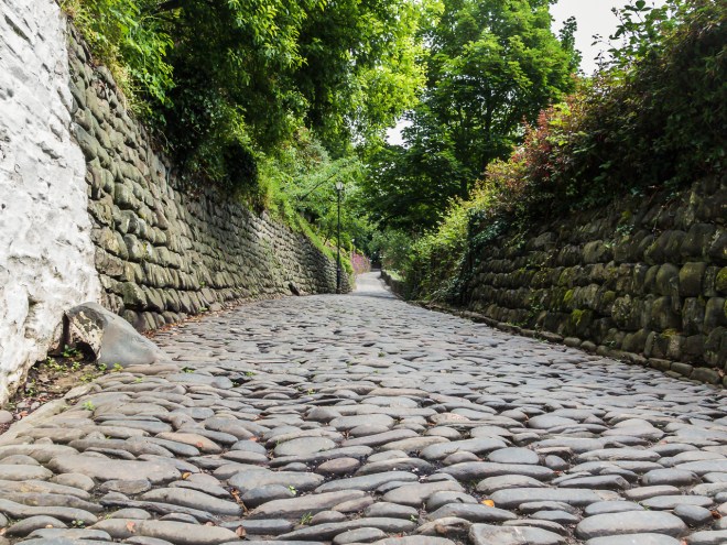
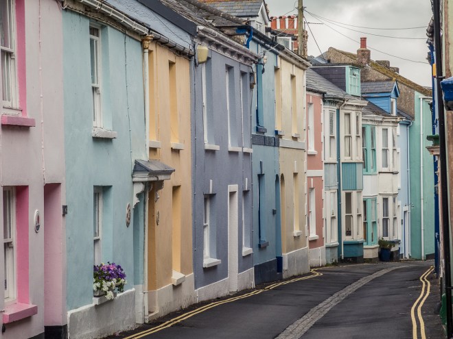
I have been looking forward to visiting Clovelly, I did not go down to the village in 2012, but have heard a lot about it. I am booked into an inn for the night, it was expensive as you would expect in such a small place. There is no way to get back to London late on a Sunday, so this was the price I paid – a lot, to do my walk. Clovelly is basically one narrow cobbled street down to the sea, it is part of a private estate and there are no cars. It sounds idyllic and I imagine it can be, though I really surprised myself by not liking it much. Maybe it was the price of everything – justified as things have to ported by hand, maybe it was the aftermath of the festival and there had also been a Queens birthday party so there were a few folk around that were a bit worse for wear. Maybe it was me being tired after walking, I don’t know. I was just disappointed.

IMG_4395

After checking in, I grabbed a pint from the bar, went to my room, divested myself of wet clothes and shoes, made a coffee and then plopped myself on the bed with beer, coffee and free biscuits. I didn’t move for a while. It rained. Heavily. This is the second time it absolutely poured down minutes after I had arrived somewhere. I was so lucky while I walked, while I got damp a few times I was never utterly soaked, though I had prepared for that with my packing.

IMG_4382

After a shower I discovered the towel rail was on, and very hot. Perfect. Towels off – shoes on. Dry shoes for tomorrow, an unexpected bonus, especially as my flip flops fell apart when I went for my walk.

IMG_4394

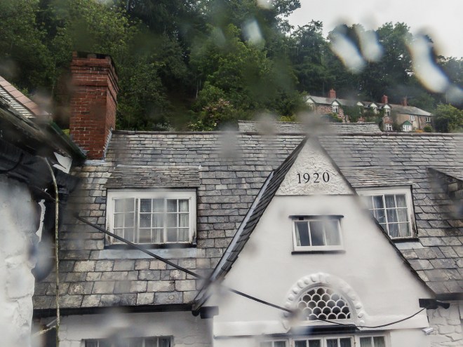
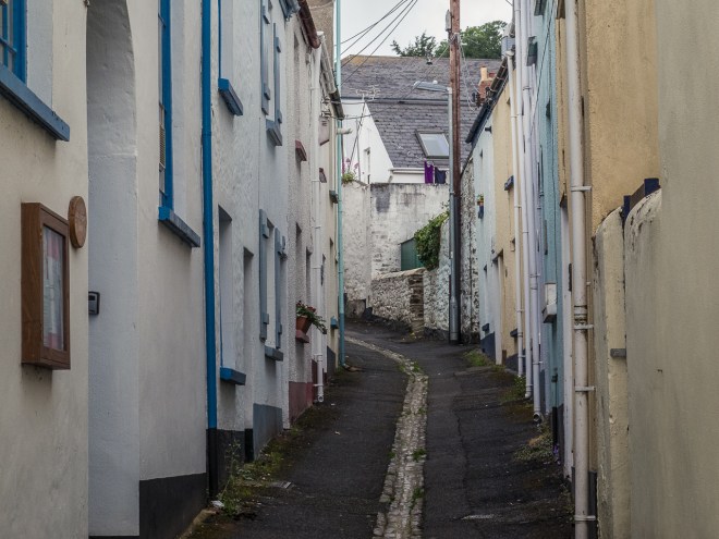
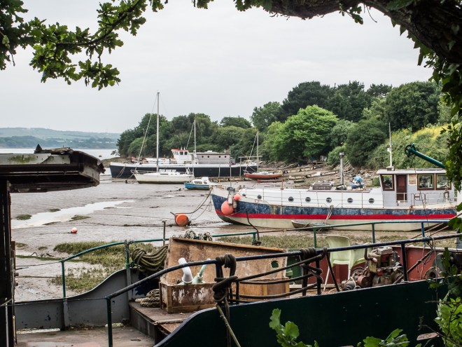
I wanted food but was too late for lunch and too early for dinner, so I went for a walk down to the waterfront to look around the village and hopefully find some food. There was no food, but I did take some photos.

IMG_4380

IMG_4388

IMG_4391

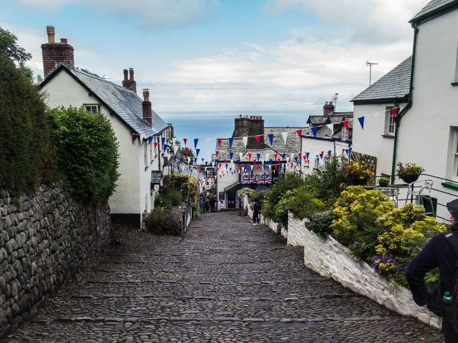
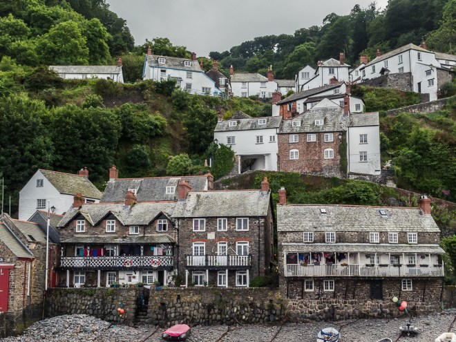
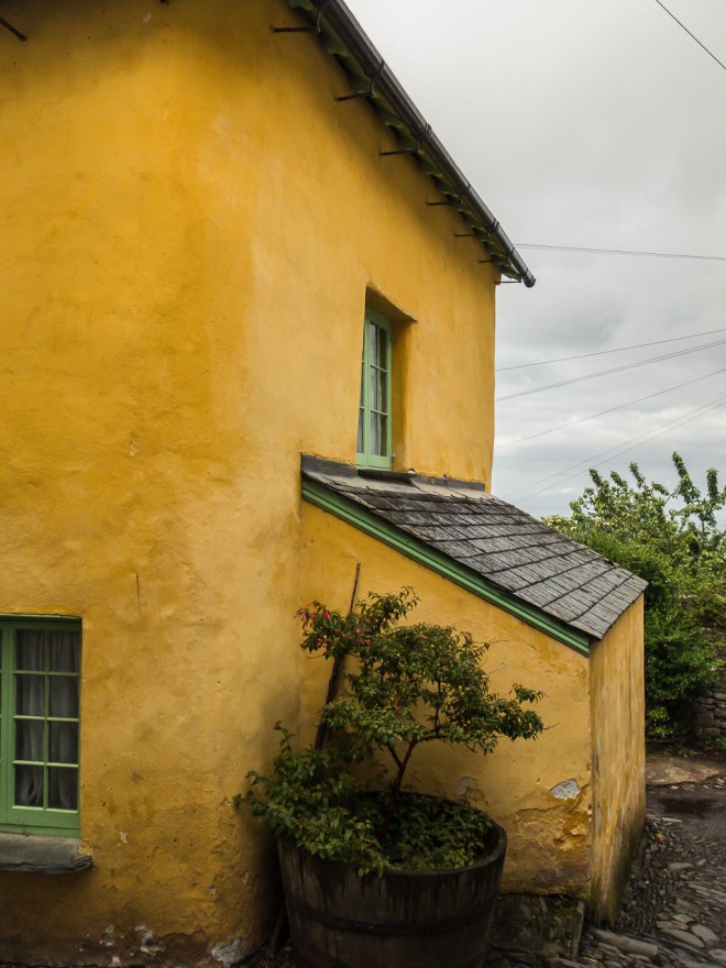
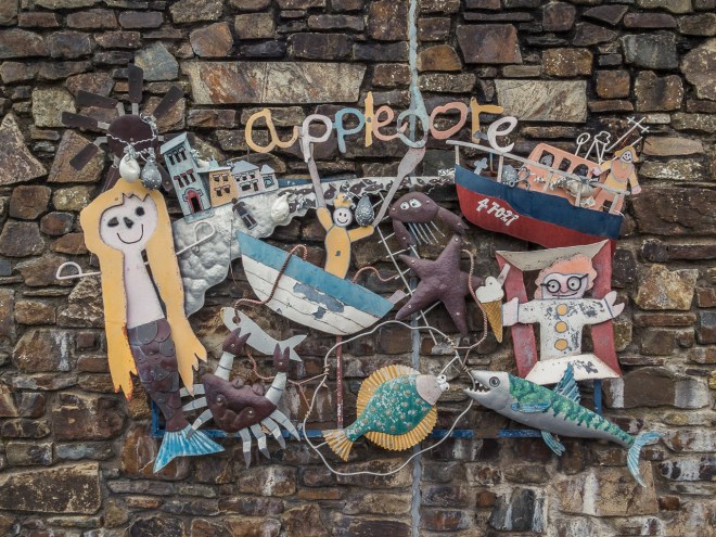
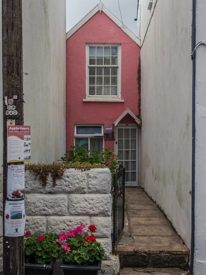
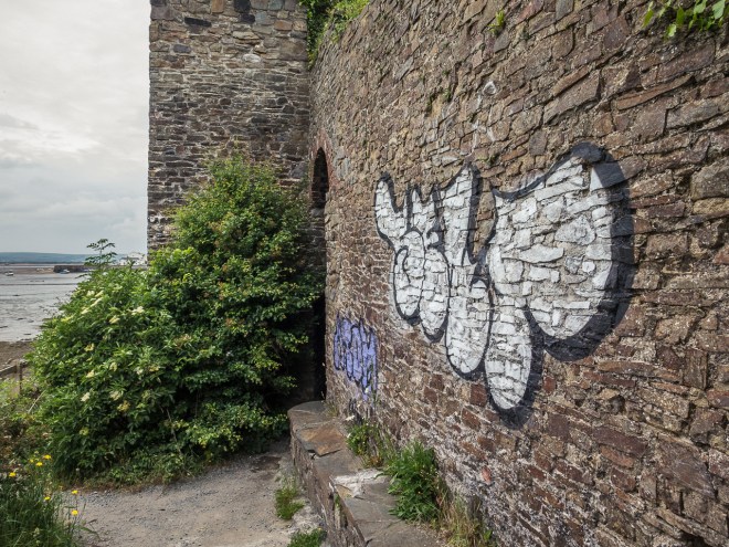
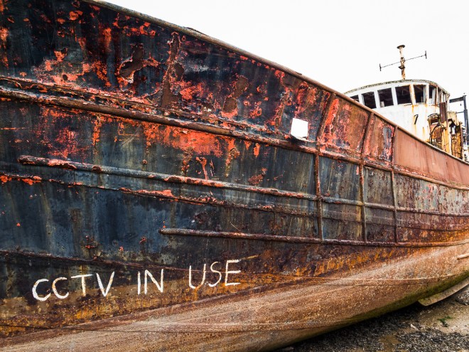
Clovelly is mostly a traditional white and grey Devon fishing village, but there is always one that has to stand out.

IMG_4385

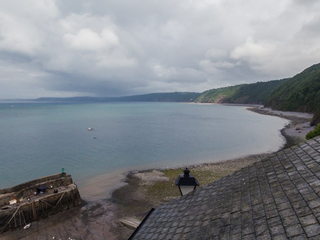
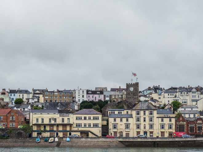
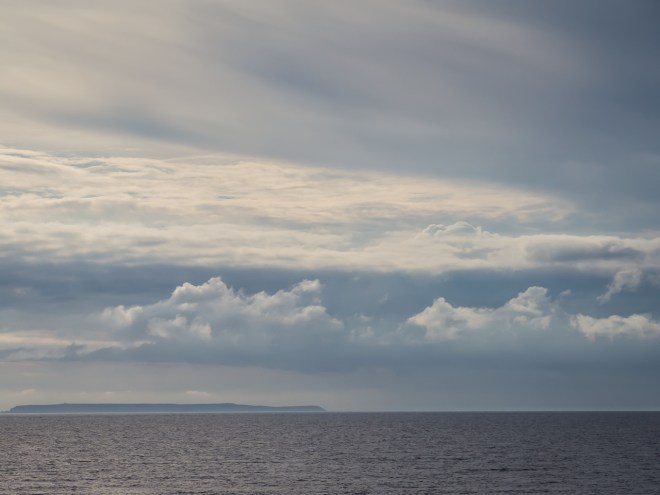
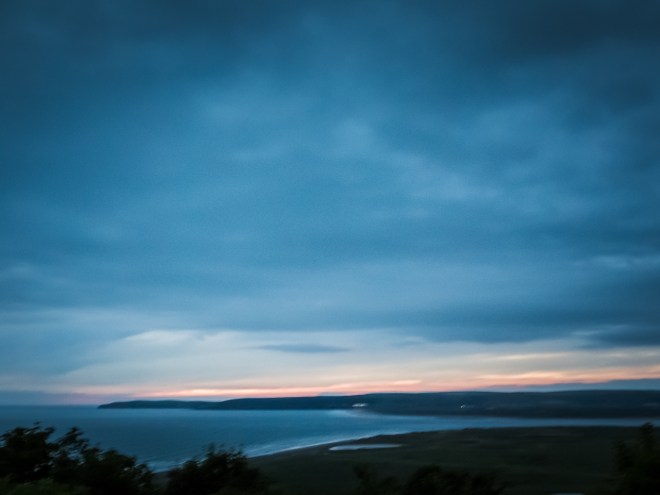
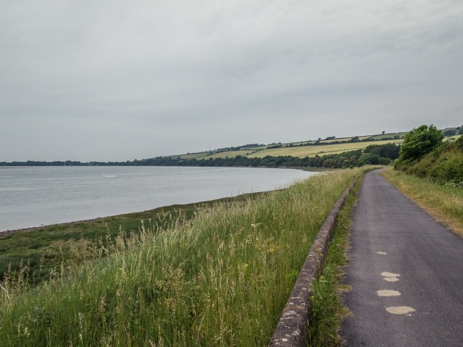
I took a photo back to where I started this morning, hidden in the low cloud.

IMG_4389

Back in the Inn I had another pint before heading down to the bar the minute it opened for food. I had dinner with two other guys solo walking the path. Both of a similar age to me. It must be a thing, I guess if you cannot afford a Ferrari and hate golf then walking long distances has to be up there in the list of mid-life crisis things to do. It was an enjoyable, though early evening as we were all knackered.

I met the same guys over breakfast, where we all seemed a little more chipper. I was feeling OK Monday morning, the legs were tired but the walk up the cliff and out of Clovelly was not too bad and I knew I could have carried on if I had the time.

IMG_4396

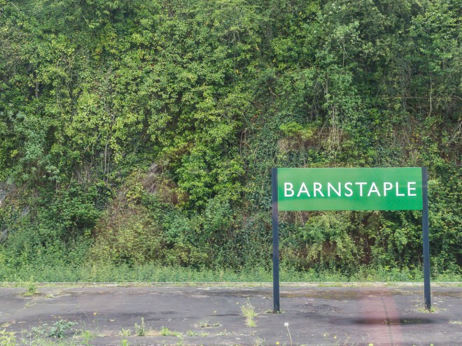
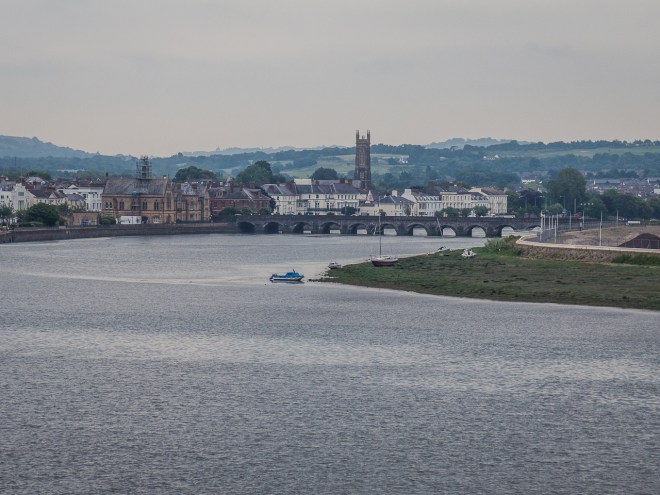
I caught two busses from Clovelly back to Barnstable Station, maybe the last time I will be catching a train back to London from here. Hopefully my next walks will get me further down the coast where another station will be closer.

IMG_4398

The walk took me 6 hours, quite a lot more than guide book suggested. It was harder than I expected, though I knew it was going to be tough, a lot harder than the preceding days that is for sure. The next two legs are supposed to be the toughest on the entire path, so I plan to be ready for those when I come back. Sooner rather than later.

I loved my time on the path, three days was long enough, but not long enough too.

SWCP Walk Part 2, Day 2. Westleigh to Westward Ho!

Saturday 11 June 2016 -Westward Ho!, Devon.

I left the B and B in Westleigh at 9:30, after waiting for the rain to stop, and to let the monster breakfast go down, fuel for the day. My legs felt good after yesterday’s walk, which pleased me. I haven’t done a lot of walking; or much else this year, and had anticipated seizing up after a day on the road. I felt better than I had in weeks. Fresh air makes so much difference to how I feel.

I joined the SWCP and Tarka Trail where I left it yesterday, by the side of the River Torridge just outside Instow. The path follows the river all the way to Bideford passing under another huge road bridge. This one with added mermaid.

IMG_4230

There were a few more old and rotting boats just outside Bideford. I think I could do an entire post on old boats. Which might be something to explore if I ever come down this way for a length of time, I am sure they have a history. Even if it is not that interesting at all.

IMG_4233

At the defunct Bideford Station I said goodbye to the Tarka Trail as the coast path heads across the river and into Bideford. I will not say it was sad to say goodbye, we had fun while it lasted, but our time was up, I need some hills, mud and the smell of the sea.

IMG_4235

IMG_4236

I stopped for coffee and  a brief rest before heading off again, I was trying to maintain a reasonable pace today as rain was forecast for late afternoon and though I was prepared for it, it did seem silly to get wet if it could be avoided. Now we were not joined with the old railway line that is the Tarka, the coast path was allowed to amber up and down small hills, through woods and fields and get all muddy – and a lot more fun.

IMG_4238

At the top of the hill there was a nice view across the Torridge to where I started this morning in Westleigh.

IMG_4239

This boat has definitely seen better days…

IMG_4241

Though it looks like this old tug (is it a tug?) has someone living on board and is being renovated.

IMG_4242

The path takes an inland route for a while to bypass a large dock site. I have heard that our councils have all been struggling with massively reduced budgets in these times of austerity, and it was obvious in this section of North Devon, an area particularly struggling that clearing paths was not on any sort of priority spending list.

I walk in shorts, I have not really been a long trouser walker, maybe if it gets cold I will put leggings on, I have always wondered why so many walkers in Britain walk in long trousers. Today I found out why. The nettles through here were pretty bad, I got stung on the stomach – through my shirt. Picking my way through to avoid the worst of the stingers slowed me right done, and meant I spent a lot of time looking at the ground.

IMG_4243

I soon arrived in the lovely little village of Appledore, there were a number of pubs and cafes as I entered, and though it was lunch time I thought I would walk through town and find somewhere on the other side.IMG_4244

IMG_4245

Which was sort of a mistake as there wasn’t anything on the other side to stop at. Eat when you can is my new motto. I liked Appledore. Especially this narrow cottage!

IMG_4250

IMG_4247

IMG_4252

Popping out the other side of the village I could see Westward Ho!, my destination for the night just up the road, however I had to walk around the Northam Burrows Country Park first, an extra couple of miles I suspect. Not that I was complaining at all, the sun popped out for a while so I took a break, shoes off, muesli bar snack and some water and I enjoyed lying on the grass looking back at Instow for a while. I haven’t done that in ages.

IMG_4255

Once the sun disappeared I took a glance towards Westward Ho! and saw that the threatened rain was looking to be a reality, so it was shoes and pack back on again and I dragged myself reluctantly back on to the path.

IMG_4261

The Burrows is an area of significant scientific interest for its mix of salt marsh, grassy plain and pebble lined beach. It was an interesting place to stroll and if it wasn’t for those very dark clouds I would have taken a bit more time to explore.

IMG_4257

The Burrows also contains the course of the Royal North Devon Golf Club, the oldest links club in England. What makes this course special to me is that there are horses on it. Grazing right next to a tee… Lovely !

IMG_4264

At the tip of the park, after approximately eight hours of walking the South West Coast Path I finally hit the actual coast. Yay! It was great to hear waves hitting the beach, I really miss that sound.

The walk to town was made at a cracking pace, hoping to get there before the rain arrived on me, I could see it was pouring down in town, so I am not sure why I was rushing into it! What a great beach.

IMG_4266

I was pretty lucky, I just caught the end of the shower, and though I had to put a coat and bag cover on I didn’t get too wet. By the time I had found a coffee shop to sit in the sun had come out again and it was a pleasant half an hour spent drinking coffee, a banana milkshake and noshing on a piece of cake. I stopped to take a photo of Lundy Island before heading up the hill to my room for the night. Why,oh why are they always at the top of the hill !!

IMG_4272

I was staying in an Air B and B for the first time. I had found it really hard to get accommodation for this trip, I guess I left it a bit late and it is supposedly summer. So many places were booked out on the usual web sites I use to find places. I really enjoyed the Air B n B though. The walk up the hill was well worth it for the view. These clouds – Yum!!!

IMG_4280

IMG_4282

In an effort to avoid a constant stream of fish/burger and chips meals I went to a Thai restaurant back in town for dinner before heading back up the hill with heavy legs and a full stomach to watch England play Russia in England’s opening game of Euro 16. England were ‘disappointing’. As usual. To make it worse the England and Russian fans were a disgrace, which made for unpleasant news reading after the game.

This was partly made up for by that great view from the room, over the mouth of the Torridge and up the coast to where I walked last year.

IMG_4283

It was another good day’s walking, a bit longer than yesterday, a few more lumps to walk over compared to all that flat walking previously. Tomorrow there will be more than a few lumps to cover, back to the coast path proper – I really cannot wait.

SWCP Walk Part 2, Day 1. Chivenor to Westleigh.

Friday 10 June 2016 – Westleigh, Devon.

I surprised myself by having a decent sleep in what was the probably the smallest single room I have ever had in a B and B, not that I need a lot of space. A good breakfast was had and I was out the door at 9:00, on a bus soon after and standing at the starting point of three days of walking before 9:30. Yeeha – it has finally arrived.

I am starting the South West Coast Path (SWCP) where I finished last July – at a bus stop!

IMG_4156

To be perfectly honest it was not the same bus stop. I was going to start in Braunton, but the path crossed the road next to a bus stop in Chivendor and it just seemed like a good place to start, so start there I did.

IMG_4157

I have three days of walking planned, the first two days will take me around the Rivers Taw and Torridge, and I won’t see the coast until the end of day two. The total distance over those two days is about 24 miles. I could probably walk the whole thing in a day, but it would have been a long day and to be honest I am not road fit at the moment and have been suffering from tight legs for weeks. There was no point in taking risks, and anyway I want to be feeling good for day three, a nice hilly walk from Westward Ho! To Clovelly, all on the coast.

Today’s walk is along a section of the SWCP that has merged with the Tarka Trail. The Tarka trail is named after the book ‘Tarka the Otter’, which was published in 1927, and describes the life of an otter living in the rivers Taw and Torridge. The section of the Tarka that I follow over the next day and half is about half tar-seal and half crushed stone. Not the ideal surface for walking with sore legs, but there were areas where I could walk on the grass verge. While not being wild and coastal, it is quite pretty in sections.

IMG_4161

IMG_4162

IMG_4167

In a few hours time I will be walking along that stretch of shore on the other side of the Taw as well…

IMG_4168

The path heads back to Barnstable, where I stayed last night and also where I stayed after finishing walking last summer. Rather than walk all the back into town I crossed over the new road bridge for the better view – and it was a bit shorter.

IMG_4170

IMG_4172

There was a path up to the bridge on the side I started on but none back down on the far side. Rather than walk all the way up to the busy road and then back again, I jumped the fence and cut through the scrub. It seemed to be a popular route, but does not explain why there was not proper access.

IMG_4174

Once out of Barnstable there was a long walk along side of some salt marshes, with dozens of little water ways and channels it was something interesting to look at. I expect if I ever came this way again it would all look totally different.

IMG_4178

IMG_4177

On the other side of the path was farm land.

IMG_4176

I arrived at Fremington Quay after a couple of hours of walking and stopped for coffee and cake in the cafe. It was good to sit down. One thing I am not particular good at on my walks is sitting down and resting. I do stop a lot to take photos, but rarely take the time to rest properly, or just enjoy a view or a cup of coffee. I need to practice that more. In truth I need to practice that more all the time, not just while I am walking

IMG_4183

As I was packing up my stuff to leave I had a phone call from my son in Australia, Dom. Though the news was not all good, it was great to chat with him for a while as I continued walking. The best thing about the conversation is that it took my thoughts away from work. I had spent the first couple of hours of my walk thinking about it, getting progressively angrier and angrier with myself for wasting my holiday and head space time focusing on the very thing I was trying to get away from. It did not enter my mind again.

IMG_4187

I really enjoyed the walk from Fremington to Instow, in parts it was quite post-apocalyptic, old jetties and ruined boats, an old electricity sub-station and rusty relics from the railway. I was alone for a while and it felt like I was the last human alive. I was waiting for ‘walkers’ to find me.

IMG_4190

IMG_4195

IMG_4199

IMG_4209

As I was taking photos of the SS Boop, a woman walking her dog ambled by, and I realised the world had not ended in the previous couple of hours.

IMG_4201

IMG_4205

IMG_4206

I stopped for lunch in Instow, it was nice, but pricey. I had earned my lunch and its accompanying pint over the morning, though I did not have much more walking to do. The renovated station house at Instow was a nicer reminder of the the old railway.

IMG_4216

Instow is at the confluence of the Rivers Taw and Torridge, I could just see the coast in the distance, past Appledore on the far side. After following the Taw all morning, I was now following the Torridge and will do for most of tomorrow as well.

IMG_4213

I was still on the SWCP and the Tarka trail as I headed out of Instow towards Bideford. This part of Devon is famous for its old lime kilns, there are hundreds of old kiln sites up and down the coast and on the edge of some of the estuaries. They were used to make quick-lime from lime stone in the region. There are a few ruins left here and there and I will pass a few of them over the couple of days.

IMG_4217

I had booked a B and B in the small village of Westleigh, just south and slightly inland from Instow. As I was walking along the path I could see the road up to the village on the far side of a narrow swampy stream. I had visions of having to walk way way down the path to find a way across the swamp, but fortunately not too far ahead there was a pathway across. Phew.

IMG_4219

There was another old fishing boat just up the river so I carried on going so I could take a look at it today, in case it was raining tomorrow. I was talking to a couple of men collecting sea weed from the rocks nearby and they told me the boat just appeared one day six months ago. They had no idea what it is doing there or how long it will remain. A further sign of a stricken fishing industry.

IMG_4222

IMG_4224

Naturally my B and B was right at the top of the longest hill of the day, it was a farmhouse on the other side of the village to the path I was walking. I have never stayed in a B and B with pillars out the front before.

IMG_4228

Last night I stayed in the smallest room ever, and tonight I stayed in the largest. It was also very comfortable. I have been really fortunate with the weather so far, just after I arrived it poured with rain, lying on my bed in my room, I just did not care !

IMG_4229

After the rain had passed I walked into the pub in Westleigh for dinner and the hope of being able to watch the opening game of Euro 16, however they did not have a TV in the pub. After eating I took a bottle of beer back to my room and watched the game on my own, it was pretty dire. 

I really enjoyed today, once work had left my head and I had the space to think – and literally stop to smell the flowers it was a very relaxing day. My legs feel good after five or so hours of walking and it was just damn good to be outside again!

IMG_4158

SWCP Walk Part 2, Day 0. On the way to the coast.

Thursday 09 June 2016 – Barnstable, Devon.

I almost cannot believe it was August last year that I started my walk of the South West Coast Path (SWCP), the longest walkway in the UK, I also cannot believe that I have not been back to walk any more since. Well I suppose I can, as I have been a bit slack, and / or busy, in the past 11 months. I did venture down to Falmouth for a few days just before Christmas, but I did not really do any path walking then, so it does not really count.

image

Anyway, I am now on the train heading back to Barnstable for the night. Tomorrow I will catch the bus to Braunton and start three days of walking, ending in Clovelly on Sunday. I am only expecting to do 4 or 5 hours walking a day. Not massive distances, but I am not really massively fit at the moment and have been suffering from aching legs for weeks. I am hoping that the ache is caused by inactivity and zero stretching rather than anything more serious.  So starting small seems like a good plan. I am also staying in B and B’s for the four nights I am away. The weather forecast has not been great and I am not ready to get soaked over three days of walking and then sleep in a wet tent. I will save that for later. If all goes well I am planning on doing a longer walk in August and will camp then.  So just consider this a tester walk.

This is where I left my walk in August 2015, on the side of the road just before Braunton. In a bus stop, waiting for a bus to Barnstable. Hip and foot pain ending my walk early.

IMG_2126

I am hoping to see a few views like this on day three. The first two days are flat walking around the Rivers Torridge and Taw and they do not sound overly interesting. One of the reasons for walking them now is to get these two least interesting days of the entire coast path out of the way.  Day three from Westward Ho! to Clovelly should be much nicer and will hopefully give me views like this one from Great Hangman.

IMG_2058

Though I suspect the view will be more like this one over Watermouth Bay, low clouds and rain 😦

IMG_2075

At least I am out on the road again, it has to be better than work 🙂

Photos of Epping Forest.

Friday 22 April 2016, Epping Forest, London.

Ever since we got back from New Zealand and Hong Kong I have been suffering from a distinct lack of interest in actually doing anything, though if I am honest this malaise has been hanging over my head like a threatening rain cloud for a while. In the last couple of weeks I blamed the jet lag. Convenient. Yet wrong. Not that I have any other answer for it. Maybe it is just simply that I got lazy! I have had a couple of attempts at the gym since we got back and didn’t enjoy either of them, I feel unfit and slow, and at times a little miserable about it all.

Yesterday I read a post by Paul, a guy I follow on WordPress, about how getting outdoors and doing some exercise can make you feel a whole lot better. I know this, in fact I have known this for a long time, yet still I was doing very little about it. It is a great read, so check it out and it did make me determined to get up early this morning, get back to Epping Forest, take my camera and go for a good walk.

Then…… This morning. I had a poor sleep, again, second really bad night in a row. I was awake when El got up for work, and I planned on getting up and out the door before mid-morning. Once El had left, the malaise hit me again and all of a sudden I was planning on a day of reading and wasting time surfing the internet – doing anything but what I really needed to do. Shift my butt – and my head.

I was on my second cup of coffee, still in bed, reading Kiwi Trail Runner magazine when I came across another article about exercise and a healthy mind. This time I did make it out of bed. I am glad I did!

I took the bus to Chingford Station on the edge of Epping Forest. I had been thinking of walking home from Chingford using all the linked sections of forest that I use on mountain bike rides, but on the bus I changed my mind and decided to head into the forest and wander vacantly instead. Getting lost would be OK, it is not a vast forest and I sort of know my way about.

I started off walking up one of the many preformed paths, following a man walking a couple of small dogs at a much faster pace than I planned on mustering today.

IMG_9886

I am trying to slow down a bit, I have always been a fast walker, and since being in London, I have got faster and more ‘aggressive’ in my walking, I have a rush hour head on all the time. I want to teach myself to relax, care more about the journey than the arriving. I think I did OK today. I noticed the smells of the forest, as soon as I was under the tree cover; the earthy smell of mould and rotting tree fall permeated the air, a healthy natural smell, not unpleasant. Just there and it felt good noticing it. Taking the time to listen and smell and really see was something I need do to more often.

IMG_9914

I finally reached the end of the path I was on and had a few choices of dirt single track to chose. I wanted to try and find a silver birch grove I have passed through on my rides, which had become a favourite part of the forest. I have not ridden here all year – part of my slackness. I was blaming the mud – but I rode last winter. I was sort of scoping out the mud today with a near future ride in mind. There was a lot less mud than winter, but still plenty about.

IMG_9891

Carrying on in what was the general direction of where I thought I wanted to go, I saw loads of trees I wanted to take photos of. I am a bit of obsessed with trees and forests at the moment, a very long moment I guess. At the start of the walk I was looking for something different to take photos of, there is a lot of tree fall in the forest, short roots and light soil leave them exposed to the dangers from a high wind.

IMG_9892

IMG_9942

With spring well under way, there is a lot green about, fresh buds mixing with old winter growth. There is not a huge amount of colour around, but seeing the trees starting to embrace the spring and lead us towards summer is such a good thing.

IMG_9938

The other thing I was looking to take some photos of was the small stream that runs through this section of the forest, it was my target for when I headed back towards the station. I like the way it twists and turns every few metres. Next time I hit the forest I will walk the stream from one edge to the other.

IMG_9893

More by good fortune than good planning I found the area I was looking for, a gentle hill that heads up in the direction of High Beach. I love this grafittied (I think) beach tree. Some of the dates stretch back a few decades.

IMG_9899

This part of the forest is just stunning, and that was before I hit the silver birch section. It is a time of the year I really like in the forest, just as the leaves are starting to reappear on the trees, there is more light, softer more delicate colour and the shapes made by the branches and trunks are still visible.

IMG_9900

And then I went a bit camera mad. One of the wise decisions I made when I packed a bag last night, and I did think twice about this, was to bring a tripod. I brought a lighter weight one, which I did regret as it did not cope well with the weight of the 5d. Next time I will take the big one. But the tripod allowed me to take better photos.

IMG_9902IMG_9903IMG_9905

I spent quite a long time wandering aimlessly around the silver birch grove. The great thing about Epping is it is so small you just cannot get seriously lost. I didn’t bother with trails up here, just moved between the trees to the next location that took my fancy. I found a nice open space at the top of the low rise, where I stopped for a drink of water, a snack and a sit down on a pile of dead trees.

IMG_9920

IMG_9921

There was another lovely little grove of silver birches on my way back towards the station; I really do love these trees and just could not help myself and took a few more photos.

IMG_9924

IMG_9927IMG_9929

I must admit to getting a bit mis-placed on my way back, thinking I was in one place and then finding out I was somewhere else, just like I do on my bike rides. I saw a couple of small deer in this section, I was not quick enough to get a photo, but it was pleasing to see them, maybe one day I will come back with a bigger lens and do a bit of deer stalking.

IMG_9930IMG_9931IMG_9936

I eventually found the stream again, so I walked along it for a while, taking photos here and there. These little bridges are pretty cool, I am assuming for mountain bikers to cross the small streams. I just like the fact they are there and there is no path leading to or away from them.

IMG_9943IMG_9945

Soon enough I was on one of the fixed paths heading back towards the station. Except I wasn’t, I was on a path heading away from the station… Not terribly away, not 180 degrees, now that would have been embarrassing! Once I worked out where I was it was a fairly short hike back to where I started.

IMG_9951

I was out for 3 ½ hours. 3 ½ hours of relative peace – you can hear the road from many places in the forest, but fresh air, lovely trees and semi-solitude. It was what the soul needed and I felt so much better than I did when I woke up this morning and almost did not go out.

I have now bought a book on English trees, it is about time I could name more than just an oak tree.

In other news – let’s drift back in time a bit to last week. I quit my job. I don’t have another one to go to, but I have a three month notice period, which just made looking for another job seem impossible. I have taken the risk and hopefully it will pay off!

P.S A question a few days after posting.

I have just looked at this post on a different computer from the one I edited the photos on. The photos on that computer were, in my opinion, a bit too bright and almost over-exposed. Do you see over-bright photos or over-dark photos ? I am interested to know so I can make sure I edit on the right computer!  Please let me know.

Visiting and old friend with an old friend.

Monday 04 April 2016 – Auckland, New Zealand.

Like most bloggers I also follow and read a few other WordPress blogs and sporadically randomly read a few others. I like to see what is out there, what other people are seeing and doing and maybe get ideas about writing and photography for my own use. I recently read a post by a youngish guy, I think he was English, who had just left Auckland. He was moaning about how boring, expensive and unfriendly he thought New Zealand and specifically Auckland was. In between his moaning he described what he did in Auckland. Pretty much nothing, he never left the city. No wonder he was bored.

I, on the other hand, always get out of the city, and today was going to be one of those out of the city days. I had yet to see my good friend Vicki on this trip, there just hadn’t been time so far to fit enough time in, but I had kept a day up my sleeve just in case. Vicki and I usually catch up over a walk or a run somewhere in the hills, as I did not have a huge amount of time we decided to keep it semi-local and go to one of my favourite places in the whole world – Karekare Beach.

Karekare is on Auckland’s west coast, it has no shops, few houses and a toilet block was only built there in the last few years. It feels remote, yet it is under an hour from the centre of the city, less if there is no traffic on the very winding road. It is a magical place and I have been here to run, walk, swim and photograph many many times.

There was not going to be much running today, I am woefully unfit and Vicki is very very fit and would leave me for dead on the trails, but we had lots of gossiping to do so a good walk was definitely in order. We started walking along the black sand beach – following where we could find them, the trail markers for the Hillary Trail.

IMG_3777

I have mentioned the Hillary in previous posts, it was created in honour of Sir Edmund Hillary, and is 75kms of interlinked trail traversing the Waitakere Ranges from South to North (or Vice Versa). When it was first created it was a rugged and gnarly walk using old hiking trails. Over the last few years, it is slowly being ‘dumbed down’ and made easier and safer – though it was never dangerous. This is to cater more for the walking tourist who may not necessarily want to get their boots dirty, well that is how it seems to me. This section along the beach did not exist when I left the country, the trail was back in the hills then.

IMG_3778

Back in the old kauri logging days there used to be a train line running along this section of the coast, ferrying the great logs to Whatipu where ships used to take them into Auckland, the train line is long gone, but the old tunnel at Tunnel Point still remains, as does a rusting hulk of a cylinder.

IMG_3782

I stopped to take a few photos of the small lake that has long been here, stuck between the sand dunes and the cliff face, over a rainy winter this whole area can flood as the water comes down from the hills and finds nowhere else to go.

IMG_3784

IMG_3785

IMG_3786

One of the things I really love about New Zealand is, apart from some people, there is nothing dangerous, too bitey or poisonous living here. Wading barefoot and legged through a swampy flooded lake might not feel good on the feet, but at least no animal is going to try and kill you. Being the end of summer, there was no flood, and no need to wade barefoot through anything at all. The only life we saw were a couple of black swans.

IMG_3787

We turned inland past the lake and headed up the start of the Pararaha Valley. The first hundred yards or so cuts through reed beds and the track is a low boardwalk. Designed to allow 365 day access to the area, though I have walked up here before when the boardwalk has been submerged as well.

IMG_3790

And then it was UP ! Buck Taylor was always one of my least favourite tracks on a long run or walk, it is steep ! But the view back down over the entrance to the valley is always worth it.

IMG_3794

I was surprised by how much mud there was when we got to the ridge line at the top, there wasn’t huge amounts, but I was surprised to find any at all, given that it is the end of summer. It was good to see the tracks here are still proper hiking tracks with mud and roots uneven steps. Just how I like it.

IMG_3795

We followed Zion Ridge Track, it is pretty flat and a real joy to run on, the bush up here is really nice too, with lots of manuka, kauri and puriri trees leaving layers of crunchy leaves on the trail.

IMG_3797

We came across this big old puriri tree, slowly being taken over by the vine like rata. It is a massive tree, ancient and twisted. Lovely.

IMG_3799
IMG_3804

Very soon we were on the cliff top overlooking Karekare Beach where we started. Looking back down the beach towards Pararaha Valley.

IMG_3805

Karekare Beach.

IMG_3806

IMG_3809

Now you can see why this is one of my favourite places ! Beach, surf, hills, mud, trees, wilderness. What is there not to love about Karekare.

It was a great couple of hours out and about, Vicki is good company, a not too old friend, but one of my best friends and it was great to catch up. Vicki is the editor of Kiwi Trail Runner magazine and is very enthusiastic about anything trail and trail running. She gave me a couple of issues of the mag to take home with me as I was not quite up to date !!

She also stores my trail shoes at her house, to save me carting them back and forth from England. Now that is a true friend !

IMG_3810

Visiting one of my happy places, the Waitakere Ranges.

Sunday 27 March 2016 – Auckland, New Zealand.

Breaking with a long held, and slightly ridiculous, tradition I am going to post some photos taken over a few days, but in the same general location. Over the four year history of this blog I have pretty faithfully stuck to writing in chronological order. This vexes me mightily on occasion; especially when I have a photo I want to post ‘right now’ but there is a backlog of older things to write about so I can stick to my self-imposed fascination with chronological order.

This process change is a bit of annoyance as I had written a whole load of text over the past few days that followed the right order of things, so now I am going to hit delete and get rid of it. I am going to rebel against myself. Maybe this will be the start of something new – non-date based blog posts, change is good right ?

Mum, El and I had arranged to meet my daughter Mel and her partner DIckie at the Arataki Centre in the Waitakere Ranges. The ranges are pretty much entirely forest (or bush as we call it in NZ) and form the bulk of a regional park running along the western edge of the city of Auckland, separating the city from the Tasman Sea. The ranges are why I love Auckland, I lived on the fringes of the forest before I went travelling and moved to London. The Arataki Centre is the information hub for the ranges and quite a tourist spot, with some lovely views out over the national park.

El and I visited the centre when we last came to New Zealand, but this time we are going to do the 1.6km nature walk. I haven’t done the walk since the kids were small and we had a horrible experience dragging small children up a steep path amongst some trees – they hated it, and made sure we did to. I was hoping for a lot more now I am doing the walk with adults, even if one of those adults was originally one of those kids.

I have always had a love of trees, but this has become a bit of an obsession over recent times, especially the naked winter trees I see in England. New Zealand native trees are primarily evergreen, so seeing tree skeleton forests in wintery England is something I am really fascinated by. There would be no tree skeletons today. Early autumn in the Waitakere Ranges means a sea of green; there are very few colours in a northern NZ forest!

The nature walk is on the other side of the road from the information centre and there is an underpass to get there. This sign was at the entrance to the tunnel. A message we need to think about as cities expand into wilderness areas and we deforest our world in the name of growth.

IMG_3458

The thing that stood out for me the most in the walk was the kauri trees. They are my favourite NZ tree and get to be very big over time, the largest remaining kauri in New Zealand is Tane Mahuta and I am planning on seeing it when El and I take a trip up north in a few days time. Tane Mahuta is somewhere between 1200 and 2000 years old, this tree is about 600. Stupidly I forgot to note its name, thinking the internet would supply it for me when I got home. It appears the internet cannot.

IMG_3459

It is a magnificent tree, but looks to be suffering. The Waitakeres, and large areas of other native forests are inflicted with Kauri Dieback, a fungal disease which is killing both young and old kauri. Once a tree has been infected there is no cure, and a number of un-logged kauri groves have been devastated, it is terribly sad. The kauri is a tall, straight hardwood tree and covered the Auckland and Northland regions. They were hugely popular with European house and ship builders when they arrived in the 1800s, which resulted in almost all the forests being wiped out by loggers, with only a few ancient trees remaining across the northern part of the country.IMG_3462

It is a really nice walk, quite steep in parts, but it is short so overall it is not too strenuous, we took the small detour at the furthest end from the car park to the kauri knoll to see a few, much younger kauri trees. Not all hope for these trees is lost!

IMG_3467

IMG_3468

Dickie, Mel, me and El

IMG_3470

There are a few other interesting things to see, perhaps if we had walked along the trail with tree names I would know what this rather interesting plant is called.

IMG_3460

The New Zealand bush in the north island is sub-tropical, it is predominantly evergreen, and is pretty much entirely green in colour, there are very few plants that have bright flowers or berries.

IMG_3463-Edit

The rata tree is an exception with lovely red flowers.

IMG_3476

It was a very nice walk, and given we were outside for only a short time and it was not particularly sunny, it was all a bit hot and sweaty!

IMG_3478

A couple of days later El and I had moved to stay at my sister’s house in Titirangi, she has only recently moved in and has renovated extensively, it is a lovely space to live, and is surrounded by immature kauri trees.

IMG_3509

These three kauri are right outside the back door and the deck is built around them.

IMG_3492

After the family had left after a very nice lunch El, my sister and I went for a walk around the block. (I will sneak a quick after lunch Mason photo just because I can. It is my blog after all)

IMG_3508

A walk round the block where my sister lives is nothing like a walk round the block where El and I live in suburban London. There are some houses, she is very close to the city after all, but there is plenty of not-houses as well. Exhibition drive is a flat, gravel road that runs from the edge of Titirangi out towards the dams in the Waitakere Ranges. It is about 3.25km long, is closed to all motor vehicles and was a very regular running track for me. It is popular with walkers, and forms part of a good loop to walk from my sister’s house.

The road is used for service vehicles that monitor the pipes that run water from the dams to a nearby water treatment station.

IMG_3519

The pipe runs fairly straight so there are lots of short tunnels on the way, when I was young you could walk/crawl through them, health and safety means they are all blocked off now.

IMG_3515

The path is through a very scruffy, and regenerating part of the forest, it is a lovely walk, especially on a sunnyish day like today – and especially after a large lunch!

IMG_3521

As the large trees were cut down a long time ago the lower level trees and scrub have taken off here and there are a large number of nikau palm and punga trees all along the walk.

IMG_3524

IMG_3522

I was looking for a bit of flare action through the nikau palm leaves.

IMG_3517-Edit

I am fascinated by how the palm fronds appear to interlace with each other, forming patchworks of shadow and light.

IMG_3518

I really like these roots, I think they are from an old macracarpa tree. I have photographed them before, may years ago, and I was pleased to see they were still intact, popping out of the bank below the tree, merging with the rock and the hard old clay.

IMG_3523

We cut down a steep, and considering it is the end of summer, surprisingly muddy track down to a newer pipeline, and short cut back home. Not many people know about this section of pipeline, I found it years ago, when I was looking for short tracks to ride a mountain bike in this semi-urban area.

IMG_3526

We were soon back at my sisters after another really enjoyable walk, in one of my favourite forests, and time for a glass of pinot gris before dinner.

A quick visit to the Imperial War Museum

February 07 2016 – London.

One of the many topics discussed over a very long new years day lunch was the pending exhibition of photos from Lee Miller at the Imperial War Museum, ‘A woman’s war’. The exhibition was showing a series of photos that acclaimed model, Vogue photographer and then war photographer, Lee Miller took during the second world war. A number of us were interested in going, so using the power of BookFace I organised a group outing, and today was the day.

A group of us met at Walthamstow Central, in a bitterly cold wind, to take a couple of tube trains under London and the Thames to Lambeth North. I love the Imperial War Museum, and have done since I was a child, though I have only visited a couple of times since I have been back in London.

IMG_3147

Lee Miller started her career as a model in New York in the 1920s before moving to Paris to study photography under the tutelage of Man Ray. While in Paris she got to hang out with some very influential and interesting people, including Picasso and Cocteau, who she modelled for. At the outbreak of WWII Miller was living in London and became a photojournalist for Vogue, documenting life in London during the blitz – where a lot of the images in the exhibition were from. Working for Conde Nast, she was the first woman photographer to arrive in Normandy soon after the allies landed in June 1944 and spent much of the next few years documenting Europe to and beyond the end of the war. She visited and documented Dachau and Buchenwald concentration camps soon after they were liberated, which led to what is now called post traumatic stress disorder which affected to some degree her for the rest of her life. She passed away in 1977.

The exhibition was fantastic, some wonderful photos of life for women in London and its surrounds during the war, as well as images taken in Normandy and Europe. This was not a celebration of war, but a record of the tough conditions that women lived and worked in under during the war, and how they managed to enjoy what time they could. Like so many exhibitions I have been to, it was really well done and thoroughly interesting.

We did not linger in the museum after visiting the exhibition, I will have to visit again, but I did take a couple of photos as we were regrouping.

IMG_3153

IMG_3152

Lee Miller spent a lot of time driving around Europe in a Jeep, during and immediately after the war. I bet she would have liked one of these !

IMG_3158

On the way out we were talking about the number of V1 and V2 missiles that landed in London during the war, a number landed in Walthamstow. There is an alley in our street that was formed when a V1 landed on, and destroyed, a house that was in the middle of a terrace.

IMG_3156

As we were talking one of the museum staff came up to offer his help in our discussion and we had quite an interesting chat about the missiles that were launched at London. Informed, helpful and friendly staff – nice one Imperial War Museum!

Both my father and I worked on the Harrier jump jet. My dad’s time was way back in the late 60s working as a coppersmith for Hawker Siddeley in Kingston on the aircraft prototypes. In 1986 I worked in the same factory as him; surprisingly, with some of his old colleagues, but under British Aerospace. My job was less exciting than his and for some of my short time there I fitted the rotating vertical take off nozzles under the plane. It was a horrible and under paid job and I left after six months. I still have a soft spot for the aircraft though, and it is nice to have another connection to my dad.

IMG_3157

IMG_3155

The museum is very popular, which is great, and the cafe; even more so. Not so great when you are a group of nine. We decided to walk towards Waterloo Station and look for coffee and then some lunch. It was a lovely day outside, but the wind was biting and out of the sun it was quite cold.

IMG_3159

IMG_3160

After stopping for a warming coffee we decided to carry on walking and El had a spot she wanted to take us to near Waterloo Station. I loved this building and it’s London phone box that we passed on the way.

IMG_3162

Roupell Street is a beautifully preserved street of terraced houses from the 1830s and is used in many TV shows and movies, it is a lovely small part of London, yet to be uglified by modernity. Long may it remain so! The sub-purpose of visiting the street was to stop for a drink in the Kings Arms, a pub El used to visit when she worked in the area. They had my new favourite pint on tap as well – Cwtch, a Welsh red ale that I discovered on Thursday night. The pub was great, a proper boozer, but with decent beer. There were too many parked cars to take a decent photo, so I took one of an equally lovely side street, and one of the top half of the terraces, trying to avoid satellite dishes and alarm boxes !

IMG_3163

IMG_3164

We just carried on walking after the drink, in the end all the way back to Liverpool Street station. We walked along the Southbank for a short while, I stopped to take a few photos of St Paul’s through the bubble blowers bubbles.

IMG_3166

Along with a quick snap of the group amongst the tourists crossing the Millennium Bridge.

IMG_3169

I was a really good afternoon out, I loved the exhibition and it was a thoroughly enjoyable walk through the city to the station. I look forward to the next group outing.

A castle-ing I will go! A day trip to Dover Castle

Saturday 03 October 2015 – Dover Castle.

I wanted to get out and about today, summer has drifted inexorably into autumn, days will get shorter and days out are going to become less frequent, though they can hardly be much less frequent than they have been lately. With the forecasters predicting a sunny but cool day El and I planned on heading across London to Richmond where I was going to show El around my mid-1980s ‘hood before walking along the Thames for a late lunch in Kew. However, El was not feeling well, a nasty head cold on the back of chest infections preceded by a flu meant she did not feel like, or want to go out. She was keen that I made use of the day though, and unsurprisingly, so was I.

As I have been so busy at work for most of the year I had not prepared any sort of a list of things I want to do or see, so I spent at least an hour finding and then rejecting places to visit, before I settled on Dover Castle. Dover suited, not too expensive or too long a train journey and plenty to see, and I would get to be outside in what would hopefully be a sunny day – once the low lying cloud has cleared.

Work has been interesting, the madness of the past 12 months is over and it has become almost relaxing – I do not work in the evenings or weekends anywhere nearly as much as used to, though I cannot help myself at times and have to have a week peek at email. My contract expired while I was away walking and I have renewed it until the end of the year, though I turned down taking on the role permanently when I was offered it on my return.

I am now committed to finding a role outside of London – preferably towards the south west. I want to be able to feel the sand between my toes more readily and not have to quit a run half way through as I cannot breathe due to the pollution. I want to be within a couple of hours of London so El and I can see each other easily at weekends and on the occasional ‘school’ night. Plus, I don’t hate London, I have just had enough of it for now.

I booked my return train tickets for Dover on-line, I wanted to go from Stratford as it saved travelling into central London, but return from Stratford to Dover was 113 pounds, a return from St Pancras, was 30. I discovered once I got on the train at St Pancras that the first stop was Stratford… Go figure.

IMG_2391

The journey was pretty fast, high speed train to Folkestone, however, as I also discovered once I was on the train at St Pancras there was no connecting to service to Dover as the station was closed for maintenance – there was a replacement bus service. This seems to feature a bit on my train trips to the south east! Sitting in front of me were three blokes who worked for the train company talking about their model railway collections and some of the trains they owned or lusted after. It was an interesting discussion from an observer’s point of view. Model trains can be very very expensive! I was also intrigued to learn you can control some parts of a model railway with an iPhone app. The world has moved on since I last saw a train set – or a layout to use their terminology.

I reached Folkestone on time and there was only a short wait for the bus to Dover so I did not get to experience the joys of Folkestone. I have family who lived here for many years and vaguely recall holidays when I was a child. I liked this figurine under the bridge arch outside the station, a little bit of street art.

IMG_2392

It was short hop to Dover and the bus dropped a few of us off at the station before continuing on past the castle to Deal. I thought about asking if the driver would drop me at the castle entrance as it is up a hill, but suspecting a refusal I decided not to. I will reserve my un-informed opinions of the delights of Dover, as I passed straight through it on my way to the castle – it was pretty obvious where the castle was.

IMG_2394

The rail works at Dover Priory Station were fairly obvious too.

IMG_2393

Finding a sign that showed a simple walking route to the castle took a little bit of effort. I suspected there would be a way to get there that did not mean walking up the side of the main road, and I was right. It would have been nice to see more signs in the centre of town that did not just cater for drivers.

IMG_2396

Unsurprisingly it was all up hill – via a delightful alleyway strewn with food wrappers, empty booze cans, and most charmingly, the residue of both. Luckily that was the only downside to the entire journey!

IMG_2397

It is only a ten minute walk to the castle entrance. Last time I was here, I took a shot at English Heritage as the castle was closed, which I found a bit ridiculous given its status amongst southern English castles. I would like to give credit where it is due and say English Heritage have done a fantastic job with the castle though and I thoroughly enjoyed my visit today. Nice one EH !

IMG_2398

Dover Castle is one of the major English castles, from a distance it looks spectacular, and from the sea it must dominate the skyline. It was built to guard the Strait of Dover, the narrowest point of the English Channel (what do the French call it ? The French Channel ? I must ask !)

There has probably been a fortification here for many hundreds of years, though the oldest remaining part – the Roman Lighthouse, “only” dates back to the first century. The main sections of the castle were formed in the 12th and 13th century and the castle has been changed and developed and used continuously until after WWII – when it was a crucial command centre in the retreat from Dunkirk in 1940.

The pedestrian entrance to the castle is through the Constables Gate, built in 1221, it is a mightily impressive entrance in to the grounds.

IMG_2399

IMG_2400

It was early afternoon when I arrived so I decided I would head directly to the cafe and get a coffee and something to eat before taking my tour around the castle, the cafe seemed to be in the right direction – i.e. downhill so it seemed like a perfect choice. I loved these old mortars.

IMG_2402

There was a small path up along the side of the battlements so I walked along for a while, taking a photo back up the moat and the outer defensive wall. The banks and ditches all around the castle pre-date the construction of the castle itself and are believed to have been the defences of an old iron age fort that predated the Roman invasion, perhaps over two thousand years old. The builders of the castle certainly made use of them.

IMG_2403

When I got to the other end I saw a sign saying ‘no climbing’. Oops….

IMG_2404

I stopped for a sandwich and a coffee in the cafe, not a great coffee at all sadly, but it had caffeine so that was something. The afternoon was getting on so I carried on down to the far end of the castle to the ‘Wartime Tunnels’. There are guided tours through these every few minutes, but the queue was really long so I carried on going. The tunnels were originally started in 1797 as barracks but had been heavily modified and strengthened during the second world war.

IMG_2412

There was a small section at the far end that could be entered down a long sloping tunnel that had a small display on the castle during the war. I loved this old poster.

IMG_2410

There was a great view from here over the harbour mouth with one of the numerous ferries departing into the mist still hanging over the channel.

IMG_2406

IMG_2413

The castle is reasonably open to the public, but there are lots of sections gated off for, I am assuming for safety purposes, but I am always intrigued about stairs and ramps that lead into the ground. I suspect this whole are is utterly riddled with tunnels – more so than has ever been let on.

IMG_2414

The officers new barracks were built at the end of the 19th century and are closed off to the public, they are surrounded by a large car park, so a shot from the slopes of the bank leading up to the chapel was the best angle.

IMG_2415

I started a walk around the northerly walls, stopping to take a photo out of the start of the famed White Cliffs of Dover.

IMG_2417

When I was travelling in SE Asia, I developed a habit of walking the outer walls of the places I visited, firstly to give a bit of perspective to the size of the place, but mainly because other people didn’t do it, so it was less crowded. On rare occasions I found things that other people never got to see. I still do this perimeter walk, so even though time was not big today I did walk the outer boundaries first.

IMG_2427

Looking into the ammo stores for the gun emplacements, and their heavily graffitied walls.

IMG_2420

Past the back of St Mary in Castro.

IMG_2418

And down the view of some of the old cannons facing out to ward of potential threat.

IMG_2422

The inner bailey and the great tower kept appearing in my view and I was saving them to last and looking forward to having a look inside.

IMG_2423

One place I was really looking forward to exploring was the medieval tunnels. The original entrance to the castle was in a different location until 1217 when it was under-minded during a failed siege by the French. Once the siege was over the castle’s constable, Hubert de Burgh supervised a rebuilding of the wall and gate towers and outer towers to prevent attackers getting close. These were all linked together by a series of tunnels, some of the linking tunnels had port gates to allow defenders to mount counter attacks, and much of this 800 year old system is open to the public. It was my favourite part of the castle.

IMG_2432

Dark and smelling of damp, cool and quiet – with the occasional childish shriek and laugh coming from places unknown as family groups toured the tunnels. There were lots of steps and ramps and rooms and it was all quite fun.

IMG_2429

IMG_2430

I loved these massive door handles that allowed the opening and closing of the port gates from the protection of solid bunkers.

IMG_2431

After the tunnels, and back into glorious warm sunlight I walked past the massive imposing outer walls of the inner bailey and headed off to see the Roman light house and St Mary’s Church.

IMG_2434

The pharos (lighthouse) was probably built at the end of the first century, it is the only surviving pharos in the UK and its survival is probably due to the importance that Dover Castle had since those early days. It was still used as lighthouse into the 13th century but was roofed and floored in the 1580’s and used as a gunpowder store.

IMG_2440

The Church of St Mary in Castro has a Saxon core and has been dated to around 1000AD, it was heavily refurbished and modified in the 19th century, but the main structure of the building is still the Saxon original.

IMG_2439

Last but not least I headed towards the inner bailey and the great tower. This 12th century construction is massive and solid and stunning to look at. I had lost the angle of the sun, so my photos do not do it justice, but the guide book I have in front of me as I write this has photos that make me want to go back and try again.

IMG_2442

Most of the buildings in the inner bailey are of later construction as military barracks were built in the 1740s.

IMG_2452

IMG_2444

Exploring the great tower was great fun, it is large and it seems that visitors can roam most of it, there are a heck of a lot of stairways, and I do love a circular staircase !

IMG_2446

IMG_2447

The tower has been modified many times since Henry II commissioned its construction in the 1180s, and it has been used for many purposes – from royal residence to holding prisoners of war and as a munitions store. The interior has been decked out as it would have been set up as a royal residence in the time of King Henry II.

IMG_2445

IMG_2451

I was really surprised to find that visitors were allowed up on to the roof, so many of these ancient places are not safe for roof visits. With its great height, and location on the cliff top there were lovely views to be had from the roof!

IMG_2450

And over the hills on the far side of Dover town.

IMG_2449

Back down from the roof, it was time to bid farewell to Dover Castle, I had seen most of what I wanted to see, and the day was drawing to a close – as was the castle. I took a few parting photos as I left, before heading back down the hill to Dover.

IMG_2453

IMG_2454

It really is a magnificent looking castle!

IMG_2455

I bought a can of beer from one of the local corner shops and got to the train station about 30 seconds before the rail replacement bus was leaving for Folkestone. The bus arrived just before the train left, so I jumped on and sat down in a mostly empty carriage with my can of beer and my book and relaxed. It was the first time I had sat down in over 3 hours and I was knackered !

I swapped trains at Ashford to get the fast train to Stratford, it was a short wait and I was lucky to walk out of Stratford station and straight on to a bus to Walthamstow. Never has my travelling luck been this good !!

It was a great day out, I really enjoyed Dover Castle, it is a great place to visit and comes highly recommended.

A day in Plymouth.

Wednesday 12 and Thursday 13 August 2015, Plymouth, Devon – Walthamstow, London.

I had another lousy sleep. My right hip started to seize up in the night, and I ‘awoke’ to a bit of pain on the outside of my hip. My room in the guest house was on the 3th floor, in what would have been the attic before conversion. There was a really steep stair down to the main landing and then a couple of flights down to the breakfast room. Walking both up and down the stairs was agonising. I rang El after breakfast to discuss things, I hate being a quitter, but it was the right thing to do and I wanted to have her blessing as well, which she gave of course. So I quit walking Sad smile

El is in Edinburgh until tomorrow so as I didn’t bring house keys with me I decided to stay for one more day and after some faffing and searching on the interweb decided on spending the night in Plymouth. I booked another guest house, which was again cheaper than the campground in Woolacombe !

It was at this point I discovered that my shoes were pretty stuffed, I have had them for a while – I did my 50th birthday 50km run (also on the SWCP) in them almost three years ago, though I didn’t think I had completed too many off-road miles since. I didn’t think enough to check them before I left anyway. A shame as they were so comfy.

The 20 minute walk to Barnstaple station cemented my decision to stop. It was a very painful walk, there was no way I would have been able to do tough coastal sections like this.

20150812_101109

I arrived in Plymouth just after 1:00 and there was another painful 20 minute walk to my guest house. I was exhausted when I arrived, lack of sleep over the last week and lots of walking, left me completely drained. I had a brief lie down before heading out to find some lunch as I was starving as well Smile

Plymouth is another really old town, it is a port town and the first pilgrims to the US left from here in 1620. As a significant naval port it was heavily bombed during the second world war, so a lot of the city centre has been designed and built in that delightful post war concrete Stalinist style. Luckily the harbour remains lovely and there is still a very small old town to explore.

My guest house was not far from the Hoe so that was my first choice of place to visit, nice views out over the harbour. I spotted a tapas bar down below and decided that was what I wanted for dinner. Which meant I could have pizza for lunch. Though I could not find somewhere to have pizza…

IMG_2132

Smeaton’s Tower is a lighthouse from 1739 and is the central point on the big Hoe park area, it was surrounded by lots of families eating lunch and playing ball, very nice. I always like to see parks being used.

IMG_2133

IMG_2135

Below the park is a big old outdoor pool, I am kinda liking Plymouth.

IMG_2134

I wandered around for ages trying to find pizza, my hip hurt and my foot was hurting and I was hungry and getting grumpy…. it was turning into less of case of trying to find pizza and more of a case of trying to find somewhere I wanted to eat. I finally found The Barbican area – I should have gone there first as it is one of the big tourist areas and full of bars and restaurants. I still could not find pizza so settled for chicken and chips in one of the waterfront bars. It was remarkably disappointing – the food, not the waterfront….

IMG_2137

IMG_2136

The Barbican is next to the old town, so I took a very quick walk through there, it is tiny so a quick walk is all that is achievable!

IMG_2138

I somehow missed the Mayflower steps, I think because someone was parked in front of the sign, but I did see this plaque commemorating the sailing of the Tory, one of the first ships that sailed off to far away New Zealand to start the colony there in 1839. I loved the fact that the lighthouse was 100 years older than the start of the colonisation of New Zealand.

IMG_2139

With my hip and foot getting more and more painful I decided to hobble my way back to my lodgings, along the waterfront and passed the Royal Citadel – which I don’t think is open to the public, though it looks big and forty and probably quite interesting.

IMG_2140

IMG_2141

IMG_2142

After a bit of a lie down, and possibly a bit of a doze I headed out again for more food, but with some wine this time. I left early as I suspected the tapas would get quite full later in the evening. I took a detour past the lighthouse to try and get a couple of silhouette type shots, I was hoping to get the sun coming through the windows at the top, but left it slightly too late to do so.

IMG_2145

I got a nice outside seat at the tapas bar, overlooking the harbour and the sun setting on the day, lovely. The food was great – I ate more than I should Smile The wine was also really nice, I had a very light rose to go with the food and it was perfect, a great combination.

IMG_2148

As it was still early I walked back to the hotel via the supermarket and bought a small bar of chocolate and a small bottle of rioja and slobbed in bed reading and finishing my wine and chockie.

Plymouth was OK, for a city that has sooooo much history I would liked to have been able to find it more easily, or maybe so much of the history is wrapped up in the navy that it is all behind barbed wire ?

I woke up Thursday morning quite stiff, I knew I would seize up one day so I was not surprised at all. Worst though was the pain in my foot, sharp shooting pains with every step. I get this every now and then, and it is always related to walking distance in the wrong shoes. It sort of confirmed my thoughts that my old Salomon trainers were knackered.

It was hurling it down with rain so I accepted the final humiliation and got a cab to the station for the journey back to London.

IMG_2152

That was it. Trip over. I walked less than I wanted to, enjoyed most of the walking, enjoyed the evenings less. Still keen to do it, still keen to do it and camp on the way. As I said a few posts back, I learned a few lessons on the way, so next time will be better.

My foot was still sending shooting pains up leg four days later, so the right decision was made!