Victoria Caves

May 5 2019 Part 2 – Settle, North Yorkshire.

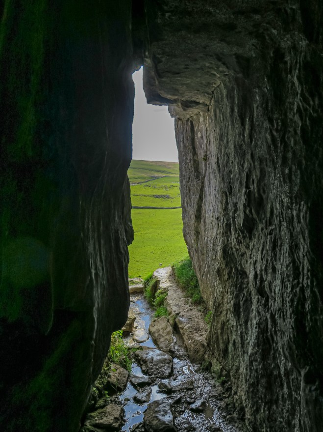
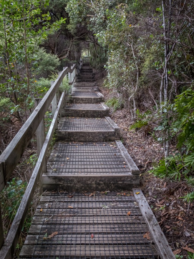
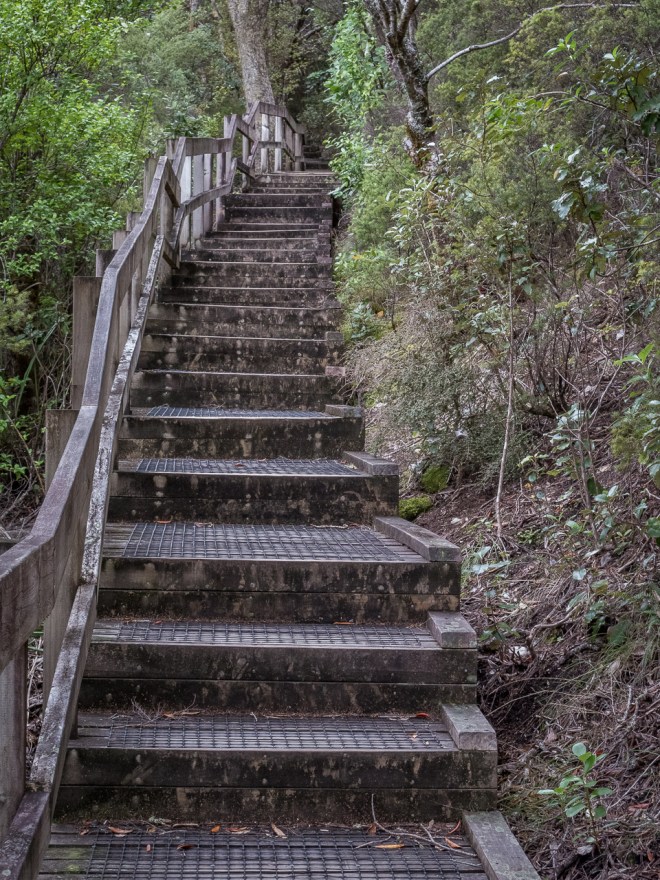
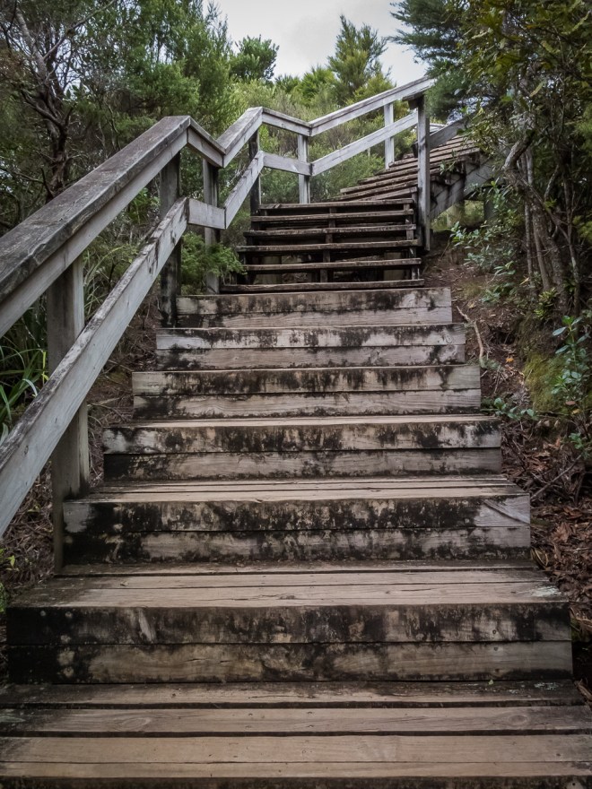
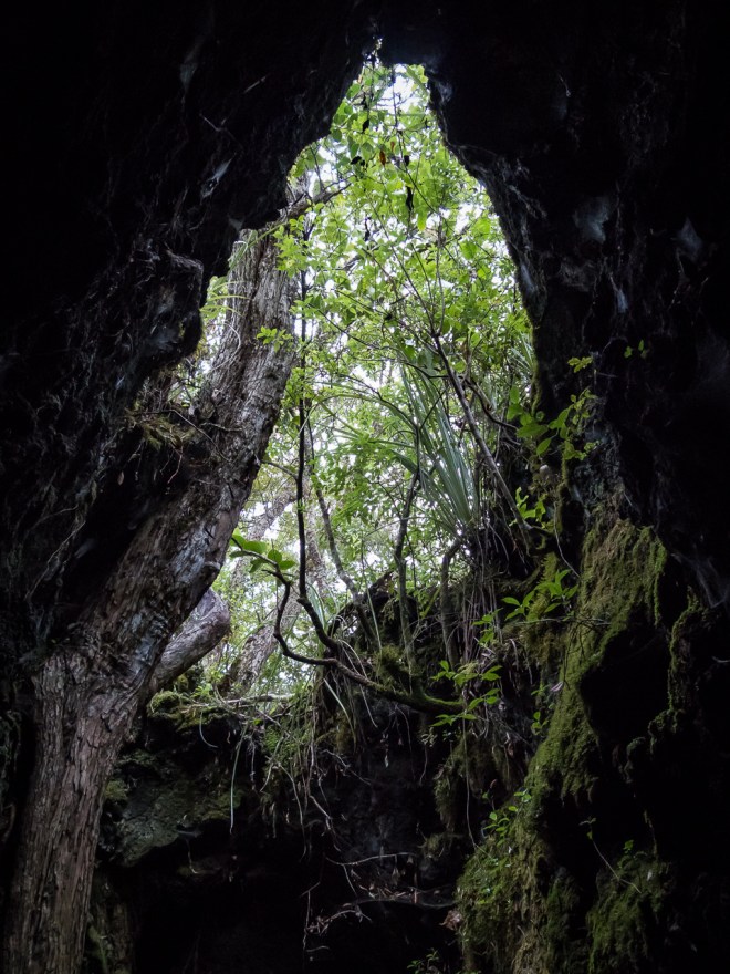
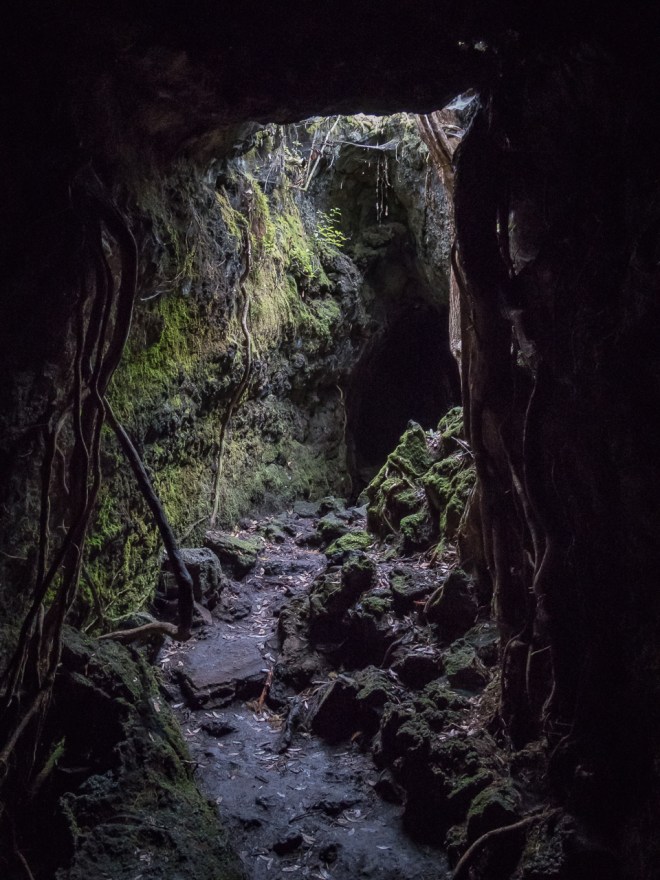
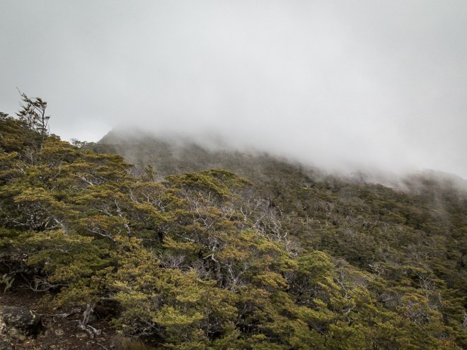
Inside the cave mouth it is near silent; no bird call, no wind. Just the occasional bleat of a ewe calling her lamb, and the steady yet slow drip of water falling from the rock above It feels like the outside world is slowly ceasing to exist. The further I move into this, most shallow of caves, the more the outside disappears. As light slowly reduces so does sound, natural noise cancelling headphones.

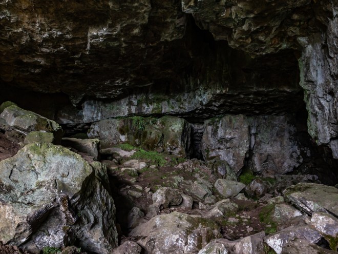
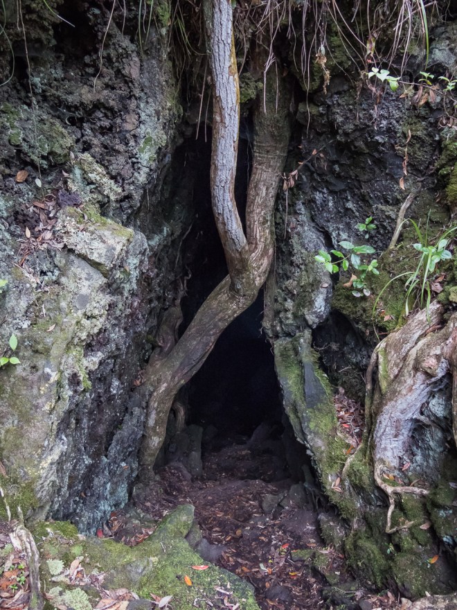
Caves terrify me. That is not totally correct, as THIS particular cave doesn’t terrify me. It is quite large and open and at a glance it does not appear too deep and foreboding. Being a law-abiding citizen, I am not going to pass that safety rope, so I don’t have to explore its crannies and tunnels. I can safely ignore any paths into the dark below, into the underland. It is they, and the unknown terrify me.

One person who does know what lies in the dark below is the author Robert Macfarlane, who has just published a new book ‘Underland’. Exploring ancient and future history by looking at what is under our feet and hidden from view. Cave systems, mines and melting ice fields revealing all sorts of things that humans have buried or disappeared. I started reading it in the pub on Friday night, and have been reflecting on the passages I have read over the weekend, I am going to take my time with this book. it intrigues me.

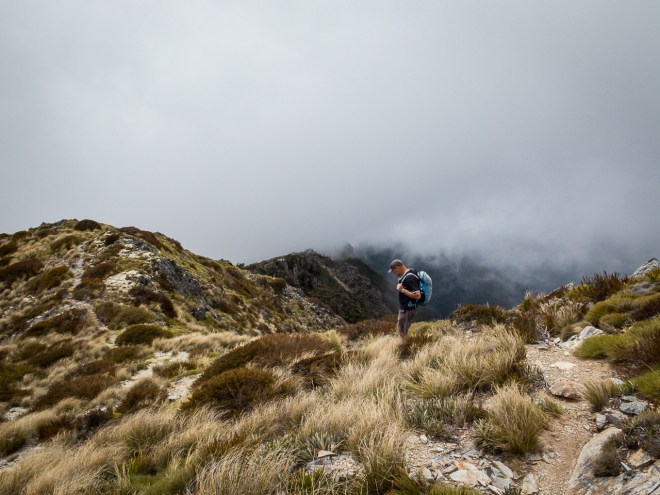
After five hours of job application writing I was finally ready to back out again, it was getting late in the afternoon, though I still decided to take a walk up into the hills and try to find Victoria Cave. It was clearly marked on Google maps and was do-able in the time I had between now and it being too dark to be out wandering alone in strange hills.

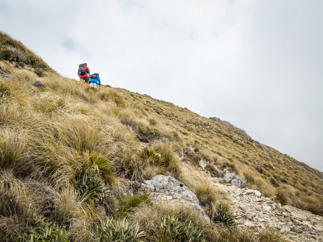
The first 40 minutes just seemed to be uphill, with a little bit of flat before going back up hill again. I am not as fit as I used to be, but managed to keep pretty good pace given I didn’t have a lot of time.

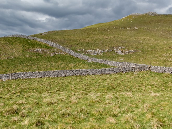
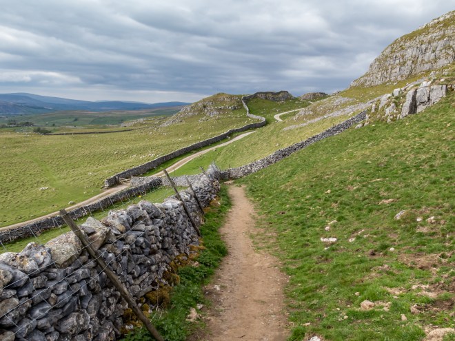
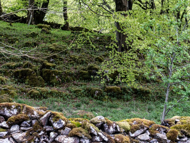
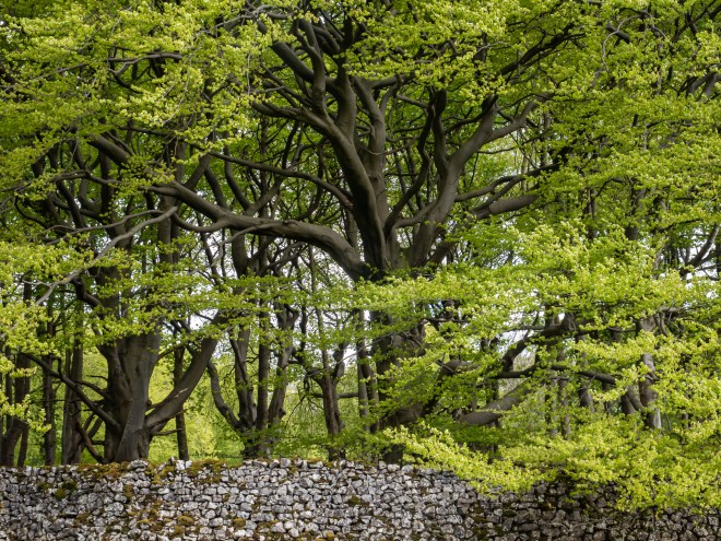
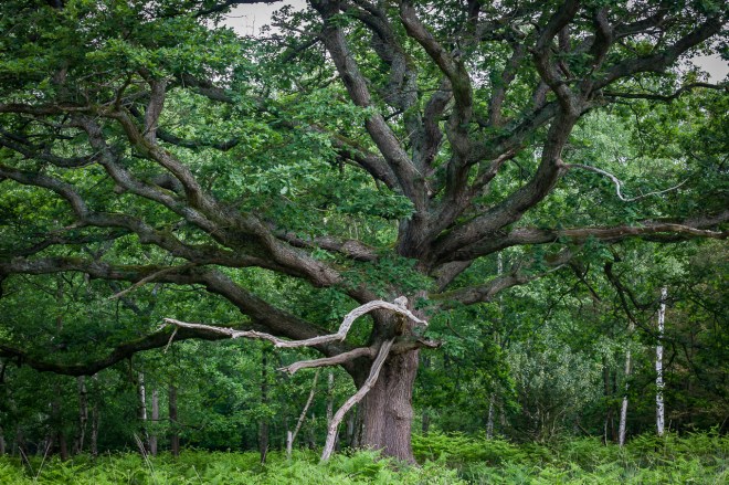
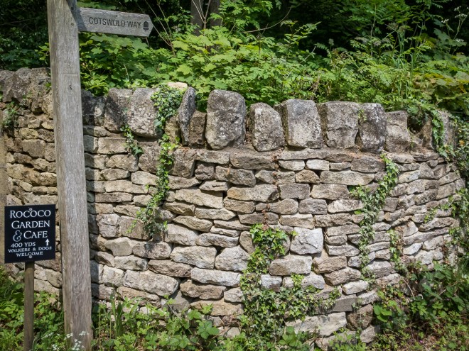
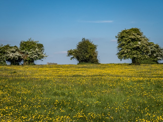
I love the dry stone walls here in Yorkshire. There are very few trees in the hills. Not knowing the old history of the area I am assuming that this was not heavily forested back when these walls were built, some possibly date as far back as the bronze age, though those old stones will be very low down in the walls as remedial work has taken place over the centuries. They are a thing of beauty, and control in this otherwise slightly disordered landscape.

I wish I had taken more time, exploring the bluffs and craggs that surrounded me would have been so much more interesting than writing job applications. Though I guess being in work allows me the time to indulge in walking and photography in places that are a way from home.

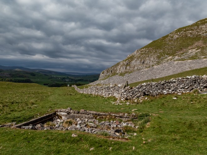
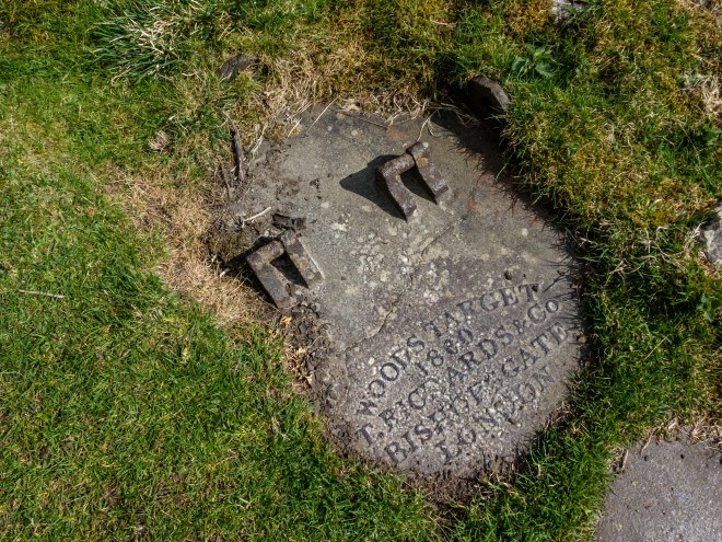
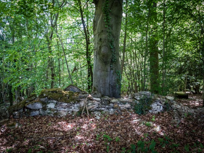
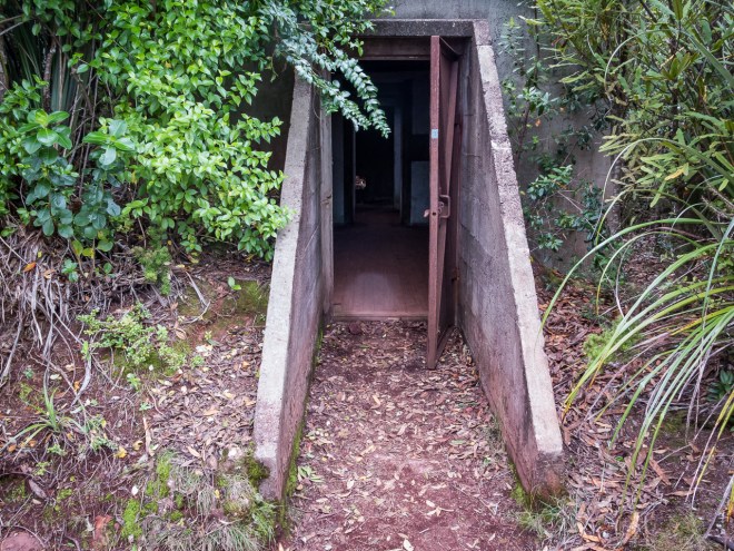
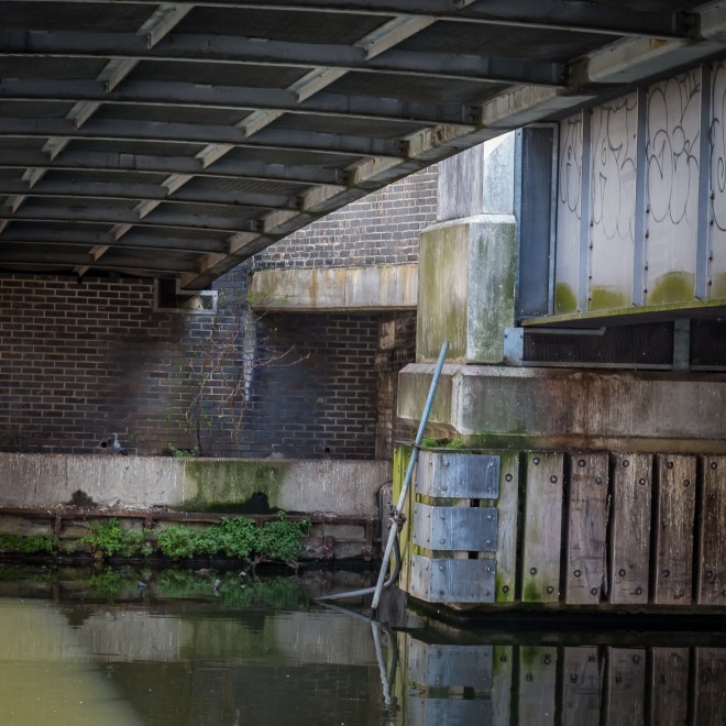
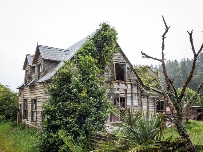
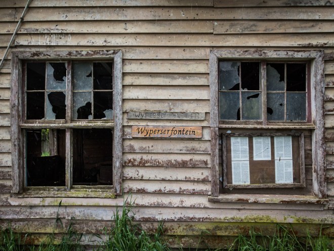
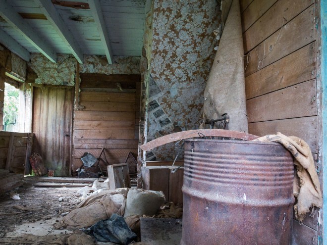
At the top of the first climb I came across this ruin. I have no idea what it was, and do not really want to know as my imagination ran riot trying to work it out. Why are there blast holes in both directions on that panel, what the heck blew holes that size?

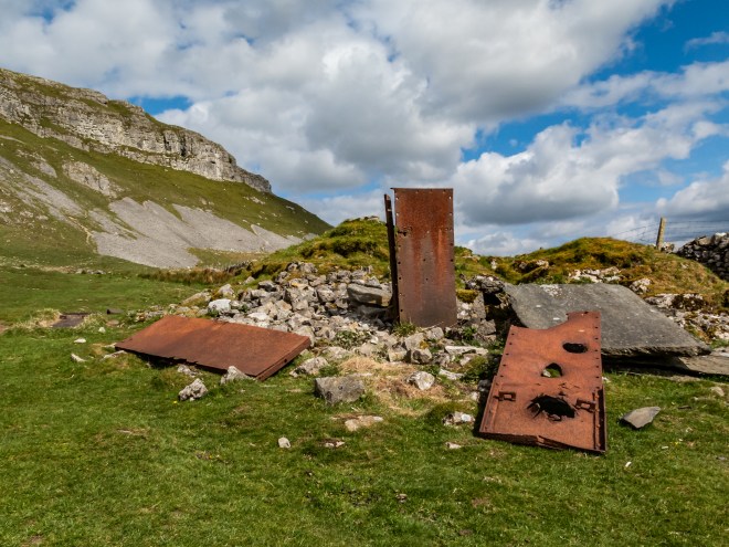
I also want to know if this plate, made in Bishopsgate, in what is the heart of the finance centre of the City of London is covering, is there something under here ? did it blow up ?

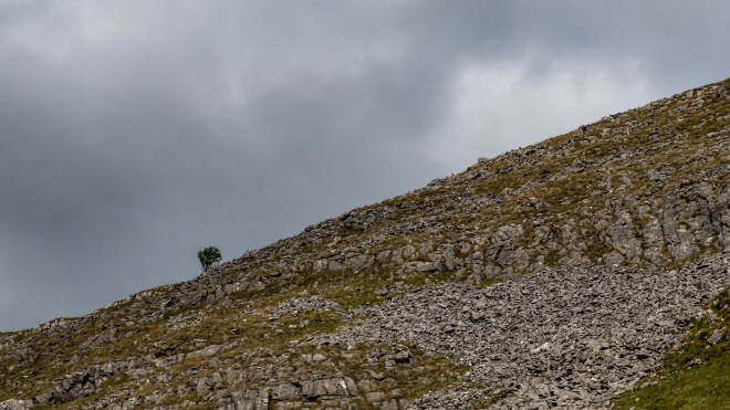
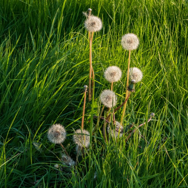
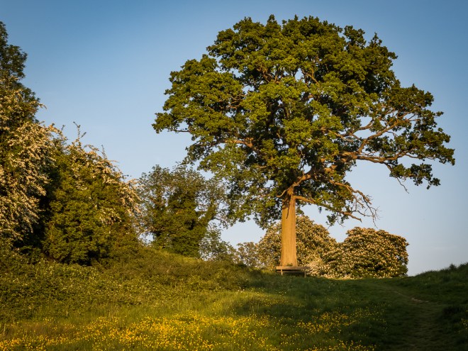
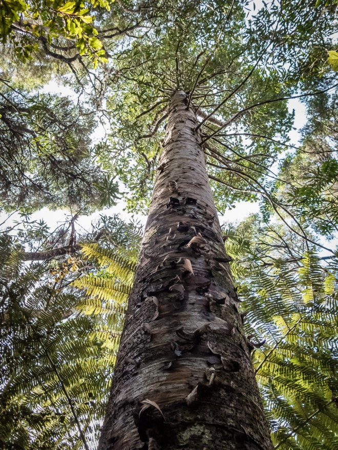
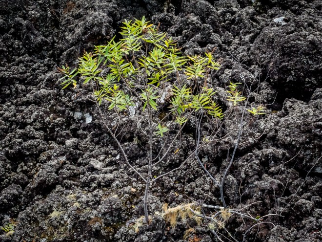
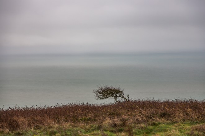
There are not a lot of trees here, the land does not look it would sustain many, and I wanted to photograph each and every one. How old are they? And why one? So many questions.

It is very unusual for me to not be listening to music, I have headphones glued to my head on my commute and as much as possible in the office. I play music when I cook, sometimes it is why I cook. I am playing music as I type. I listen to it a lot. Except when I am walking in the country, when I walk I want to listen to nothing but the countryside and the questions in my head. There are often a lot of questions.

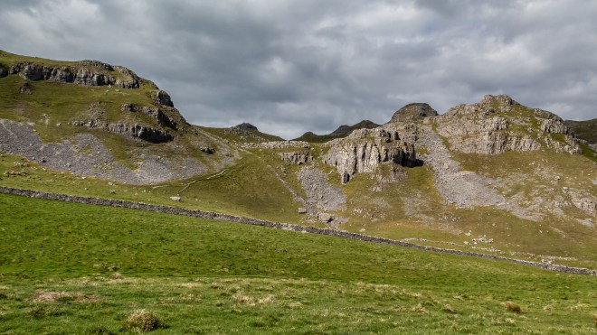
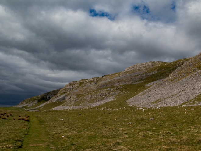
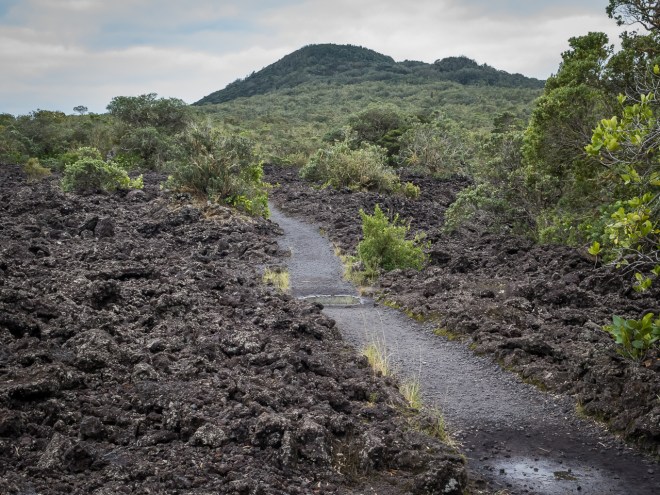
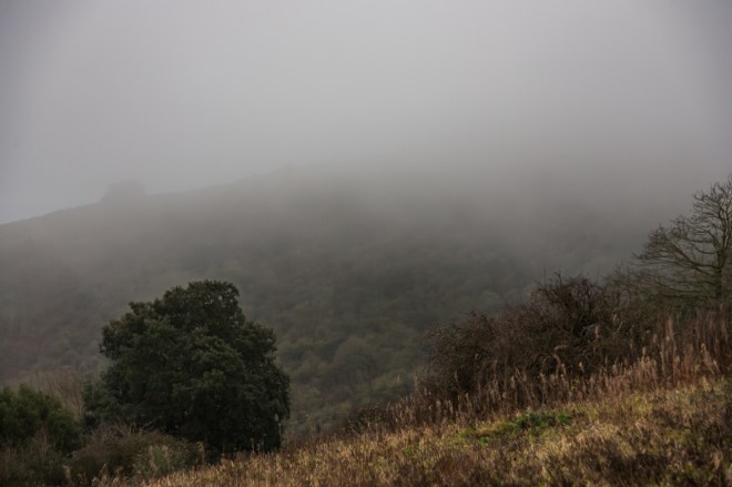
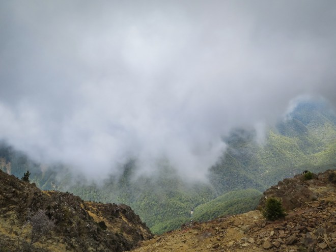
My object for this afternoon’s walk, the Victoria Caves are somewhere in this bluff, the Attemire Scar. There are a lot of cave systems in the Dales, including some managed commercial systems. If I had more time I would have had a look at some, though I doubt they would be as amazing as those mega caves I visited in Malaysian Borneo. I am intrigued by what fears me.

I reached the cave about 5:00pm and had a sit down, a drink of water and a snack bar. I had walked quite quickly up to the cave as I had no idea how long the loop would take to do. The return journey was simpler than the way there. So arrival with plenty of time meant a relaxed walk back.

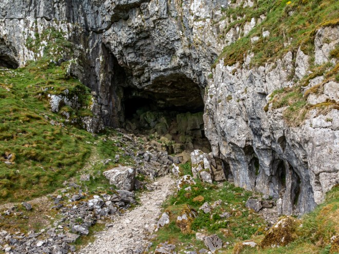
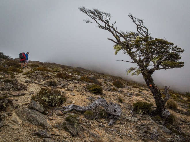
The cave is not deep, or at least access is not deep, there is a lot of rock fall and most of the cave is roped off. I could have gone deeper, there is no-one there to stop you, but I am a chicken so only went as far as the barrier. The darkness, dankness and silence was calling me further in, I really wanted to see and learn more, perhaps find someting so far undiscovered, new bones, a few coins. Something newly revealed by rock fall or fissure. 

The caves were discovered in 1837, the year of Queen Victoria’s coronation, hence the name. They were apparently an archaeologists dream find, with loads of prehistoric bones as well as a collection of Roman and pre-Roman artifacts. The question remains as to what it was used for.

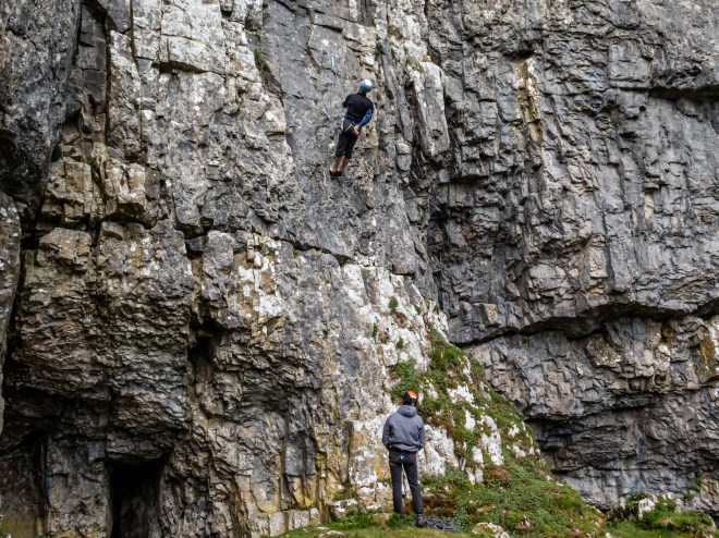
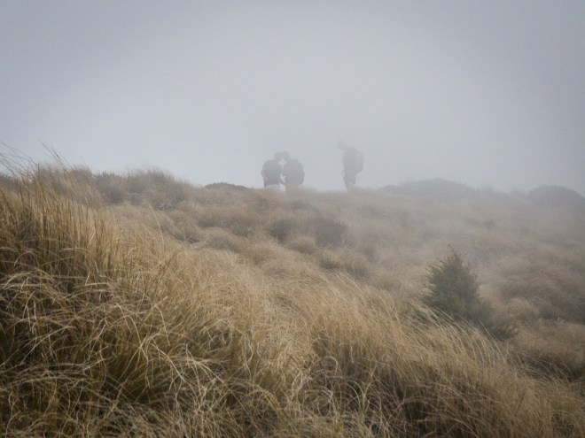
Between the main cave and the much smaller second cave I found two climbers, playing on a wall. The wall was not high, not particularly dangerous looking, though I was terrified just walking up the scree slope to the caves. As well as not doing dark narrow tunnels I also do not do heights, and the older I get the worse the vertigo gets and I really struggled getting back down from the caves to the level grass below.

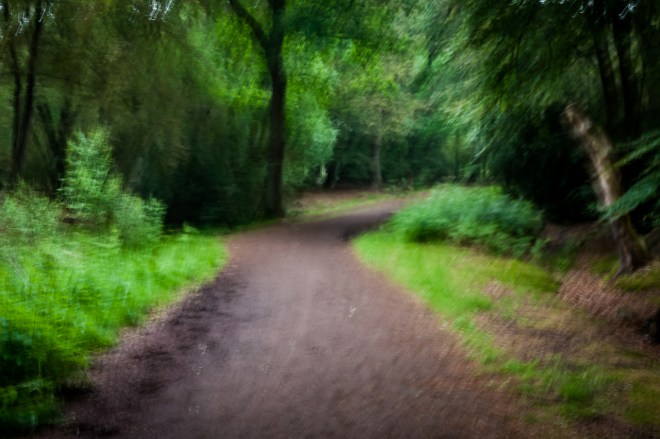
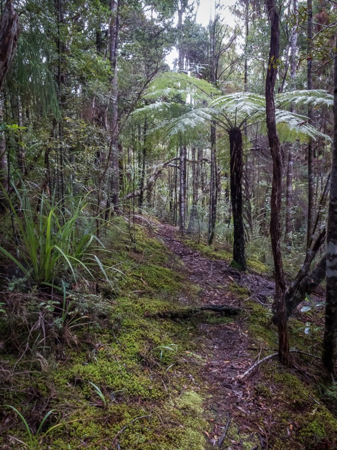
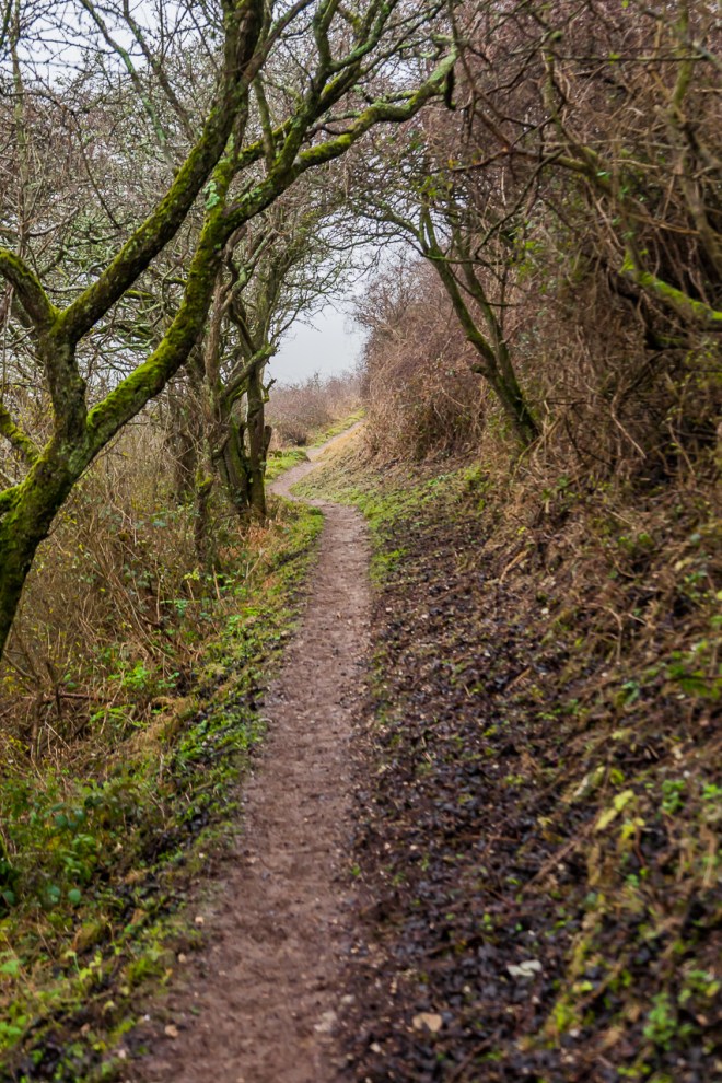
The path that makes up the second half of the loop was more clearly defined than the one I followed on the way up, which was at the best of times a mown strip in the grass. This path leads to a nearby car-park, and then the road,  following a very wiggly line of dry stone wall.

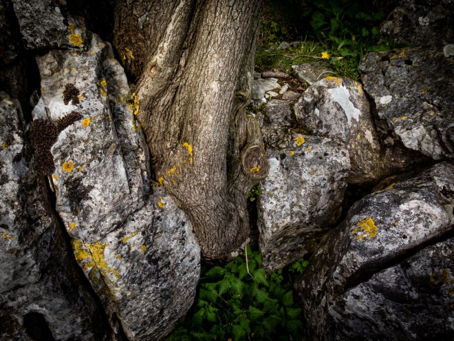
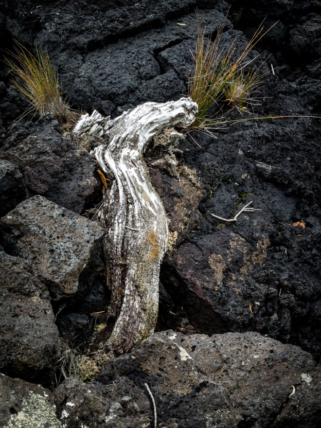
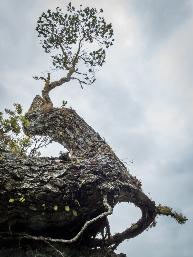
I came across another solitary tree, as this one was in my path I stopped to take a few photos, intrigued as to how and why it was growing on this particular rock outcrop.

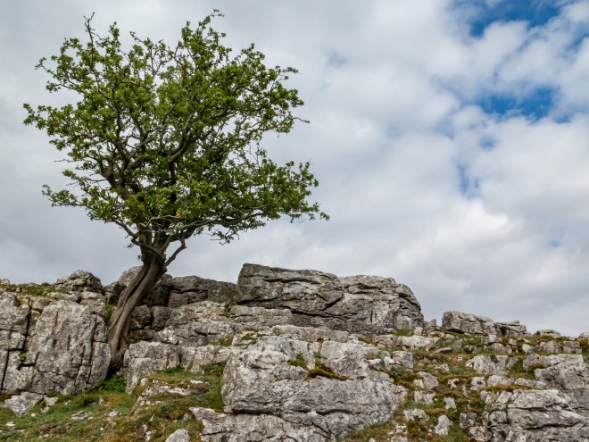
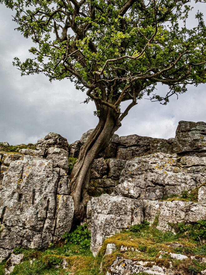
I think this is a hawthorn. I love how nature has allowed a seed to grow between the rocks of this harsh environment, forcing its way up into the light, pushing the rocks apart to allow its growth.

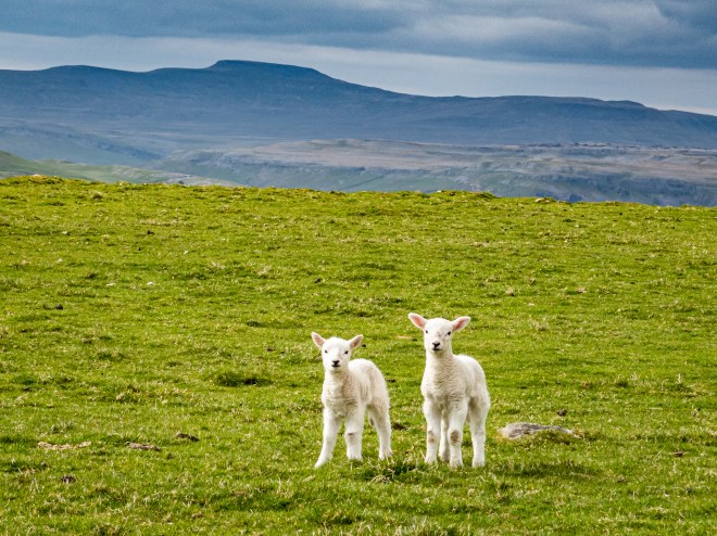
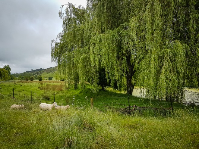
I was soon walking down the road towards Lancliffe, passing these very friendly lambs on the way, I thought they were trying to come with me for a while. Maybe my sheep voice is better than my Scottish accent ?

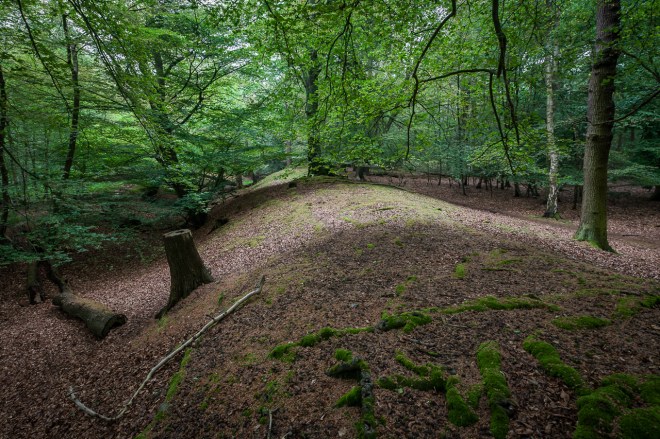
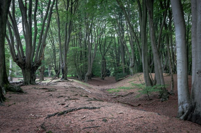
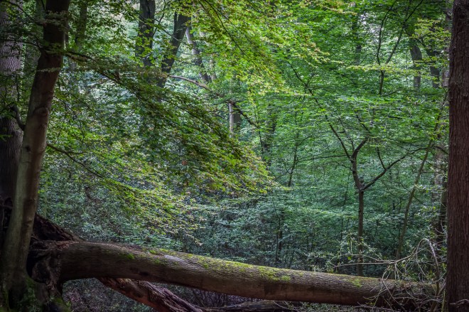
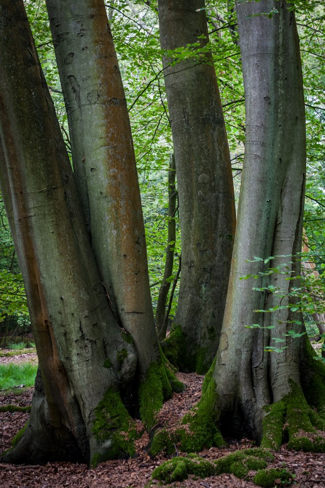
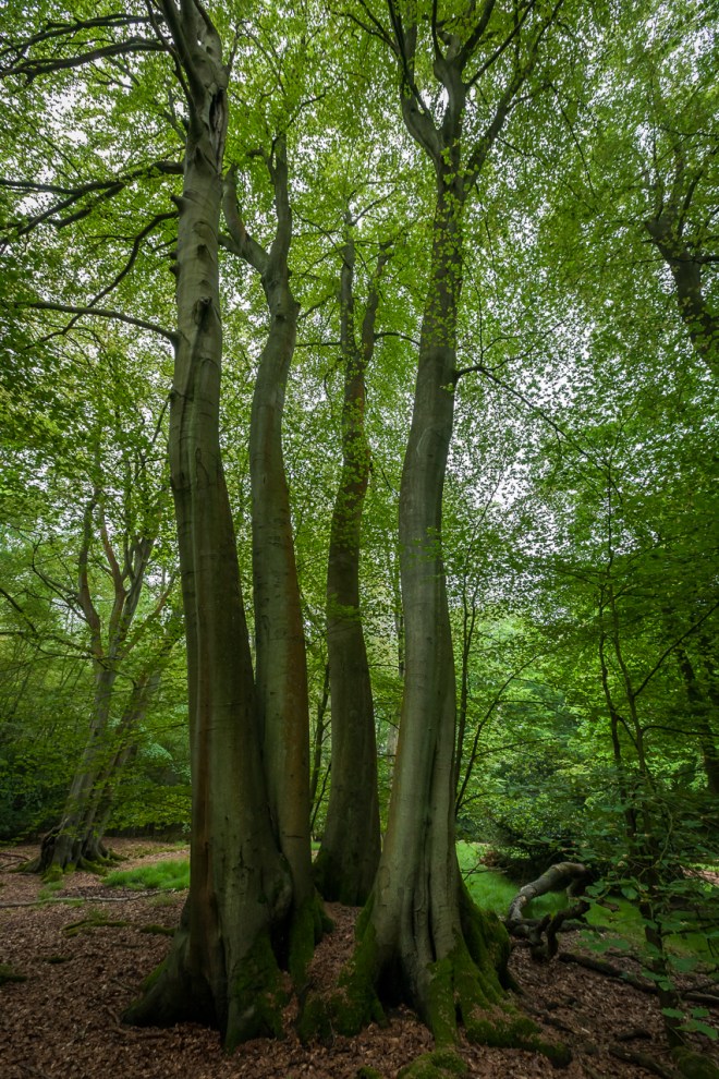
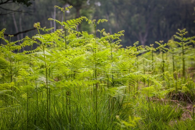
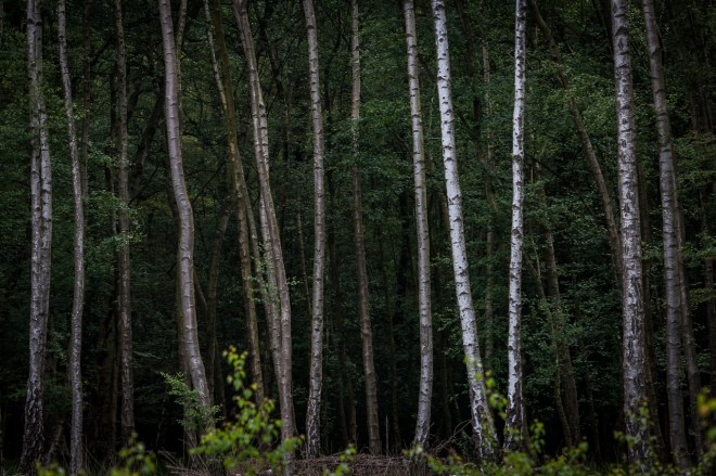
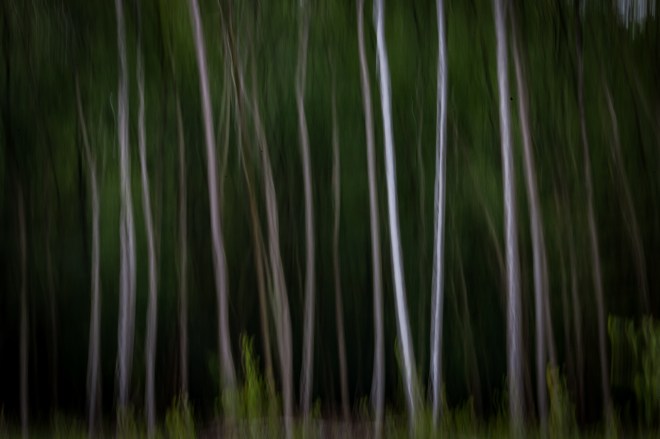
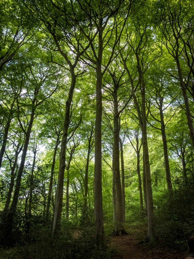
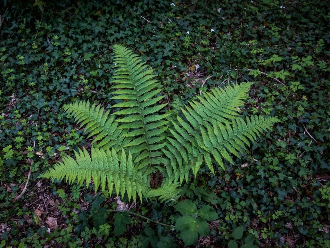
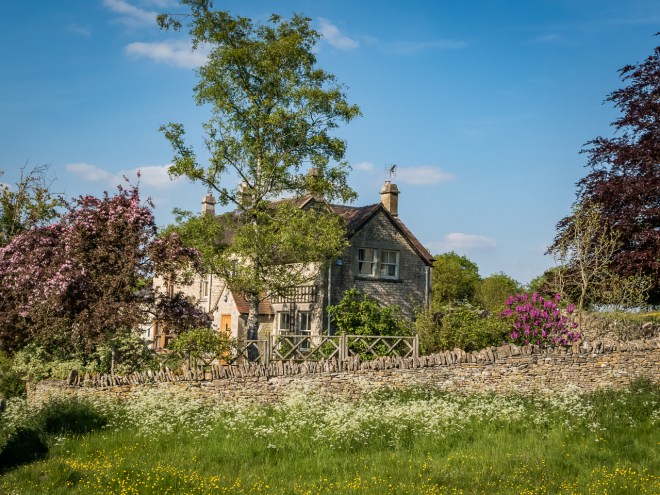
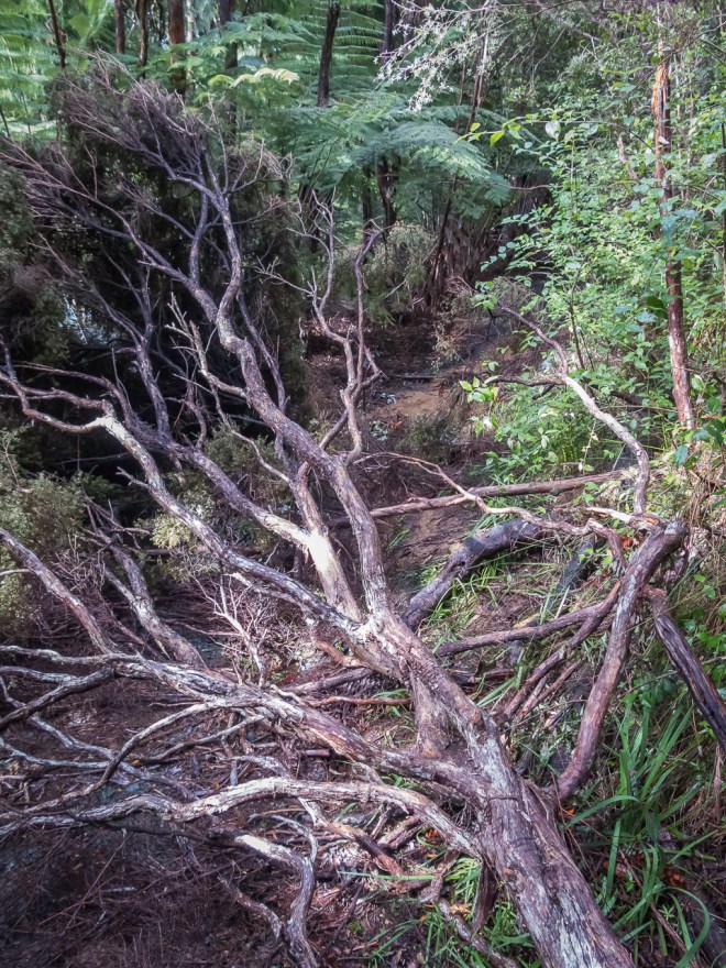
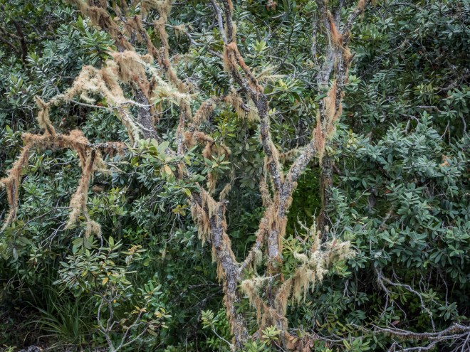
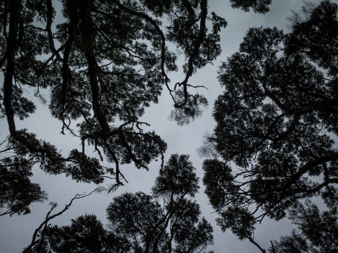
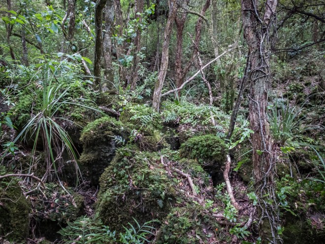
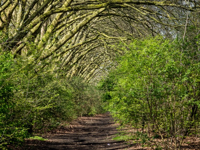
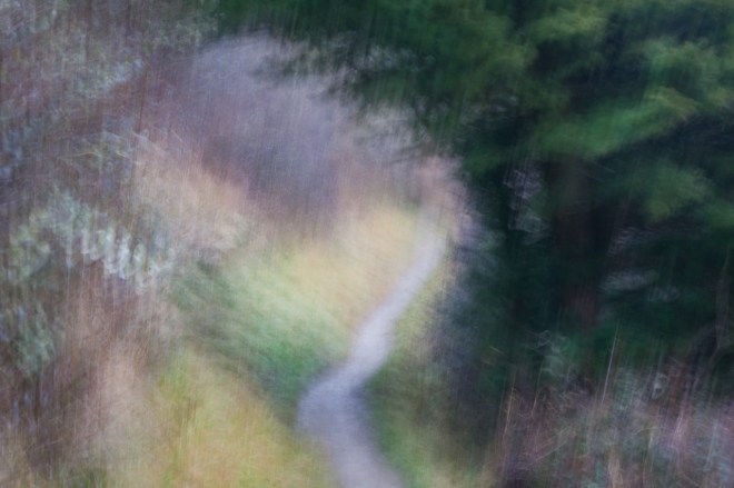
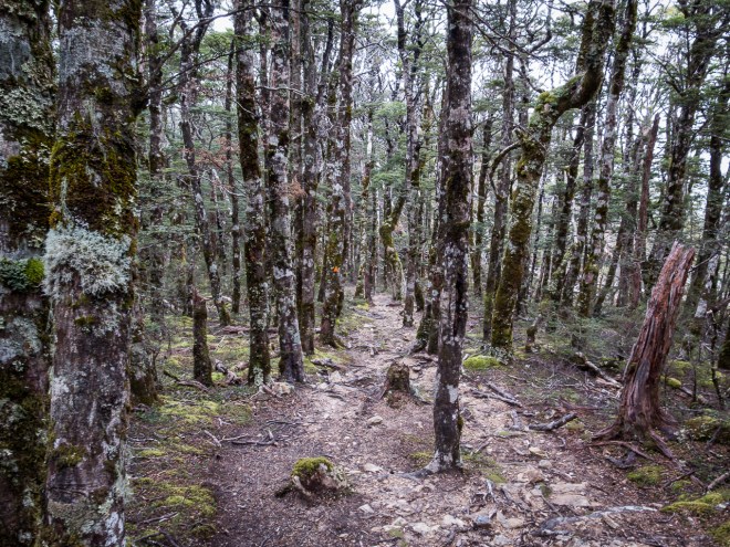
On the outskirts of Lancliffe I passed what I am assuming is a private forest, possibly surrounding some large manor house. The variety of shades of green in the walls, the moss on the banks and the trees was incredible and I have failed to capture them with any accuracy. The light was low and I had no tripod. After spending so much time with few trees, it was wonderful to be reminded of why we need more, not less of these wonderful things, and that wandering amongst them should not be just the privelidge of the wealthy.

That was pretty much the end of the walk. It was lovely and I wished I had more time to enjoy it. I did deserve the massive meal and couple of pints I had in one of the pubs!

A walk along the River Lea

Saturday 14 June 2018 – Walthamstow to Liverpool St.

I am pretty sure I start every post off with the fact that I have been very busy and I am way behind with writing and photo-editing. I can at least say this time that I am up to date with photo-editing. However, I am now six weeks behind in post writing, with five left to do to just catch up, and now I have two big things on that are consuming all my non-working hours.

After a small amount of negotiation I have an offer agreed on a flat purchase in St Leonards-on-Sea, on the East Sussex coast.  I have taken a few trips down there over the past couple of months, more on those trips in a later post. Naturally I am very happy with this. Though of course it will mean I will have a lot less money.

I also have an exhibition of photography coming up in October. My favourite local cafe are giving me their walls for two months and I am going to show 13 photos, they will be big photos!

That is the future dealt with, now back to the past!

It was one of those nice Saturdays back in July, the middle of the longest and hottest summer for many a year. There was a record out I wanted to buy and I thought it would be a good idea to take the 8 mile trip to Brick Lane on foot. Most of the journey is quite nice, along the River Lea and canal tow paths.

I also wanted to get some images I could use for the exhibition, some close up shots of grasses and plants as I passed through Walthamstow Marshes, the Middlesex Filterbeds and along the Lea itself.

So here they all are!

IMG_8291

IMG_8293

IMG_8300

IMG_8307

IMG_8308

IMG_8322

IMG_8329

IMG_8335

IMG_8339

IMG_8343

It took me three and a bit hours to get to Rough Trade, and they didn’t have the record I wanted. I was in no way disappointed, it had been a great walk.

The beautifully brutal.

Sunday 03 June 2018 – London.

When I started thinking on this post it was going to comprise a number of semi random images taken during June. However, I could not put together much of a thread for the images beyond ‘All taken in June 2018’, and well, some of them were a bit crap. This post thread has now reduced to images taken on a single walk.

On and off over the past three years I have been visiting towns and villages outside of London, looking for somewhere that I would want to live, and that I can afford to live in. There have not been many. Long term readers (are there any? If you are one “Hello, and thanks ” 🙂 ) will know that I was looking quite seriously at Folkestone back in early 2016. Sadly Folkestone was ruled out with the MEP (Member of the European Parliament) election, where the right wing UKIP party won a number of seats in the European Parliament; and then Brexit happened. Folkestone and its surrounding areas were pretty Brexity, this was something I was not happy with so I subsequently wrote Folkestone off as somewhere I wanted to live.  Hastings, however has come back into the picture, and more of that in near-future post.

Anyway, that was a long preamble, and almost, but not quite pointless. Much as I am trying to find somewhere else to live part time, it has to be said that that has nothing to do with the city I live in. I do actually love London, and do not ever see myself not being in or near the city. There is so much to love about this city, access to concerts, to galleries, its history; and its architecture. Today El and I visit two of those things.

Tate Modern has a couple of really interesting exhibitions on at the moment. As members we get to visit these exhibitions for ‘free’, more importantly we get to visit them an hour before the public. This is crucial as sometimes these special exhibitions can be packed, even with a £16+ per person entry. The Picasso 1932 exhibition was very busy even before the public viewing, I am very glad we got in there early! There was some interesting work there, but with a single year focus the broad range of his work was not on display, it was not the best Picasso event I have been to.

The second exhibition we visited was ‘Shape of Light – 100 years of photography and abstract art’ combining painting, photography, and other light manipulation techniques. I will admit to being a bit disappointed, mainly because I misunderstood the subject. It was OK though. This was the first time I have been to an exhibition where photography was allowed, not sure if this is a new thing, or just for that particular show. I liked the idea and took a couple of pictures. I particularly liked this doorway…

This final room was by far my favourite, and seems to be the subject of a number of Instragram posts. A wonderful moving abstract piece by Maya Rochat.

The other great thing about having Tate membership is access to the various members lounges for food and drink, in relative peace. There is a great members lounge on the 8th floor of the new wing, so taking a detour via the free exhibitions we took to the members lounge. This piece ‘Babel’ by Cildo Meireles is quite amazing, and quite loud. At 4 metres(at a guess) tall and with hundreds of radios tuned to different stations it is quite disconcerting; and very aptly named.

This is Terry, according to his Starbucks coffee. I always try to take a picture in this section of the members lounge, the view down this narrow and beautifully lit passage is one of my favourite bits of the building.

After coffee and cake we decided to take a walk from one key London location for brutalist architecture to another; South Bank to The Barbican. The new wing of the museum is amazing, in fact architecturally, both buildings are amazing, I am going to have to come here on my own one day and spend some just taking photos of the building itself. I love it. A lot.

There are a lot of solid, angular, concrete buildings between the Tate and Festival Hall, including this block of flats that used to be on my courier run when I lived here in the 1980s.

The Barbican Estate was built between the 1960s and 1980s on old WWII bomb sites, there is still building going on around the fringes of the estate as, with new buildings being finished on London Wall. I love the Barbican and the area around it, my cousin lived in one of the towers in the 1980s and I visited a couple of times, the view from her flat was magnificent.

The Barbican Estate is the classic example of 60s brutalist architecture. Being a private estate with relatively (and very) wealthy residents, means it is well maintained and its fine sharp, industrial looks are not marred by decay.

I have been here a few times before, usually with EL or other friends, not usually with much of an opportunity to use the camera. I grabbed a few photos today, trying to catch the lovely late spring flowers against the sharp angles and dirty brown and grey concrete.

We stopped for a drink and very nice lunch in the Barbican Centre before wandering slowly to Liverpool St Station and on to home. A really nice end to a great morning.

The Epping Forest Project, Phase 5 – May.

The Epping Forest Project, Phase 5 – May.

Reluctant at first I headed down the gentle slope and into trees, uninspired and frustrated at myself for not being able to relax into this morning alone in the forest.

As I descend towards what I suspect will be a small stream the noise from Epping Road slowly recedes, the bird noise becomes prevalent and I start to hear beech nuts and other tree fall crunching under foot. The peace of the surroundings is settling my busy mind and soon enough my footfall is quieter, my march has become a relaxed stroll and my ears and eyes are tuning into the frequency of my environment. I hope to see deer.

Another busy month, another with few opportunities to get to the forest of a weekend. I must try and get up after work some time, battle my way through the late afternoon traffic, or this project will never take place.

For the first time this year I took the mountain bike for a quick ride before El and I went out. I didn’t go far, just to Higham’s Park Lake, though even that was enough for me. The newly arrived adult hay fever has been particularly bad this summer, even with the daily pill I am left sneezing, coughing and streamy of eye on the worst days. It was still great to be out on the bike for the first time in months, though I did suffer for it.

I also found my new favourite tree, so gnarly!

I bought an Epping Forest book the other week, it was mentioned on Twitter and just seemed like the perfect book for me. Written by the naturalist Edward North Buxton in 1884, I found a second edition copy from 1885 on the internet for £17. The book is in fabulous condition and contains the author’s description of the forest and 6 maps, all drawn from his exploration of the forest. Epping Forest have recently released an updated version of their forest map, so it was with great delight I spent some time comparing the two. There were not too many differences, the roads and paths were almost all the same, interestingly Hollow Pond did not exist in Buxton’s book. I looked it up and the pond was only created in 1905 when stone was quarried for the construction of nearby Whipps Cross Hospital.

This morning’s walk was to look at Ambresbury Banks, one of the two ancient earthen forts in the forest; the other being Loughton Fort which I have visited many times in the past. The construction of the earth fort is believed to have commenced around 700BC and the site was occupied until at least 42AD. There is a 6ft tall bank and moat surrounding an area of around 4 hectares.

There is not a lot to see to honest, a bank and some beech trees, some pollarded and some not. It is quite close to Epping Rd and the traffic noise was quite loud, verging on unpleasant. It was not what I needed this morning. I walked the perimeter, where possible I used the top of the wall. Walk in the footsteps of those ancients who created this haven for their families and their livestock. It is more clearly defined than Loughton Fort, but I feel less of it than I do for Loughton, perhaps it was just the nearby road?

Completing the loop of the site I consulted my new map and decided to head towards Theydon. I did not have a huge amount of time this morning, so started walking along one of the mapped pathways, taking the opportunity to experiment further with impressionist photography.

Mapped pathways are not really my thing so spotting a bike trail pointing roughly where I wanted to go I wandered off into the trees. Finding the small stream at the bottom of the valley I could see loads of deer sign in the mud, clearly this place, without a steep bank is where wild life came to drink. I decided to follow what looked to be a well used deer track through the twisted young scrub. No human or cow sized animal could walk though here, it was all very low. I was making so much noise bashing though that I gave up any idea of seeing any wildlife at all.

I followed the stream until it joined with a proper trail and finally I found a scene that was worth spending some time setting up the tripod and getting angles just right. The tripod thing is a whole story in itself, though I am never sure on how to express it, one for another day.

Soon after I found this big old beach, I think it is one that was a coppice (chopped at ground level) which has led to these four separate trunks. I decided to take some time with my camera, walk around the tree, set up some shots and try to make some crisp photos. Then the noisiest man in Epping Forest turned up with a friend and they sat right by the tree I was taking photos of. Talking inanely, he at the loudest possible volume, I quickly lost my happy vibe , took two pictures and stomped off.

Almost back at the car I came across a small open plain area with some lovely tall silver birch on the edge and a wonderful old oak surrounded by fern in the centre. I took a lot of images, though the light was hideous; bright and flat, filtered through low light cloud. I will come back here again when there is some big cloud going on. It is a lovely spot.

These silver birch just screamed out for a bit of panning, so tall and straight.

After a fairly flat and uninspired start to this walk things really did pick up and I was happy with the photos I took, and the time I had outside. My enjoyment increasing the further I moved away from the noise of the traffic; something to add to my mental health toolkit.

A small taste of the Cotswalds

Sunday 20 May 2018 – Cotswalds, Gloucestershire.

How do they fit all this countryside in? This is something I ponder (and wonder at) every time I leave the city and explore somewhere new.

Why is it all stunning? often follows immediately after that first thought. This is now my favourite part of the country, being the final thought in that head conversation.

The UK has a population of about 65 million. It is roughly the same size as New Zealand, which has a population of 4.5 million. Where are all the people in the UK?

Admittedly almost 9 million live in London alone, but that leaves a heck of a lot to fit in somewhere else. I cannot believe the country has so much rural and open space. I am not complaining one little bit.

My daughter, Meliesha, recently took a nannying job in Stonehouse, a small, unremarkable place on the fringe of the Cotswalds town of Stroud, about 3 ½ hours by car from home.

El and I were invited up to stay with her and her host family for the weekend.

We arrived in time for Saturday lunch. After meeting the family, Meliesha, El and I got back in the car and Meliesha showed us around some of the nearby places. Stonehouse itself is not that great, a commuter town, three crap pubs, no coffee shop, and probably voted for Brexit. It is that sort of place. But wowsers; all around is loveliness. Out first stop was the gorgeous village of Painswick.

Painswick made its money as a wool town, and was obviously once a very wealthy place, and probably still is. It is an absolutely gorgeous village, the epitome of English villageness.

It was remarkably quiet when we arrived, with very few cars passing through and very few people on the streets. This made it even nicer, in my eyes. The buildings are primarily made from local stone and are similar in style and colour. It is all very attractive, and I immediately fell in love with the place.

We passed through the churchyard with its sculptured yew trees. I could quite easily have spent 30 minutes there alone with my camera.

Meliesha has been to Painswick Beacon with a local walking friend she has made. Leaving the village, we started up a small section of the Cotswalds Way long distance walk.

The walk begins with a loose collection of interlinked foot and bike trails through a tiny section of ancient forest. Tall unpollarded beech trees tower above and shade the last of the spring bluebells and the abundant ferns. It is quite lovely.

The forest runs along the edge of a golf course that slowly rises up towards the beacon. On its edge lies one of the quarries where stone is carved from the hillside for the building trade.

One of many, many things I love about the British countryside, and a point of difference with New Zealand, is stone walls.  Though they are very difficult to take an interesting photo of.

The top of the hill is a popular place. As part of the Cotswalds Way, walking groups pass by and there was a large group of school kids monopolising the beacon when we arrived. The view from the top was far-reaching in all directions.

IMG_8090

We did not stay long on the top. Too many people and a cold pint beckoned.

On the way back down through the forest I experimented further with some intentional camera movement photography, working on a technique to produce impressionist painting-style images without relying on post-production techniques.

Meliesha had another village to take us to, this time with a pub, rather than a walk. So off to Amberley Village we went. I cannot remember the name of the pub we went to, but I do remember that the three drinks I bought cost less than two in London, and that there was a nice view. A brief walk from where we parked the car took us past fields full of daisies and buttercups. I remember that parks and verges used to be covered in these flowers, but we see so few in the city these days. Is this a false memory?

This mini library in a phone box is brilliant, one book out and one book in. A large version of the little libraries on the streets of Walthamstow.

Our final stop for the day was for an early dinner at the Stroud Brewery and its really nice pizzeria. Sadly being the driver, I could only have a single drink. Nice beer, great pizza and a really nice family vibe, I would definitely be a regular if I lived here!

Meliesha was babysitting that night so El and I went for a walk to one of the local pubs. We didn’t stay beyond a hastily consumed single drink. Not our sort of pub.

It had been recommended to us to walk up to the top of a nearby hill. Meliesha comes here often to watch the sunset.

There is a magnificent oak at the top of a wild flower filled field, though we didn’t get to see the sunset. Sitting down turned us into midge magnets and we were soon swarmed with flying, biting things.

The following morning, after breakfast with the family, Meliesha took us on one of her regular walks round the neighbourhood. Stonehouse sits on one of the canals that were used to transport goods from the mills that abound in the valleys, providing the source of wealth that created these now lovely old villages.

Like the tow paths of the canal system through London, there were numerous runners, cyclists and walkers making the most of this lovely late spring morning. What a lovely place to take some exercise. One day I would love to take a long bike ride along these paths.

Too soon, it was back to Mel’s place and then El and I were in the car for the 3 ½ drive back home. A lovely weekend away, and a place we would like to come back to and explore more.

Wainamu

Sunday 29 April 2018. Lake Wainamu, Bethells Beach, Auckland, New Zealand.

‘You are here’ the sign tells me, us. However, this is not always helpful. Where exactly is here? The sign may show which way is up, but sans compass in the middle of dense forest, how do I know which way north really is? Getting the map out doesn’t really help. Doubt creeps in. We have been here before, making assumptions, tired decisions, stupid decisions, decisions based on what we know, familiarity leading to contempt. Wrong choices and wrong directions.

I am not talking about life, or a trans-Gobi expedition, this is just a four hour walk in the bush (as we in New Zealand call the forest). Though there was a brief moment on our walk this afternoon when we were not exactly sure where we were. The sign told us, but making sense of that in relation to where we came from and the map we carried led to a brief moment of indecision. We are both experienced in the bush, but have both made directional errors in the past. Nothing tragic, this is hardly serious wilderness, but frustrating and tiring mistakes, ego deflating mistakes, a loss of face as we consider ourselves experts in our domain.

Vicki is my newest Auckland friend, I am guessing we were introduced to each other some time in 2010 when we were both looking for someone to run in the hills with. Vicki wanted someone to slow her down so she could train for ultra distance off-road events and I was just too slow for the other trail runners I knew. We both love the bush and running the Waitakere Ranges trails, and we both like to yak incessantly. We made for good running/walking companions, and she became one of my closest friends. I always leave a day free on my visits to Auckland to ‘go bush’ with Vicki.

The Waitakere Ranges are under severe pressure right now. Kauri die-back is a fungal killer of New Zealand native kauri trees, most of which are found in the northern part of the north island. It has been identified that the fungus is spread manually and with this in mind the Waitakere Ranges are to be completely closed to humans from 1 May 2018. Two days time. As tracks are upgraded and modified; basically made into dull, boring, non-muddy super-highways they will be reopened. It is better than having no kauri, though I wonder if that means I will never be able to walk in the ranges again ? A terrible thought to contemplate. Luckily there were two days to go before the ban, my timing was perfect yet again.

I am now so unfit that the idea of a run fills me with dread, and though Vicki still likes to run she has put together a nice afternoon walk for us, early training for a mega event in January. Naturally this turned out to be more complex than planned. We arrived at the Cascades car park to be greeted by a sign advising that the trails were closed. We were a bit miffed at this as the closure was not due for a couple of days. Ignoring it we carried on, only to be met by a park ranger on the road down to the tracks. We questioned him about the closure, and he informed us that the swing bridge over the river had been washed out in the recent storm, hence the track closure, that was not a pre-empting of the council order.

Luckily Vicki had a plan B. Back in the car we carried on to the dunes at Bethells Beach and the start of the Wainamu tracks. Crossing the dunes was a bit of a slog, I hate being unfit, but we were soon in the mud and walking around the lake that has formed behind the dunes. There has been a lot of rain lately so the tracks were a little muddy, and very greasy. Pretty much how I like it.

Taking a right from the Wainamu Lake Track and on to Houghton’s Track we started to head uphill, always up hill. I have walked up and run down this trail a few times in the past, it has never been dry and I have been on my bum more than a few times coming down. The recent storms had turned the trail into a bit of a river. Though merely wet now you can see where the water had  flowed not that long ago.

Two weeks ago a super storm hit Auckland, there was a lot of wind damage, trees and power lines down, my youngest son had no power to his house for three days; and some were out for as long as ten. The Waitakeres took a battering as well and there were a lot of trees down across the tracks. I guess with the area being closed in a couple of days there was no compelling reason to keep these paths clear.

At the top of Houghton’s we decided to break the rules and walk a track that had been closed for some time. It was slowly disappearing as the bush took over, there were a couple of moments when we had to scout around a bit to find the trail as tree fall and new growth hid those faint traces of prior human passage. I can see how easily it is to get lost here. The bush is spectacular, lots of nikau, rimu and kauri. Punga trees, ferns and cutty grass line the trail.

I wish I knew more about the various bushes and trees, both here and in England. I can see that even in these low hills the variety of plant life varies at the different altitudes and I would love to be able to describe why.

Dropping back down the far side of the ridge we cross the Wainamu Stream, the exiting path slightly upstream from the entry. Luckily the stream is not running too fast, or too deep. I am foolishly wearing long trousers. Good for the cutty grass, but not so good for stream crossings.

The stream marked a low point, a valley bottom. Half way round the walk, naturally this meant a schlep back to the top, to the next ridge. grrrr….  At the end of this track we had the ‘which way do we go now?’ discussion, the signs and the map not helping. Up was the right way, which was lucky as up we went, though we went that more based on feel than fact. Sometimes feel is right. These old signs are slowly being replaced with newer, modern, shiny white and orange signs. None of which I think will last as long at the old wooden signs, signs from youthful walking and camping sessions in these hills.

More uphill, more greasy track and windfall clambering, more bush bashing. This is why I love the Waitakere Ranges so much more than Epping Forest. Epping is not a bad substitute, and it certainly gets muddy and slippery, but it does not have the short steep climbs and the range of flora is limited, it feels less ‘jungle’ Most disappointingly, it does not have all these lovely and photogenic streams.

Our rolling ridge loop completed we were back at the top of Houghton’s Track. It is always so much easier going down, and I only slipped once, not quite landing on my butt; very close though. I was getting quiet tired by this stage, not having had a lot of sleep over the last week due to the time difference from London. The second (or was it third) large whisky late into the previous evening certainly didn’t aid matters, enjoyable as the evening was. We have been walking for four hours and I ran out of water a while back. I know when I am tired as my feet catch every second rock or root and each slippery patch gets closer to catching me out. Even so, I would rather be doing this than walking a mall – which I did yesterday.

Houghton’s Track ends at the bottom of the hill, back on the flat, on the far side of Wainamu Lake from the dunes and the car park. It is a boggy and wet slog back along the Lake Track and was one of the least fun sections of the day. However, it does lead to the lovely Wainamu Falls, looking quite calm and pretty with the right amount of water flowing over them.

Behind us is a valley connecting the falls to the lake,  we had approached the falls up the valley from the other side of the river. We could see the flood flattened grass, the water mark up the bank was scarily high, there must have been a metre of water flowing through here after the rain a couple of weeks ago. You cannot see the normal flow of the stream in this picture, it is off to the right and I could have easily jumped over it. I cannot imagine how it would have looked and sounded as a raging torrent. Like all wild streams and rivers, these can be very dangerous in flood, two young lads drowned not that far from here only a couple of weeks ago.

I had been thinking that we were pretty close to the end as we left the falls, but there was still a way to go. As we rounded the lake an early autumn squall passed, we stopped to don rain jackets, but by the time I took a picture and put my coat on the rain had passed and humidity briefly increased.

The last few hundred metres were mostly spent walking through the stream, it is shallow, but with all the rain it was too wide to bypass. Private farm land on one side and steep sided dunes on the other meant wet and sand filled shoes.

The stream narrowed just before the car park, forcing us to crab walk up a steep dune face to avoid the deeper and faster running water. My shoes were black with sand, and all I was thinking was ‘I am going to have wash these before I go to Australia on Tuesday.’  We soon arrived at the trail head and on to the waiting car, and lovely tin shed near the car park.

It was an excellent afternoon out, my second to last day in Auckland and a fitting end. I am pretty sure there was not more than a few seconds when one of us was not talking. I must note that more than once on the uphill bits I was only capable of a grunt or two. I must get fit again!

Thanks Vicki, I love our walks and talks. Good luck with your training, and don’t get caught Smile x

Rangitoto Island.

Monday 23 April 2018. Rangitoto Island, Auckland, New Zealand.

Walking from the hotel to the waterfront Auckland appears to be one large construction site. Just like central London only the buildings are newer and uglier; the harbour not distracting from decades of bad design and poor planning decisions by a variety of careless and care less councils. For 9.45 am on a work day downtown seems lifeless and deserted. There are few people about; some tourists and some who look like the street is their home. Maybe everyone is in their office or school. It is school holidays this week so perhaps everyone has fled the city. Which is precisely what I am now doing.

I arrived in Auckland late yesterday afternoon, stopping over in Singapore for two hours on an otherwise non-stop 27 hours flying from London. Mum is away in Australia until Tuesday so I have decided to take two days off from people, stay in a hotel and just be on my own. I need the space, it has been a while since I had any length of time alone, and one thing I have learned as I have aged is alone time is critical to my mental health.

What I like to do when I am on my own is walk, preferably as close to nature as possible. There is a ban on walking in the Waitakere Ranges; my favoured Auckland walking place, so I am going to walk up Rangitoto instead. There will be more on the Waitakere walking ban in a later post; when I go walking in them.

Rangitoto Island is 25 minutes from downtown Auckland via ferry. It is a dormant volcano, last erupting, when it is arose from the sea about 600 years ago. It is my favourite Auckland sight, being close to symmetrical, and now a pest free reserve. Being created by volcanic activity it is largely made of scoria, and has become, over the decades more forested. As an environment it is unique, I love the place.

I was surprised at the number of people heading over on the ferry, though discovered when we disembarked that there is now a shuttle to the top. This goes some way to explaining those on the trip who were not built for walking up hills. I was not planning on the shuttle, there are a couple of walks to be done. I had a loop planned that takes me past the old bachs (pronounced batches), along the shorefront and then a slog up to the summit, back down again past the lava caves. I had 4 ½ hours, which seemed ample time; though I only made it back with 10 minutes to spare at the end.

Once off the ferry I waited for the rest of the passengers to work out which way they were going; most taking the shuttle to the top, before heading off on my walk, nice and alone. The first part of my walk took me past a number of the old bachs, these were detailed in my last post, so I will only add one photo here. It goes without saying that as a part of Auckland’s limited history, I do love them.

There is a road that follows the shore around one side of the island, to walk it takes just over an hour. It is pretty flat, a good warm up for the climb to come.

The shore line is quite interesting, predominantly dark, rough, scoria, with tufts of grass and a few mangrove sections. Pohutakawa trees are the main flora at this level and they have taken to the rocky shore with gusto. I am surprised that anything manages to grow here at all.

All over the island, the trees and shrubs are covered with this moss like growth, it is both quite beautiful and otherworldly eerie, like something from an ancient primeval forest; where bad things happen…

All along the shore there is driftwood, both man-made and natural, some bleached white and looking like the last remains of some previously unknown deep sea monstrosity.

There was a lovely grove of large, mature pohutakawa trees as I approached McKenzie Bay, these trees are known as ‘New Zealand Christmas trees’ and flower bright red for a very short time around Christmas, a shame to not be here then.

McKenzie Bay is one of the few sandy beaches on the island, the shuttle comes here and I was surprised to find only six other people here, pleasantly surprised I should add.

It also where the path turns inland and a gentle climb to the summit begins. I found this part of the walk less interesting, it was also warm and humid and though cloudy I could feel the sun starting to burn my ridiculously feeble, turned English, skin. I liked this tree, just growing all alone out of the rock.

Soon enough the gentle climb reaches that point when things turn upward, and the steps begin. About 300, apparently. I did not count them.

At about this point the tree line changed and we entered into a different type of forest, there was more soil here, trees have obviously been growing, shedding and dying for longer. Leaving matter for newer generations to grow in. There was a lot of beech, manuka and other trees and shrub species I know nothing about. (Note to self; learn more trees!). Time for a bit of blur action.

After significant time and effort Rangitoto is now a pest free island. No rats, no mice, no stoaty/ferrety/weasely things that kill flightless birds or raid nests of unhatched eggs. This has led to a large increase in the bird population on the island, and this was made quite obvious in the amount of bird call I could hear as I slowly walked up the last flight of stairs to the crater rim track, and almost the summit.

At the summit I finally caught up with some of the other folk who had been on my ferry, as well as a bunch of people who had come on the following. It was a lot noisier up here than on the trail. There is a great 360 degree view from the top, and I was surprised that it was slightly hazy over the city.

As the island is close to the entrance to the Waitemata Harbour ( the east facing of Auckland’s two harbours. The Manukau Harbour has its entrance on the west coast) and the gateway to downtown Auckland there was a military presence on the island for some time. On the summit there is an old observation post, along with the ubiquitous trig.

There was a lot of bird life at the summit viewing area, like many people I stopped to eat the lunch I had bought before I left the city (there is no shop on the island, part of the pest management plan), this obvious attracts the more curious, and greedy of the birds.

After lunch I took the short crater rim walk back to the top of the steps. On the walk I found this building dug into the rim, I am assuming it was some sort of ammunition or dangerous good store. It was has been well visited; inside there are the names of many visitors from a wide range of countries. Germany, Brazil and France all featured heavily, along with this missive from, I am assuming, an Aucklander ‘pigz are dogz’. Got to love the locals…

Heading back down the steep track I came across a few people still struggling to the top, welcoming them with a cheery ‘you’re almost there’, and hoping they would all make it back in time for the last ferry.

I took the short detour to the Lava Caves, these were formed when the island emerged from the gulf, and are tunnels burnt through the scoria by the lava flowing down from the summit. I am sure the island is riddled with them, but these three are all that are publicly advertised. In a rare show of planning I had bought a head torch with me, though the battery was pretty flat and it was virtually useless in the short tunnels. I had a look in a couple, but was not prepared to do any crawling around on my own. Though this 10 metre tunnel was high enough to walk through.

The circular route has been blocked by a slip and the path is closed, though the slip looks quite old, no-one has had the time, money, or inclination to re-open the path. Heading back the way I came I detoured off into the forest for a short way. The forest at this level of the park is wonderful, very ‘Jurassic Park’, rocky and viney, dense and lush, old looking, yet new. It would be great to be able to stay and spend a few hours exploring more deeply. The final ferry is at 15:30, so no time for too much off-piste clambering about.

I took a more strident walk down the final section of the path, looking back up to the summit as I crossed the line between heavy and sparse vegetation.

I wanted to get back to the shore line to have a look at the bachs on the other side of the wharf from where I started my journey, though I did not get the time to see them all before I had to join the throng and make my way to the ferry to take me back to the city.

I will bring El here next time we come to Auckland.

Walking and chatting. The River Lea with M.

Saturday 14 April 2018. River Lea, Walthamstow.

I think it is reasonably safe to say that I can be a little obsessive. I am no single issue fanatic, often obsessing over multiple things at the same time; work, photography, books, writing, fitness (lack thereof). Flipping and flopping my focus, thus ensuring I never achieve anything at all. This strategy has served me reliably, if not well, for most of my life. I never suffer humiliation and public failure, and dreams are never shattered because I never quite finish things. There is always something shinier and newer that catches my attention, and the last thing languishes unfinished, often at a tricky or awkward stage in its gestation.

Recently this obsession has been reading books set in and around where I currently live. I don’t mean to be unfair to Walthamstow, but on the surface it is not the most exciting part of London. It does have the longest street market in Europe, but to be honest, the market is not something I particularly value. What Walthamstow does have is some authors who make the place sound interesting. I have mentioned Will Ashon’s book about Epping Forest in the past and I have recently enjoyed reading ‘Marshlands’ by Gareth E. Rees, stories set in and around the River Lea and the ‘marshes’ that edge it. I have Esther Kinsky’s ‘River’ to read next, more tales of the Lea and the folk that live nearby.

I am off to New Zealand and Australia for two weeks from next weekend. A quick trip to see my family, and to make sure the grand kids don’t completely forget who I am. My daughter, nannying for a family in Stroud, wanted to come and visit before I left. She chose the best weather weekend of the year to come down. Today was glorious; warm sun and no wind. A perfect day to stroll the Lea down as far as the shopping centre in Stratford to buy some gifts to take back to New Zealand.

We took the long way, walking up Forest Rd, through Ferry Lane to Walthamstow Wetlands. I wanted to stop for coffee and then walk M. through the Wetlands to Coppermill Lane. However the Coppermill Lane exit was closed, so we carried on along Ferry Lane to the Lea, which was not a bad second choice. It was not too busy at that time of the morning, a lot of runners out; maybe a last minute stretch out before the London Marathon, but few cyclists. It was nice to just stroll and chat; without having to duck out of the way all the time. Spring has finally started to deliver some natural colour to the city, it is proving to be popular.

There is a lot to see, though for some reason I did not take any pictures of the river or the many river boats that are moored here. I guess I wasn’t really thinking photos and blogs when we walked and talked, as we have not seen each other in a while.

The filter beds feature in the ‘Marshlands’ book, I have been planning on visiting here again after a wander through a couple of years ago. Bright sunshine did not set the right mood, or light for the photographs I had in mind, though no mist has descended on this part of London for ages, not once all winter. Unusual.

The Middlesex Filter Beds were built in the 1850s in response to new thinking about cholera, after an epidemic in London in 1849 took 14,000 lives. Physician John Snow correctly deducing that cholera was spread via contaminated drinking water, not the thick dirty air of London. The filter beds were built where the River Lea met the Hackney Cut canal and filtered the cleaner water of Essex through sand and gravel and pumped it into reservoirs and on to the homes of NE London. The filter beds expanded massively over the years until the Coppermill Waterworks, nearer the reservoirs, was opened in 1969. The area has been left to be re-wilded and is now a nature reserve. It is very green.

I have been here twice before, and been virtually alone both times, seeing only a ‘romancing’ couple under the trees on the bank of the Lea last time I passed by. Today it was really busy, families with kids, bikes and strollers. We are re-wilding our landscape for the benefit of the urban and urbane, the least wild of us.

Back out on the Lea-side path the traffic got heavier as we made our way towards Hackney, M. wanted to walk barefoot so we detoured off the broken chipped path on to a mud track in the grass, feet having softened from a few months in Europe. It was nicer in the trees and off the path. The A12 road bridges have long been a shelter for river barges and boats under repair, sheltering from the rain and the worst of the wind. There has always been graffiti and odd artworks on the concrete shoulder and bridge abutments. This morning there were three guys working spray cans on the wall and a stone-carver at work, I have never seen the actual artists before. There was also a group of climbers, practising roping up the short, thick round pillars supporting the hellishly loud road above.

We stopped for lunch and coffee at one of the new cafes on the Stratford side of the river, they were all really busy, but we found spot in the sun to chill and wait, people watching the new East Londoners who mean that places that serve vegan food and nice coffee exist.

We had left home with the intent of walking to the mall in Stratford, which was only a few minutes from where we sat sharing nachos in the sun. It was early afternoon and though I really needed to get gifts to take with me it was just too nice to even think about walking into a busy and noisy mall. We chose to turn round and start walking home.

On the way we had passed a stand of young silver birch, back from the river, and behind a fence. I have seen these trees before and always wanted to find out how to get amongst them. Though had never seen away through the fence when coming from the direction of home, walking the other way an entry point was obvious. The silver birches were a bit disappointing, though this path covered by arched trees revealed itself to us, a haven from the now very busy tow path.

We followed this new path and the mud tracks as far towards home as we could, finally stopping for a cold pint before jumping on a bus at Lea Bridge Rd.

El was at the football on Saturday night so M. and I went to Brick Lane for a dosa.

I had a great day, I really like spending time with my daughter, we are different enough to disagree on many things, but share enough passions and ideas that the differences of opinion (and age) do not get in the way of long, rambling and enjoyable chats.

A brief moment of solitude – Beachy Head.

Saturday 23 December 2017 – Eastbourne and Beachy Head.

Not having had a weekend away on my own for months I booked a couple of nights in a bed and breakfast in the coastal town of Cromer in Norfolk. I had a full day of photography planned; sunrise at Cromer Pier, some nice ruins scattered around the county, sunset back at the pier, followed by some long exposures of the sea and clouds. A drive and walk on my own. Sea air to clear the head and a couple of days with my own thoughts; not having to speak to anyone, unless I was ordering food or drink.

It was a good plan. A shame it did not happen!

To reduce the stress of travelling on what was being billed as the busiest travel day of the year I had taken Friday off work. A bit of a lie in and then on the road for mid morning, allowing myself plenty of time to get to Cromer. There were a couple of interesting places on the way I was going to stop at to take some pictures.

I loaded up the car and headed off just before 11:00. I made it approximately 100 feet up the road before stopping at the top of the hill to change a flat tyre. Bugger! Not the stress free start I planned.

Luckily the spare was not flat and all the tyre changing bits were in the boot, it was my first flat in this car and I had brief moment of panic when I could not find the jack. Tyre changed and I was on the way. The car felt fine, even at 70 on the M11 it was running straight and true. However, as I approached the inevitable tailback at the junction with the M25 I tapped the brake pedal to shave a bit of speed off and the steering wheel kicked and bucked like a wild beast. Brake off and it was fine, back on and wildness.  It was too unsafe to drive any distance, so reluctantly I turned round and headed home.

The weekend was over before lunch on Friday. Not admitting defeat I spent the rest of Friday sulking at home. I did, however, book myself a return to ticket to Eastbourne for the following day. Today.

I was up early, fed and on the tube to Victoria by 8. ‘Early’ Saturday morning is an eye (nose?) opener on the tube, the carriage stank of booze, there was a dozing rough sleeper and a well dressed woman conversing loudly with her invisible friend. A fully immersive experience.

I dislike Victoria Station, it is my least favourite of London’s mainline stations. With two concourses it is big and confusing and always seems to be manically busier than the other stations, even, like this morning when it is half empty. Drunk youths staggering around on their way home to provincial towns after a night out in the city mixed with wealthy looking tourists lugging heavy cases looking for trains to the airport. Everyone looked dazed and confused, I just felt it.

The ride to Eastbourne was uneventful. I read, listened to music, drank the coffee and ate the sausage sandwich I bought as I waited for the train. It was overcast, but was not supposed to be too cold, too windy or to rain, I was only moderately prepared for all three of those things.

A five minute walk from the station got me to the waterfront. Christmas is approaching and the shopping streets were busy. The town is nicer than I expected, and that niceness is reflected in the property prices I noted when I got home, it is more expensive than its neighbours to the north.

I took a quick look at the pier, I thought about walking to the end, but the winter days are short and I had a bit of a walk planned, so I moved on.

I have been wanting to come here and walk the South Downs, past Beachy Head Lighthouse and on to Burling Gap for quite a long time, but never managed to get around to it. The walk along the front is really nice, and it was surprisingly busy this morning. The hills of the Downs were looking a little murky, and slightly intimidating under that low cloud.

Arriving at the foot of the cliffs I found a sign pointing to the South Downs Way and its 100 miles to Winchester. I wish I had the time, fitness and the will to do a long distance walk. I fill my head with so many ideas and plans, some get started, most do not. I blame time and work, needing money to do things, my age and my sometimes aching body. Maybe I should fill my head with only one idea and see it through to completion. I still have 500 or so miles of the Southwest coast path to do, I should not be thinking about other walks.

I started up the short, steep grassy climb, glad I had worn proper walking shoes, it was pretty slippery after all the rain. A teenage break means my left ankle hates these steep climbs, if I do not stretch it, which naturally I don’t, then it loses its full range of movement after a few weeks. I struggled up, knowing tomorrow it will ache like hell.

It was windy and quite cool, very damp, and there was limited view out to sea, but what there was was glorious. There are a lot of bent and twisted hawthorn trees, providing a clear indication of the direction of the prevailing wind.

Ahead it was looking a little less enticing and as I walked I wondered if that was going to be the end of the view for the day. I was quite surprised by the amount of scrub and wildness on this stretch, in mind the walk from town to Burling Gap was almost manicured lawn, the result of mis-seen photos. Those photos led me to believe it was always sunny here too. Maybe just mis-remembered.

After walking through the edge of a scrubby wood I was out on the cliff tops and the first view of Beachy Head Lighthouse. I took a lot of photos from various angles, so if you hate lighthouses, and Beachy Head in particular you should look away now. It is a spectacular piece of coast so your turning away would just be wrong.

The chalk cliffs look amazing in any light, though they seem dirtier than they were in older photos. At this point, which is roughly the highest, the cliff top is 162 metres above the sea. Given the cliff edge and the popularity of the area, I am surprised there are few fences, only where there have been slips is the edge closed to the public. I guess you cannot fence off the entire coast. I now see there are two people ahead of me. It almost seems a shame that I appear to not be alone, that I have passed through the dull low, damp mist and can see and hear further; and that people now occupy that new space.

Further out of the cloud I can see Belle Toute Lighthouse in the distance, at least there does not appear to be any more people than when I emerged, nor am I catching up on those ahead.

From Belle Toute I looked back up the cliff line towards Beachy Head.

There are more people here, even though Belle Toute is a privately owned B and B, it attracts visitors from the car park at the bottom of the short climb on the east side and a lot more from Burling Gap on the west. I was really looking forward to seeing the tiny community of Burling Gap. It features in numerous images of the area, though none of the ones I have seen feature a large orange crane and a large car park. I was a little disappointed!

There is a National Trust Cafe and I was pleasantly surprised to find it was open. It was a good excuse to stop for lunch and a coffee, though I did not linger as it was after 1 pm and I had taken almost two hours to do the 90 minute walk. If I took the same to return after eating it would be almost dark by the time I arrived. The view along the chalk white cliffed coast is breathtaking and I will certainly be back to walk more of it, perhaps on one of those blue sky days I see on the post cards.

The walk up to Belle Toute was the busiest it had been all day. 

I want to know what this is!! Why is there hatch with a padlock? There are other concrete pads where I am guessing lookouts, gun emplacements and other wartime things were located. Though this was the only one I saw that appears to have something underneath. Are there tunnels?

I took a few more photos of the lighthouse on the way back to Eastbourne, and I saved my favourite photo to share last.

The walk back was a lot quicker, the cloud seemed lower, though with the wind in my back it was not as cold and mist no longer formed on my camera lens. I did walk a more direct route, further away from the edges, though the mist was never that thick to be unsafe. I ventured almost alone back into the cloud. There was a walker behind me and I caught glimpses of him as I walked, seeing him for the last time on the train back to London.

As the light was so dim I decided to experiment with a bit of intentional camera movement (ICM) photography, something I did a lot of back in NZ in 2008/09. I have dabbled with it a little in the past couple of months. I am trying to achieve an impressionist painter effect; a work in progress.

As I returned to the top of the hill overlooking Eastbourne I could see the sun trying to work its way through the cloud, though it never quite managed to.

I made it back with plenty of time before darkness started to arrive, so took a round about way to the waterfront, strolling through the gloomy Italian Gardens,

before heading back down the beach. I love the way that over the years (decades?) the tide has finally overcome the steps, and every other set of steps along the front. I really want to know how deep they are and when the council gave up resisting the relentless move of the shoreline.

The waterfront was even busier than late morning, there were a lot of family groups out walking and a lot of older folk walking dogs. In fact there are a lot of dogs here, mainly small dogs. A heck of a lot of small dogs. So many I took no pictures of them. I did take a picture of a large building, a hotel I am guessing; and a street light.

IMG_2036

As I said before, I really liked Eastbourne, the waterfront is decaying less than many of the other coastal towns, especially in the south east. It is clean and tidy and most of the shops are open and active. There seemed to be a pretty good feel in the air, though so many bloody smokers!

It does have damn good pier !

I arrived in the small station about 40 minutes before the train I had booked was schedule to leave. I was going to sit in a pub over a quiet pint, but found there was a train leaving sooner, so I grabbed a bag of crisps and a small bottle of red wine and got on the earlier train.

The ride back to London was good, I read a book and then relaxed in my seat, Mogwai playing in my headphones  and reflected on what was a really pleasant day out on my own.

A walk up Ben Nevis. The New Zealand version.

Friday 25 November 2016 – Nelson, New Zealand.

I arrived back in New Zealand in the middle of the night on Monday. I spent Tuesday around Auckland with mum and family – and got to spend an afternoon with my grand son Mason. I will do an Auckland wrap up post when I leave and there will be some Mason in there! On Wednesday my youngest son, Aiden and I flew down to Nelson to see my sister, Alison and her family, and to catch up with some old friends of mine. The plans were changed just before I left the UK with my sister asking Aiden and I if we could stay with my friends due to my nephew being in the middle of very stressful exams. Exam stress not being helped by the recent earthquakes in the top of the South Island. While Nelson was not really impacted by the shakes that have destroyed Kaikoura, they were felt there and my sister’s family did evacuate the house in the middle of the night during the worst shakes. An experience I am glad to say I have not had.

Aiden and I arrived in Nelson and picked up a rental car from the airport. The flight down was really good – magnificent views out of the window over the North Island with Mt Tongariro poking its head out. A great day for flying!

20161123_104855

img_5434

My sister had arranged to meet us in town for lunch, so we parked up in central Nelson and spent a good five or ten minutes seeing all the sights…. Nelson cathedral. Not sure if there is much else to see in town:)

img_5435

Fortunately, my old friends Paul and Jane joined us for lunch and as we were staying with them we went back to their place after. Where we drank very nice craft beer and chatted for the rest of the day. It was good to catch up. I don’t see them very often, even when I lived in NZ as we awere on different islands. Paul is my oldest friend, I met him soon after we moved to New Zealand in 1973, and Jane; well, she was my first girlfriend, way back in the very early 1980s. Lots of memories with those guys…

img-20161123-wa0001

The following morning we were joined by Tom, another old old friend who lives not too far away and while Jane went to work, the four men went and walked up a big hill.

Nelson is surrounded by hills, it is an outdoor person’s paradise and both Paul and Tom have worked in the environment all their lives. Unlike Aiden and I they are fit, though we are all getting a bit older. I was a bit nervous about the walk, but in the end it was not the fitness that let me down…

We elected to walk Ben Nevis. At 1619 metres it is almost 300 metres taller than its more famous name sake, and the UK’s tallest peak, Ben Nevis in Scotland. This Ben Nevis is just another lump in the Richmond Range. Luckily we got to park the car at around 950 metres so it was not a massive slog up. Though it was very steep to start with.

img_5437

As is very common in New Zealand forests that edge towns the foothills have been planted with pine trees, before giving away to native forest. The wind has caused a lot of damage through here in previous years, and the shallow rooted pines took the worst of it.

img_5439

It was quite warm at the start, and we were all (most of us) puffing and sweating after only a few steep minutes. We cleared the first small peak before popping out onto a ridge line, and magnificent views up and down the range.

img_5441

I suffer from mild vertigo, mostly it does not impact me, though you would not catch me working on a roof like Aiden does. I struggled on this ridge line, there were a couple of sections where I was really pensive, hold on to rocks when I was climbing up or down. In general it was ‘easy’ going, but some areas were tricky.

img_5447

img_5445

We couldn’t see the peak up ahead as the expected cloud rolled in about half way up.

img_5443

We dropped back down again and back below the tree line. I love Southern Beech forests, the trees are fabulous and they leave small crunchy leaves littering the ground. The cloud just carried on rolling in and it started to cool off a bit, we were all glad to have prepared for this. Not that it got cold, but the difference between the bottom of the climb and the top was marked.

img_5453

img_5456

We stopped for a snack at the last tree, before heading off up into more alpine conditions, with grasses, small shrubs and lots of rock.

img_5462

Soon after,and about 400 metres (about 100 meters vertical) from the top we hit a loose shale section of path and I had to stop, I had been finding the walking a bit nerve racking and am hopeless with loose shale. I had already slowed down significantly and didn’t want to stop the others from the reaching the summit. So I stopped and let them carry on without me. I thing that if it had been clear weather I may have continued to the top for the view, I am not sure though!

img_5464

They were only half an hour away, made it up to the top far quicker without me, though of course they didn’t see anything, and I could barely see them as they came down.

img_5468

The walk down from where I waited was a little slow, but at least it was semi-clear.

img_5473

After a lunch stop, back in the beech trees we made pretty good progress back down through the easy walking alpine forest section.

img_5478

With me slowing down to almost a crawl on the ridge line again, though we were briefly rewarded with a glimpse of the valley floor way down below.

img_5480

The cloud had settled down a lot further, making the steep and wind devastated section almost spooky.

img_5483

img_5481

And that was pretty much the end of the walk. My knee started to play up at the end, but apart from that my legs felt fine – and surprisingly there were no aches the following day either. Though mountain biking in Auckland on Saturday was a nightmare! The walk was brilliant. I loved getting up in the hills, and walking with a group of mates was very different than my usual solo walking – and the craft beer and chat after was really good too! Thanks Paul and Jane and Tom.

On Friday morning, after bidding farewell to my wonderful friends and hosts, Aiden and I drove up the coast to the small town of Motueka. We are having lunch with my sister at her farm and the plan was for Aiden and I to see a bit of the coast before going to the farm. The weather decided that it was not going to play ball and it rained all morning. This pretty much put paid to all our plans so we went to a cafe in Motueka and then a cafe in Mapua to kill some time, stopping between cafes to stand in the rain and stare at the harbour.

20161125_112615

On the way to my sister’s place we found this derelict house on the side of the road, I stopped to take some photos and was tempted to climb inside. If it hadn’t been raining and there was more time I probably would have.

img_5486

img_5488

img_5489

We had a great lunch with my sister and three quarters of the family. Stupidly I was engrossed in chatting I did not take any photos of the family, though I did take an admiring cell phone photo of their amazing wall sized book shelf. Something I am very envious of!

20161125_132547

20161125_144448

And that was it, after lunch I drove us back to the airport and after a bit of a delay Aiden and I flew back to Auckland.

I really enjoyed Nelson, it was great seeing people I do not normally see when I come over to NZ, my sister included, and I really liked the walk in the hills, especially with Aiden along as well. Thanks Paul, Jane, Tom, Alison and family 🙂