The amazing Orford Ness

Saturday 14 May 2016 – Orford Ness, Suffolk.

Wow, what a day today! It was so good I have had to make it a two post day. I love a day like this, and there should be/could be/would be more if I wasn’t so lazy or prone to prolonged bouts of procrastination. All I needed to do was to grab my camera and get out of the house, though it did help that I went somewhere amazing!

Last weekend I finally got around to buying a car. I have been pondering it for a while, but living and working London I have not had a desperate need to own one and if we did want to go away it is cheap enough to rent a car. However, there are always those things you need to do that require a car, and having to plan ahead to organise a rental, or book affordable train travel, meant we rarely did spontaneous trips out in to the country. Not having, or wanting to spend a vast amount of money on a car – I do hate them, I ended up buying a 2003 Lexus IS 300. With a three litre motor it is not the most economical or emissions friendly vehicle, but I wanted a car I could throw a mountain bike in the back of if I ever decided to do a riding trip. Thinking ahead, that is my motto 🙂

20160510_174636

At the end of last year I bought a book about unusual ruins in the UK and there was mention of Orford Ness. The pictures in the book made it look interesting and as Suffolk is really easy to get to by car from NE London I decided to go and check it out.

Orford Ness is a 12 mile spit of land, pretty much entirely separated from the mainland by the River Alde and is accessed via a tiny ferry from the town of Orford. Orford is just under 100 miles from home, so a perfect distance for a first drive in a new car.

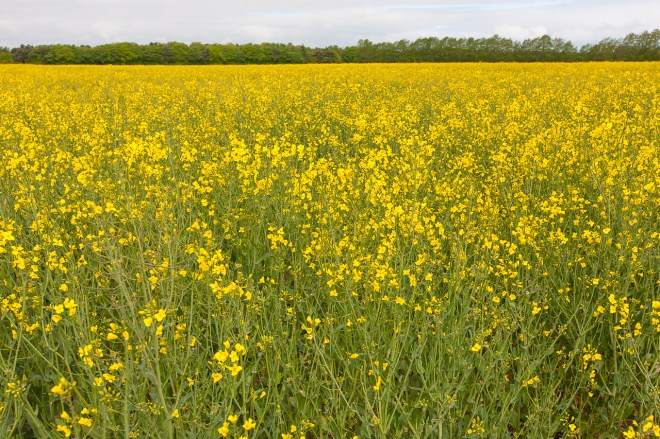
I left home pretty early, by my standards anyway, and made good time. Cruising down English country lanes shrouded in trees with dappled sunlight hitting the road has to be one of life’s real pleasures, I could have done this all day. I stopped once on the way to take a photo of a rape field. I think there is a law that requires all people who think of themselves as landscape photographers to stop and take a photo of a rape field at least once each year.

IMG_9999

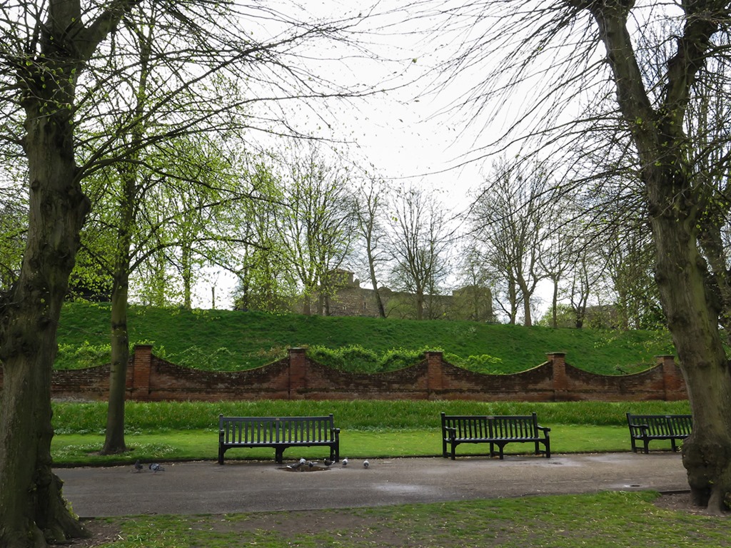
I arrived in Orford just after 10:00, when the ferry starts its regular run across to the Ness. Orford Ness, or at least this section of it, is managed by The National Trust, of which I am a member. They run a small ferry across the river and only allow 13 trips a day with a maximum of 12 people per trip. This reduces the impact of humans on the very fragile shingle environment.

IMG_0161

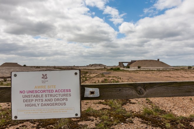
In the 1920s and 1930s the site was used to test a wonderful new technology called radar, later, in the 1960s, it was a semi-secret location for atomic weapons research. Of course no bombs were tested there – these were all done in the US, but detonators and other components were designed and tested. Testing all these things like radar and detonators meant a heck of a lot of bombs were dropped here from the 1920s onwards. Wandering off the beaten track is not encouraged, and there are numerous signs warning of this.

IMG_0028

It is also very popular with the birding community as there are a number of nesting sites across the marsh and shingle areas. Some of these areas are closed to the public at the moment while the birds are breeding, so only one of the three ‘walks’ is open today. 

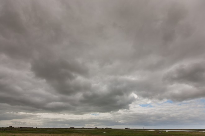
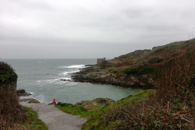
The boat ride over to the Ness only takes 5 minutes, there were seven of us on the boat, when I was leaving the ranger on the island told me there had been just over 80 people there all day, perfect numbers for me. My first photo on the Ness, flat, empty and big big clouds overhead. I was thinking that this was going to be a great day.

IMG_0013

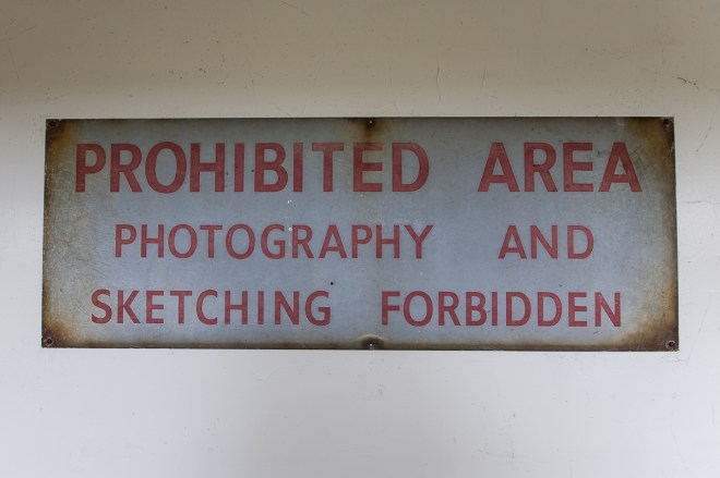
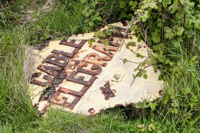
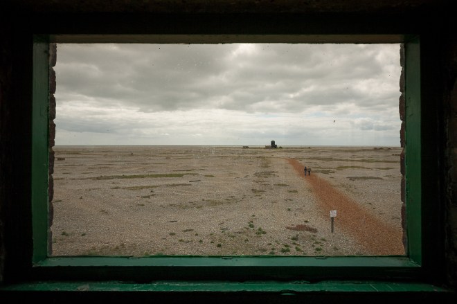
The first few hundred yards are past some swampy waterways, those more interested in birds than I am spent a bit of time here while I carried on going, heading for a bridge over a river and on to the shingly side. I stopped at the information centre for a look around, there was some interesting photos and history in there, I am assuming this warning sign is an old one!

IMG_0022

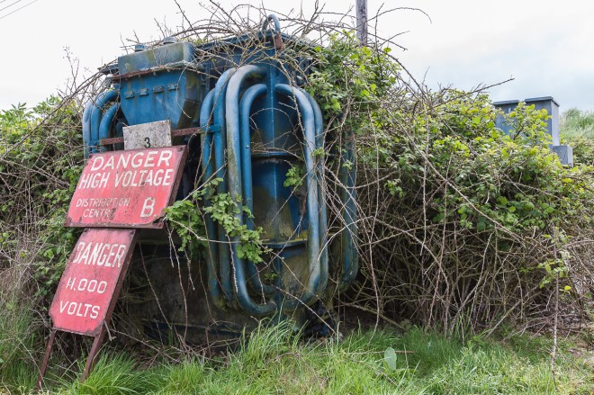
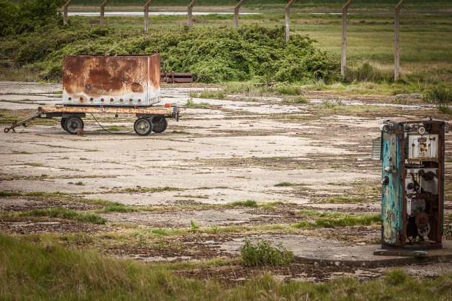
There is a concentration of old buildings here and a few rusting, decaying pieces of machinery are reminders of when this place was busy with men doing manly things with bombs and technology. A lot of it is behind signs barring entry, though all the fences have been taken down so the restrictions are just based on trust. I liked that, and decided to not breach that trust. 

IMG_0027

IMG_0144

IMG_0143

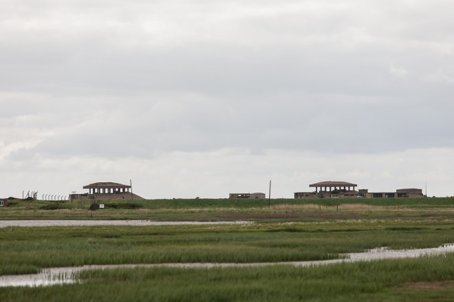
I took a few photos from the bird watching hide, none of birds of course! I wanted to visit the ‘pagodas’. Remnants from when this was under the control of Atomic Weapons Research establishment (AWRE) and I was really looking forward to getting to them. They are one of the reasons I wanted to visit. They, and a lot of the scene here, remind me of the old computer game Doom.

IMG_0017

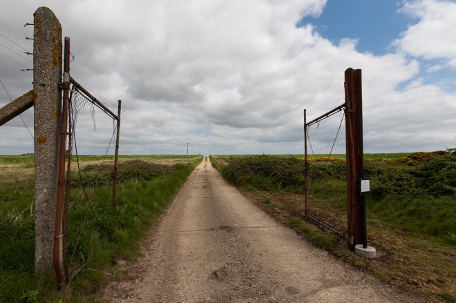
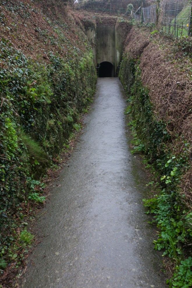
There are paths that have to be followed to get around, as I said earlier there is a lot unexploded munitions on and under the shingle, and caution needs be taken at all times. These gates were leading off to one of the paths that was closed today, as always I was intrigued as to what was there.

IMG_0030

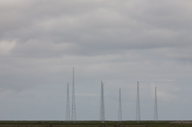
From 1982 until 2011 the BBC World Service was broadcast to Europe from Orford Ness, and the transmission towers can be clearly seen further up the spit, past those gates.

IMG_0035

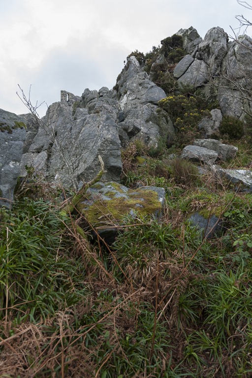
The shingle area is covered in vegetation, some of it quite rare, another reason this is a protected site. The mix of the muted greys and browns of the shingle and the brighter colours of the grasses and wild flowers made for an interesting sight and hopefully I will get some photos that make the most of that variety.

IMG_0041

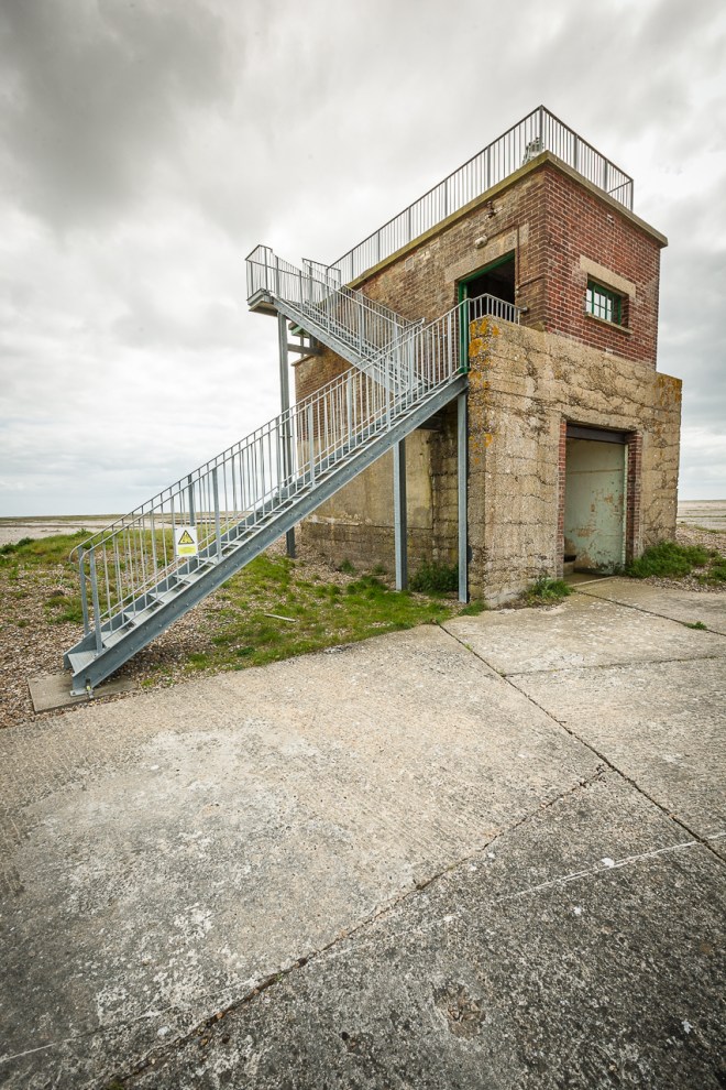
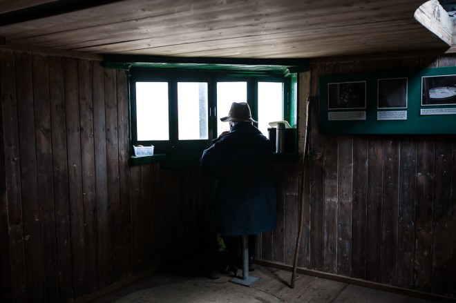
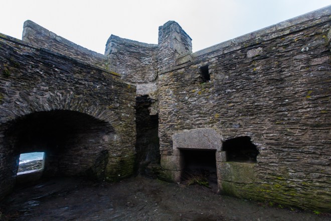
My first stop was the bomb ballistics building; built in 1933 it was fitted with state of the art equipment to monitor the flight of bombs to help with designing aiming tables. The view from the top was really interesting, it was the only place that provided enough height to look down on the shapes in the shingle

IMG_0058

IMG_0053

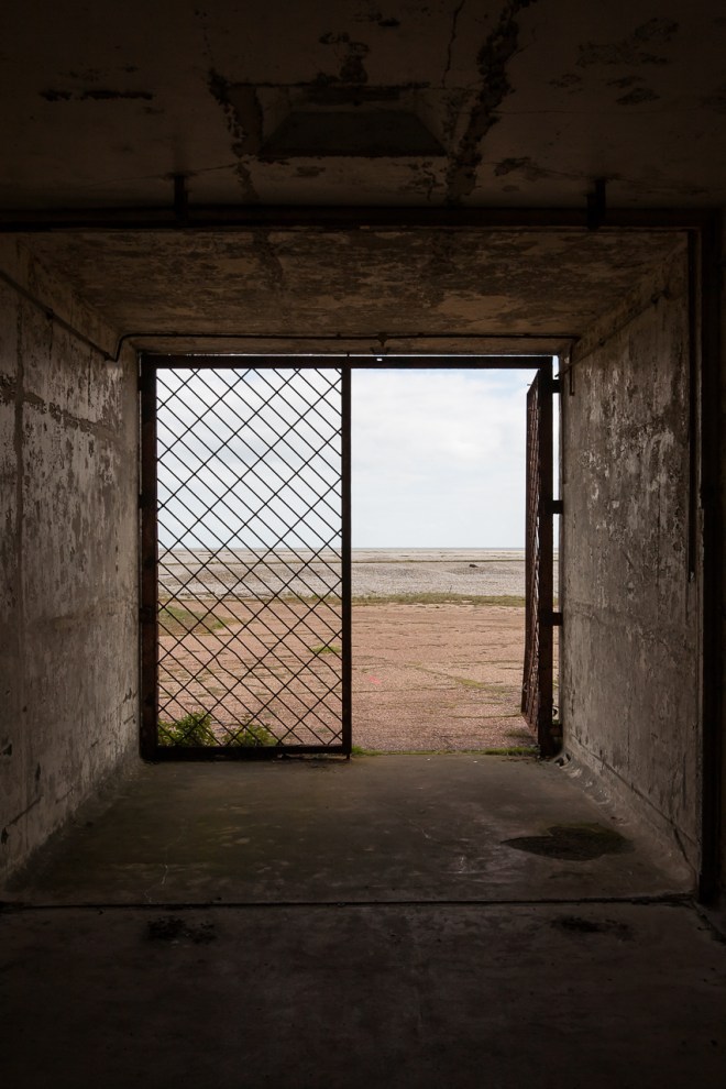
The view from the inside was good as well.

IMG_0056

IMG_0057

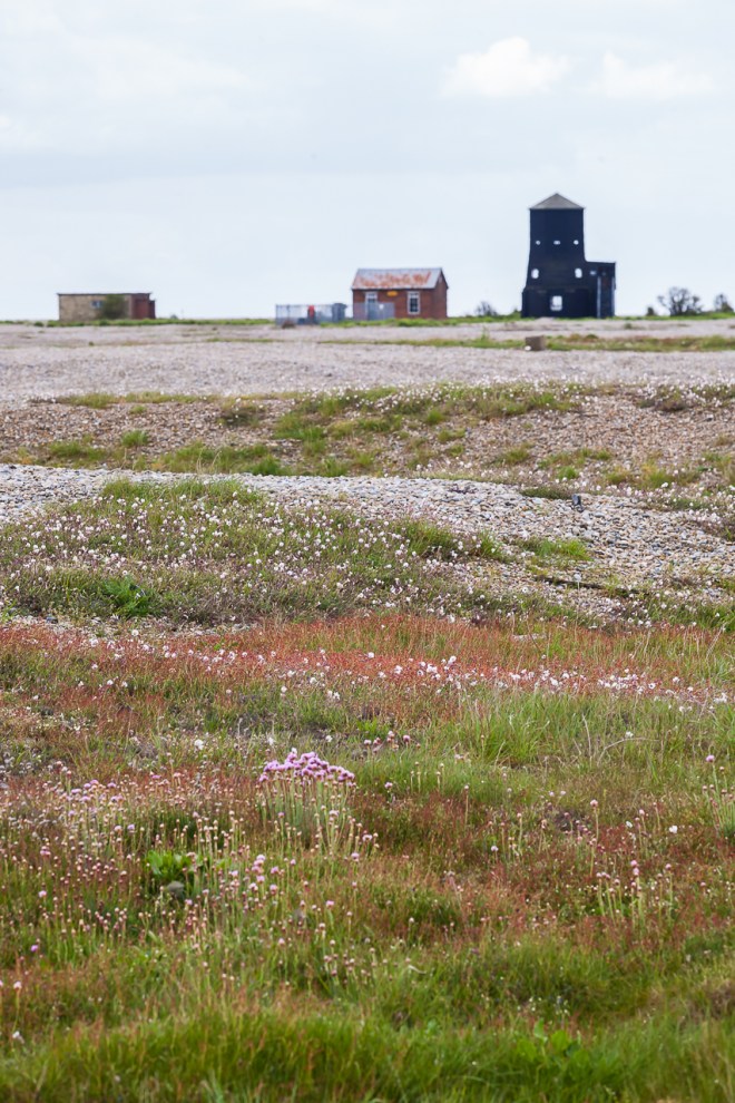
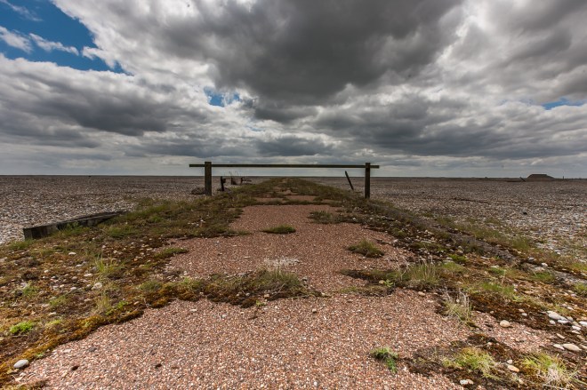
I followed the red shingle road towards the black beacon for a while before turning off and heading towards the lighthouse.

IMG_0046

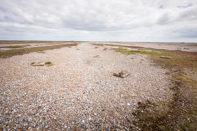
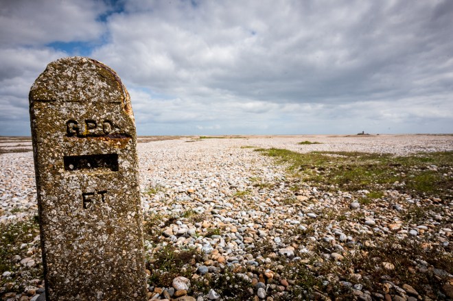
The shingle is constantly being moved around by the sea and the weather, it almost appears to be laid out in waves, with vegetation growing on its crest. It was quite arresting. I was very interested to know (and still don’t) what the small square concrete pads are, there are a hell of a lot of them seemingly randomly placed.

IMG_0063

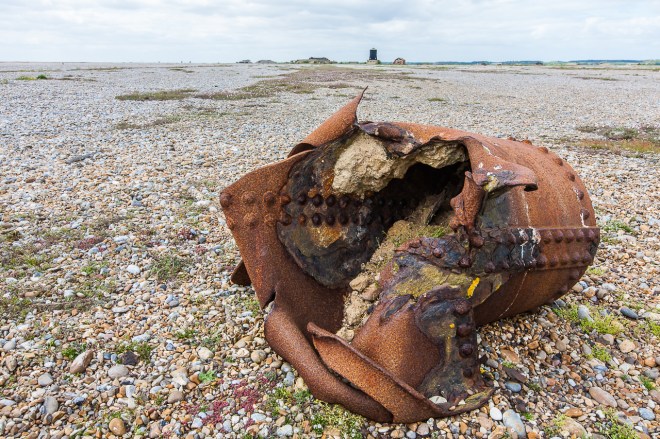
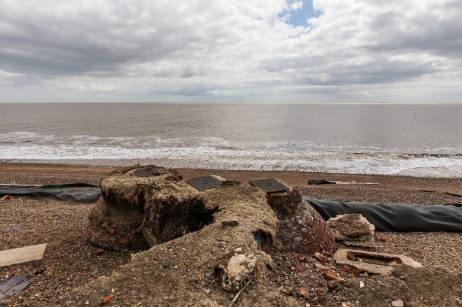
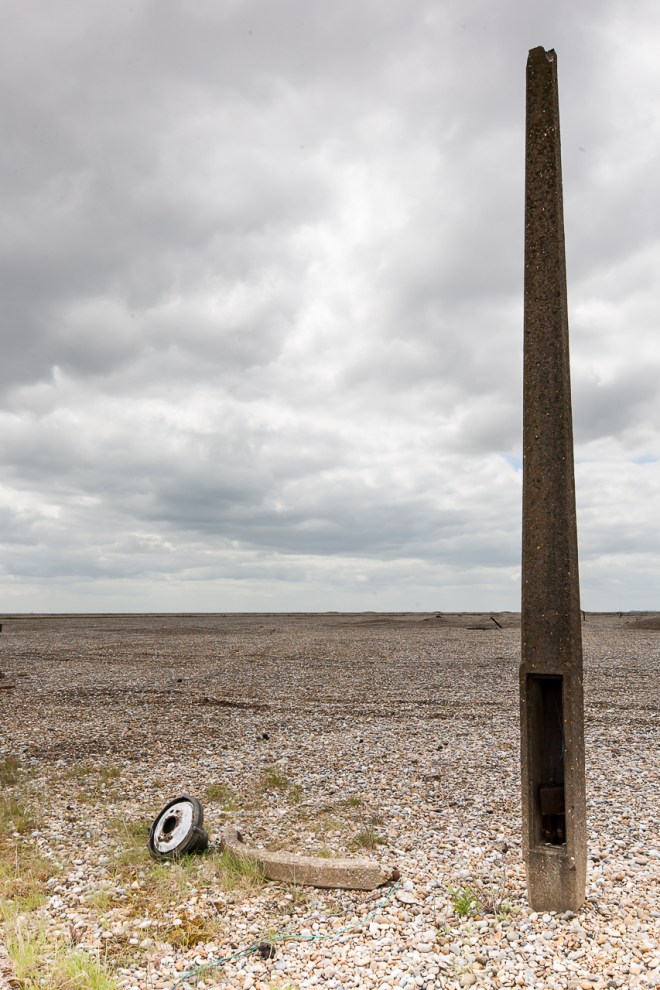
There is a lot of old metal and track lying around, but not many exploded bombs – this one was conveniently located right next to the path.

IMG_0067

The PO has been to most parts of the country, but I was surprised to find they had laid cables here, I guess they go to the lighthouse ?

IMG_0069

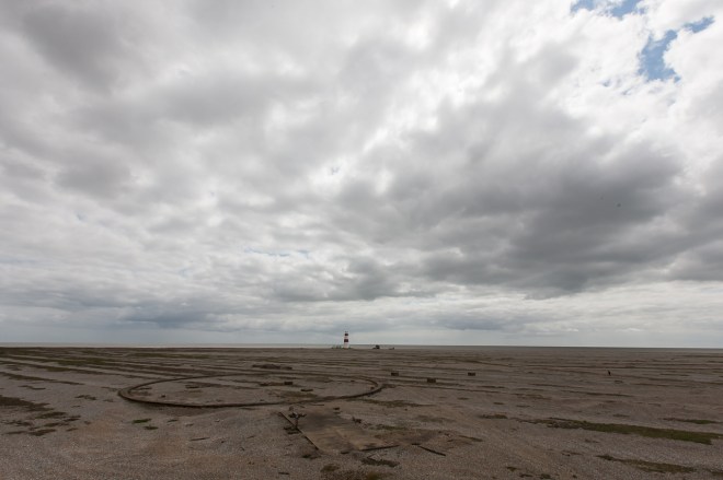
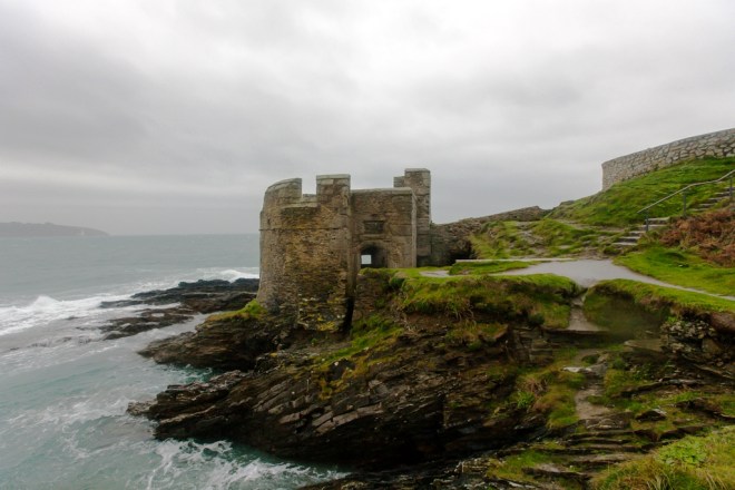
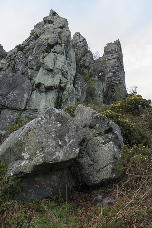
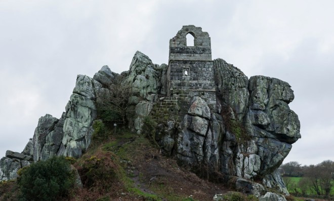
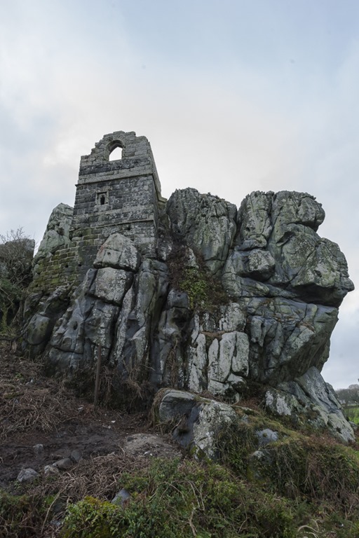
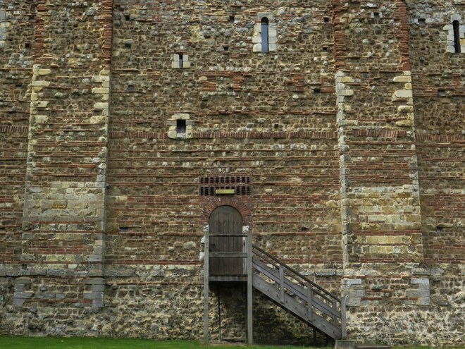
The lighthouse is not managed by the National Trust, it is owned by a small local trust, who have open days, today was not one of those days, so I was unable to get in and have a look, but I expect the view from there is stunning. The light house and its neighbouring coast guard house just feel so isolated, as a bird flies they are probably only a kilometre from Orford, but the shingle and marsh and the river have them cut off, it feel like another world.

IMG_0071

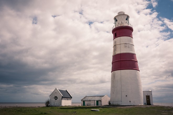
The light house is in danger of falling down now, the trust are trying to raise funds to save it. When you get round the far side you can clearly see why, the ground is almost completely subsided, the only thing holding this section together is the sewer.

IMG_0075

Next to the lighthouse is a derelict building that was used as a coast guard lookout up until 1951, and finally abandoned in the 1960s.

IMG_0082

The trail goes along the edge of the North Sea for a couple of hundred yards before turning inland towards the Black Beacon, built in 1928 to house an experimental new beacon.

IMG_0088

IMG_0092

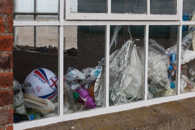
I had a walk around looking for somewhere sheltered from the strong and cold wind so I could sit down and eat some lunch, but there was not a lot of opportunity so I just carried on going I liked the football sitting in the window of this building along with a pile of rubbish washed up by the sea.

IMG_0097

Finally the path took a turn towards the old AWRE area, which I was really looking forward to exploring. I loved this gate, ensuring no-one passes along that road. It is a shame there is no longer any fence 🙂

IMG_0107

The security fence has mostly been taken down, there are occasional fence posts and light poles still standing, and I particularly liked this one with its broken light arm laying at its foot.

IMG_0109

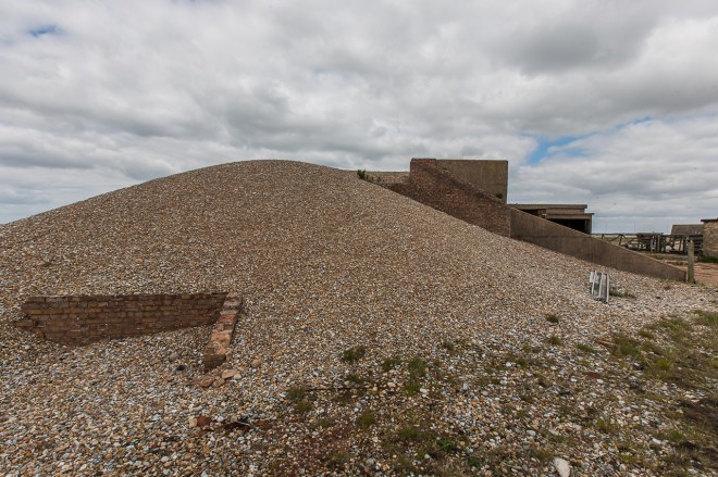
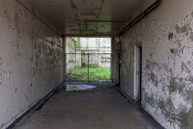
There are a couple of interesting buildings here, this one covered in shingle for instance, there was no entry point though, but I have visions of a vast network of tunnels underneath the shingle, joining all these low, almost hidden buildings together.

IMG_0108

Sadly, and to my disappointment there was no access allowed to the pagoda area 😦 I was a bit gutted by that to be honest. I guess I could have strayed in there for a sneaky look, but there a number of rangers around and I did not want to annoy anyone, and I do want to come back!

IMG_0110

I cannot quite work out what this last building is, but you could at least get in the doorway and peer through into its rather damaged centre.

IMG_0114IMG_0117

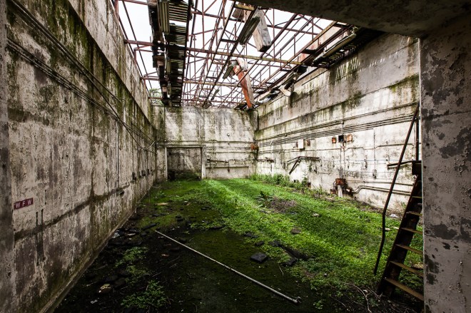
This photo almost sums up the Ness for me, darkness, dankness and decay in the buildings, and an almost arid nothingness outside. Like a post-apocalyptic science fiction movie. Love it!

IMG_0121

I stopped for lunch here, before turning round and walking back, mostly the way I came, to the ferry point. Stopping to give some grass and then take a photo of these lambs on the way.

IMG_0136

While I waited for the ferry I had a chat with one of the National Trust volunteers. He told me about some organised photo tours that take place three times a year and explore some of the places closed to the general public. One of those tours is an over night visit in July and I managed to book myself on one of the final places once I got home. I am very excited about that!

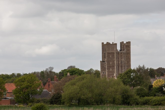
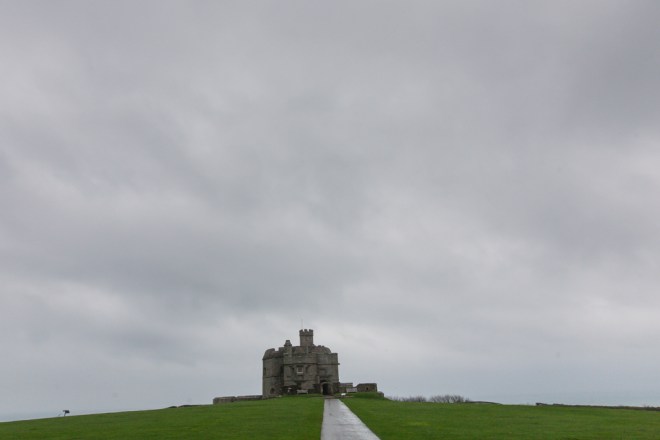
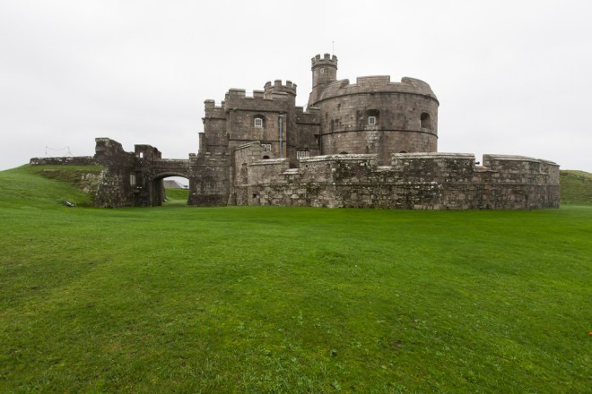
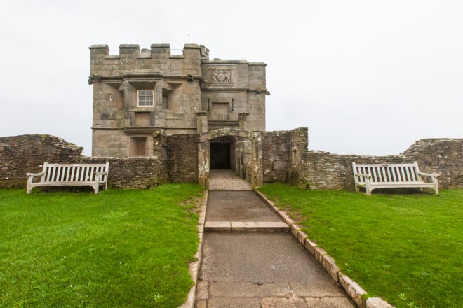
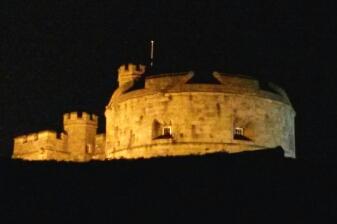
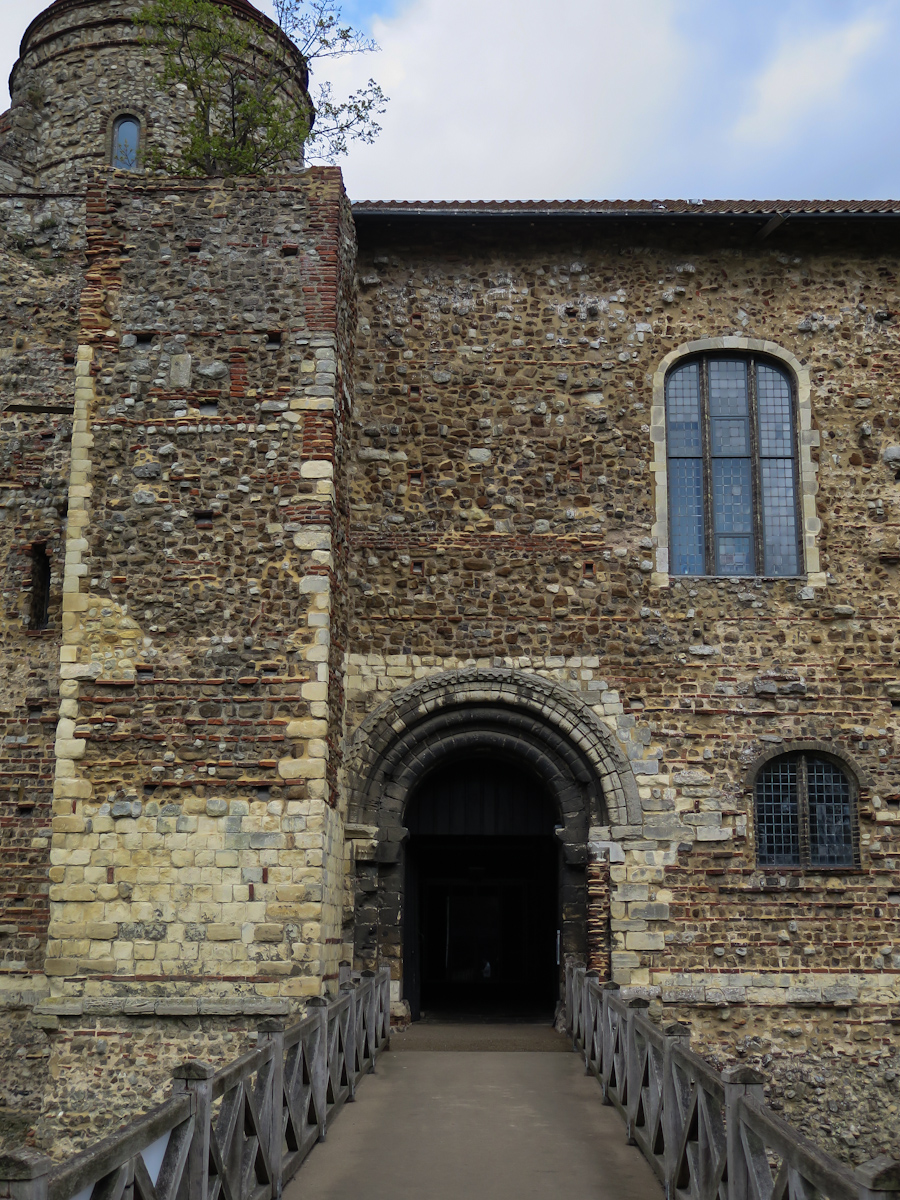
Just before I left I took a photo of where I am heading next, once I am back on the mainland. Orford Castle.

IMG_0162

I was on the Ness for about four hours. I took more photos there (as you can tell) than I have anywhere else in a very long time. It is a fascinating, interesting, glorious place. Make a visit !

For the first time in ages I took and used two lenses. I have got into a bad habit of just using the 16-35mm wide angle lens, and at the occasional gig the 50mm. Today I used the wide angle and a 70-200mm zoom, I really should use the 70-200 more, it is a brilliant, if very heavy lens and allowed me the chance to get different angles and views.  I want to improve my photography, so I should use all the tools I have to hand. 

What a fantastic day, and it was only mid afternoon!

The drive back to London – Part three of three; Fussells Iron Works.

Monday 21 December 2015 – Mells, Somerset.

The final stop on my drive from Falmouth in Cornwall back to NE London. I took quite a few photos in three different locations on my way back so have decided to make it a three post day.

My final destination for the day – before home of course, was Fussells Iron Works near the village of Mells in Somerset. Like Burrow Mump earlier in the day the iron works were a find from my recently purchased Wild Ruins book.

After finding Mells OK and ending up on the right road out of town I missed the entrance to the valley as it was temporarily blocked by a rubbish lorry. After a mile or so of driving up the narrow country road, I decided I had gone too far and turned round and pulled up outside what I hoped was the right gate.

The sign did not mention anything about a ruined iron works, but it was sort of in the right place so I headed off up the path anyway. If it was wrong, then at least it was a decent walk – and by now the rain had actually stopped, and being in a valley meant there was no wind either. I should have taken the tripod. And another couple of hours…

IMG_9800

After a couple of hundred yards of walking up the path, I came across an old sluice gate and some ruined walls and knew I was in the right spot. I didn’t know too much about the valley and the iron works, I had seen a few photos on the internet, but that was about it.

IMG_9801

The town of Mells and its surrounding area have been known for iron work since the 14th century, and the workings in this particular site started in the 1500s. The present day remains are from a large foundry site started by the Fussell family in 1744.

James Fussell leased the land from John Horner, who is rumoured to be a descendent of one Little Jack Horner. Little Jack was given the responsibility of taking pies from a nearby abbey to London, hidden inside one of the pies was the deed to a piece of land – now the site of the iron works. He nicked it…

The works lasted for well over 100 years, making farm tools that were used across the UK and exported to the USA. A failure to convert the water powered works to steam in the late 1800s led to the eventual failure of the business and it was closed in 1900. It has languished as a ruin ever since. Yay Smile

The walk up the valley was amazing. It is a wonderful place to explore, especially in winter when the trees are free of leaves and the weak sun can shine through on the moss covered trees and old stone work.

IMG_9805

IMG_9807

There was even a mystery waterfall with the water pouring out from under the rocks, seemingly coming from nowhere at all.

IMG_9806

There was a long section of wall, maybe holding back the valley bank from what must have been a long building along the bank of the river.

IMG_9809

IMG_9811

I really liked the trees growing out of the stones, they remind me of the some of the ancient Angkor sites I went to, and loved, in Cambodia.

IMG_9813

Though I was getting a bit pushed for time I carried on heading along the path and soon found the main part of the ruin. It was looking very cool, though there was security fencing at the entrance to the building.

IMG_9815

I walked along the outside edge of the wall for a bit, until I found a bit of fencing that was loose so I stuck my head inside and took a photo of the moss covered wall – slightly blown out by the weird problem affecting my camera.

IMG_9817

There was no one around, so I thought ‘sod it’ and carried on through the gap in the fence and down into the ruins themselves. Everything was damp and dripping, the ground was mushy under the rotten fallen leaves, and the tree tops up the valley sides were whistling and creaking in the wind. Fabulously gloomy and ruiny.

IMG_9819

IMG_9820

Walking back towards the entrance I made my way to the largest of the old ruins.

IMG_9822

There is obviously some work going on here to stabilise walls, there was a sign warning people to keep out as stone had been coming down from the walls. I poked my head inside the rooms for a look, but did not hang around there for long before deciding to head back up the path to the car and continue my journey homeward – I still had a long way to go !

IMG_9823

IMG_9825

Naturally when I returned to the car the skies finally cleared leaving a fairly cloudless and slowly darkening sky. I am looking forward to coming back to explore this place again, maybe take a day out on the way somewhere and arrive when there is some decent light left – and carry the tripod up the valley.

I had seen some quite cool things so far today, but this really was the highlight of the day. It was a shame it was mid afternoon and the light was dropping fast, and it was a shame my camera was just not handling the big contrasts in light very well. I am going to have to come back and allow myself a lot more time.

IMG_9826

IMG_9827

The rest of the drive back home was pretty tedious, it is a long long drive, though I did pass by Stonehenge which was cool as I have never seen it in real life before. I was sort of faintly hoping for a wicked sunset, but to cap the weekend off it all clouded over again and started to drizzle as dusk arrived, my least favourite driving conditions. Actually, to really cap it off I think I got speed camera’d on the M25 , which is fairly ironic as I said a couple of posts ago that there is little fear of getting pinged for speeding on the motorways. I will wait and see if anything unpleasant arrives in the mail.

It had been a great weekend away, I really enjoyed all the things I visited and saw, I had some very nice food and sort of enjoyed the time away on my own.

The drive back to London – Part two of three; Nunney Castle.

Monday 21 December 2015 – Nunney Castle, Somerset.

My drive north east wards from the lovely church of St Michael on Burrow Mump took me through the historic town of Glastonbury, which I must confess to not expecting when I was vaguely planning my route over breakfast. I tried to stop at the tor, but some moron had parked their small truck almost completely blocking the road to the car park. Given this was a rental car I was not willing to bump the curb and squeeze through. I am sure I will return to Glasto one day. Though, music fan that I am, I will still be avoiding the festival (or maybe it is because I am a music fan…)

I was looking for the small village of Mells – and I did set the sat nav for this one as it is way off the beaten track. I was fortunate to pass through the town of Nunney, which conveniently has a small castle that is free to visit. Most excellent!

Nunney Castle was constructed in the 1370s when Sir John Delamare was given licence to build a castle by King Edward III after returning with a small fortune from the Hundred Years War. It is supposedly modelled on castles he had seen when on duty in France, though this has been hotly debated.

The castle remained in the extended family through the 1500s before finally being sold in 1577 to the Praters. Like many Catholics the Praters sided with the royalists during the civil war and the castle was severely damaged during a siege in 1645. It has slowly fallen into disrepair since,  being gifted to the crown in 1926.

It is a lovely building, and was an unplanned and unexpected surprise bonus for the day. I took a walk around the outside.

IMG_9788

IMG_9789

From the car park entrance you cannot see if there is a bridge across the moat into the castle, so I was delighted when I walked around to the far side of the small castle to find there was a way in, through the walls destroyed in the civil war.

IMG_9797

There is not a lot to see inside the ruin itself, for its height I was quite surprised how small it actually is inside the walls.  It must have been awful living in here during the siege.

IMG_9795

I didn’t expect to be visiting a ruined castle today, so even though it was raining and a bit unpleasant (again) this was an excellent mid-day stop – if only I had found some lunch!

IMG_9799

The drive back to London – Part one of three; Burrow Mump.

Monday 21 December 2015 – Burrow Mump, Somerset.

The forecast was not brilliant for my return trip to London, and when I got up for breakfast it was hammering down outside, the wind had picked back up again to the level it was on Saturday. I think I am fated to always have a windy and rainy trip when I go away with camera and tripod – perhaps I should chose a nice time of year.

Over breakfast I consulted my ruins book and the road map to see if I could find anything interesting to see that was sort of on the way back to London. There are so many places in the south west that would be intriguing to visit, but with a five hour plus drive ahead I did not want to stray too far from a direct route to the M25. Though I did find a couple of hidden gems to hunt out on the way.

I left Falmouth at 9:45, a bit later than I wanted, but still with plenty of the day left. It was pretty rank outside, definitely the worst morning of the three I have had here, so my timing was pretty good. It was an uneventful drive, I stopped on Bodmin Moor to take a photo under the gloomy skies I would like to explore any of the moors one day, but come properly prepared for a visit. I don’t mind the rain so much, but wind, rain and moorland are not such a great combination for photography.

IMG_9770

It took me quite a while to get to my first stop of the day. Off the motorway in the depths of the Somerset levels stands Burrow Mump, a small lonely hill in the middle of farm land. The hill was at a junction of the rivers Tone and Cary, but the Cary has subsequently changed course. It is possible a Roman and a Saxon fort was located on the top of the hill, Roman and early Saxon artefacts have been found in the area and at the confluence of two rivers it would likely have been a trading area back in the day.

It really stands out from quite a way in the distance as I approached from the Taunton side, so I didn’t need the GPS to tell me where it was…

IMG_9780

There has been a church here since the 15th century, but the ruins that now stand are from an attempted complete rebuild in the 1790s. Funds ran out and it was never finished. A church was built in the village at the foot of the hill instead and hill top slowly turned to ruin. It is wonderful!

IMG_9775

It was still a bit rainy as I walked up the slippery grass slope and the wind was howling too, it was not particularly nice out there. But not bad enough to put me off.

IMG_9782

The church is dedicated to St Michael, and is located on St Michaels Ley Line. Interestingly the central line of the church follows the ley line rather than the natural line of the hill.

IMG_9779

IMG_9777

You cannot go inside the ruin, and in this case I chose not to.

IMG_9774

IMG_9773

It is quite amazing to look around, and I imagine there are not too many visitors either, so well worth the visit.

Part two of the drive home will be coming up soon !

Pendennis Castle and Falmouth.

Saturday 19 December 2015 – Falmouth, Cornwall.

It was a really windy night, and it is now a really windy morning. The wind was howling around the hotel making things whistle and creak all night long. The weather is pretty lousy this morning too, rain is forecasted for most of the day and with 30mh winds blowing in off the sea I don’t think I will be doing too much coastal walking. But there is a castle, or two to visit – so not all bad !

After a very nice, and not too large Cornish breakfast I got myself organised and was out the door for 10:00, opening time for Pendennis Castle. My hotel is one street back from the beach and wow, the wind was so strong! It wasn’t raining when I left so I made the most of the time and took a couple of photos of the sea before power walking up to the distant castle.

The Lerryn Hotel, where I am staying, I have the near balcony room, but the view has been pretty much entirely grey since I have been here.

 IMG_9608

IMG_9609

IMG_9613

At the top of the hill I took a detour around the back of the castle to see if there was a view over the wall, which there wasn’t, but there were a couple of trees just begging to have their photo taken so I happily obliged. I love trees without leaves, most of the trees in and around Auckland are evergreen, so I am just not used to seeing so many naked trees. Such a clear marker of seasons changing.

IMG_9619

As I discovered last night on my stroll in the dark, there is a decent, though empty moat, and high walls separating me from the castle.

IMG_9621

IMG_9622

Once across the moat and through the entrance I decided to do something I should have done about five castles ago – I joined English Heritage for a year, hopefully this will not mean I stop visiting English Heritage run castles now I have paid the fee. I am planning on doing two today, so a decent start.

Like St Mawes Castle, a sister castle on the far bank of the Fal River, Pendennis Castle is a Henrician castle built under Henry VIII between 1540 and 1545 to protect the river from a perceived threat by both the French and the Spanish. I was surprised to learn today that the harbour at the entrance to the River Fal is the third deepest harbour in the world, after Sydney and Rio. This made it very attractive as a naval base, though it was never really used as one at all. The castle is one of a string of castles built across the south coast after Henry decided to annoy the French and Spanish when he rejected the Catholic church.

The castle was expanded during Elizabethan times with the majority of the outer buildings and the high walls being added then. As an artillery fort the site was continued to be modified up to and just after the end of the Second World War as new artillery technology was developed. The fort was abandoned by the military in 1956. A story I heard while I was there was the that most damage done to the fort since a siege during the English Civil War was caused by the MOD in the 60s when they destroyed a temporary barracks building by blowing it up – and cracking the walls of other buildings in the process.

As it wasn’t raining once I was on site, I decided to follow my usual tactic of walking around the perimeter, looking at the views and checking out the outside of the tower.

IMG_9624 IMG_9625 IMG_9626 IMG_9627

I headed down toward the WW2 observation post and had a look at the window.

IMG_9629

I tried to find my way to the WW2 gun emplacements below, but my efforts seemed quite fruitless as all the paths were gated off – reading the map was going be a last resort obviously. I eventually came across a tunnel… I so love a tunnel.

IMG_9632

This led the way under some earthen defences to the gun emplacements. There was a small group having a tour while I was there so I tagged along and listened in. Turns out the group were the only other visitors on this miserable day – and they were Kiwis too. The wind was really howling on the point, the whistling as the wind passed through the mast was incredible.

IMG_9635

I walked around the grounds a little bit more, before finally entering the Henrician artillery tower as the rain arrived again. I liked the gargoyles, sadly I got rain on my lens, but I have decided to keep the photo anyway.

IMG_9638 IMG_9640 IMG_9641

The inside of the artillery keep was decked out like it was in the 1700’s, including a very loud soundtrack that kicks in when you walk in the door – a bit of a surprise.

IMG_9644

The roof was locked off but I was told I could go up there if I re-barred the door once I was back inside, I could see why once i was on the narrow steep, circular stairs to the roof, they were quite wet and slippery. I met one of the Kiwis on the stairs and we took it in turns to go out on the roof and have a quick look around, while the other held the door closed in the ferocious wind.

IMG_9646 IMG_9647

Down from the roof I headed over to the more recent barracks block – only a hundred or so years old and had a coffee and piece of cake for a late morning tea, and that was pretty much my last act in the grounds and I left the castle soon after.

IMG_9648

I decided to replicate the walk I did round the moat last night.

IMG_9649

And then headed down to the sea front to visit Little Dennis, a small coastal blockhouse. The wind was so strong here, I was struggling to stand still to take photos. It is right on the tip of the point with wonderful views across a blustery sea to St Mawes.

IMG_9653 IMG_9654

This ice cream seller was very keen, surprisingly I saw a couple with ice creams as I walked up from Little Dennis, so I suppose his efforts paid off. Good on him, it was not nice out there, but at least it was not cold…

IMG_9655

I took the coast path around the point rather than walk on the roads like last night.

IMG_9657

There were a couple of guys living in tents on the edge of the forest, they must be facing very tough times to choose to be in a tent with wind like this. The coast path was pretty greasy, but so much nicer than walking on the road.

IMG_9659 IMG_9661

Soon enough I was back in civilisation, I walked past the ship yards that caught me so much by surprise last night, it was raining pretty hard by now and this was the last photo I took before hiding my camera away in my back pack – and putting a rain cover on the pack as well.

IMG_9662

It was a short, but wet and not particularly lovely walk into the waterfront area of Falmouth. Money has been spent in the area nearest the port, with new restaurants and bars including a Pizza Express which I am pondering for tonight, I do love pizza and there is something special about the anonymousness of a chain restaurant when you are a solo eater. There is a Rick Stein’s fish restaurant but it looks too stale for my tastes, though I am sure it is lovely, pricey too I bet. By the time I had passed round the back of the new buildings the rain had passed and I could ditch the rain cover and get my camera out again. I sort of liked the waterfront, it is big yachting harbour, so slightly reminiscent of Auckland and other yachty places.

IMG_9663 IMG_9664

Falmouth has allowed itself to be taken over by tourism, as I was walking down the hill from the castle I passed a new waterside development of ‘exclusive’ apartments and a lot of the old buildings in town have become shops or tacky bars and eating places. Who ever thought that the old harbour master building would make a good Mexican cafe and hairdresser was badly misinformed/taking a kick back or something. I understand that towns need to keep relevant and make money, but sometimes selling your soul is not worth the price.

IMG_9665

Having said that, so far I kind of like Falmouth, but it has not made the most of its waterfront, unless you count car parking as a value add. All the small wharf areas are full of cars, I have tried to miss them when as I have taken photos, but they are there.

IMG_9666 IMG_9669

I was planning on taking a ferry over to St Mawes to visit the sister castle to Pendennis, but due to the really strong wind the ferry was cancelled for the day.

IMG_9673

Time for a new plan, it was only afternoon and I had pretty much seen all of Falmouth’s waterfront area. I headed up to the art gallery for a quick peak. Nice building, some interesting local art as well.

IMG_9674


That was pretty much my day, it was definitely my day photographically. I went back to the hotel and uploaded and edited photos, watched some football and had a rest before heading out for an early meal. Back in time for the final two episodes of The Bridge season 3.

A nice time so far in Falmouth.

This new laptop I am using is Windows 10 based. So far I am really liking it, a far better experience than I expected –  except the version of Windows Live Writer I have been using to write and manage blogs screws with images uploaded to WordPress. Boo Hiss !!! I hate writing blogs in Wordress, time to find a new writing tool. So far I have loved and lost Blogpress and now Live Writer, hopefully the next tool find is as good and lasts longer….

Roche Rock Chapel

Friday 18 December 2015 – Roche, Cornwall.

I cannot believe that another working year has passed. My first full working year in the UK, and it has been a difficult working year. When I left my IT Management job in New Zealand, just over four years ago, I vowed I would not do stressful work again, and there I was back in it in my first UK job. At least now the main piece of the project is well out the way the second half of the year has not been anywhere near as stressful and tiring as the first half, but I am still doing IT. I guess I just like the money too much!!

To end the year on a positive note I have decided to do one last road trip, no walking this time, well not much walking anyway. I have hired a car, loaded it up with the DLSR and tripod and clothing appropriate for another rainy weekend in Cornwall and headed off to Falmouth for three nights. El is working until Wednesday so I thought I should make the most of those days and head out into the wild.

I chose Falmouth mainly because it has a castle, plus I have not been there before, and of course it is on the South West Coast Path and that is always an attraction. Having a rental car meant I could take my time heading down and stop off on the way.

It was a slow start, it took ages to get out of London, the traffic was actually pretty good, but I am impatient, I do not drive often and when I do I want to be nailing it down a highway out into the country, not crawling along the north circular. I have a diesel Audi A1, it is pretty basic, but it is so much better than the Peugeot 3008 we had in St Ives. Functional and easy to drive. Once I worked out to how get my phone connected via Bluetooth and my sounds going it was sweet as and the miles just flew by – mainly because of the clear motorway and my heavy hoof… One thing Britain has over NZ is a decent speed limit – and less fear of getting nicked for speeding.

A few weeks ago I bought a book called ‘Wild Ruins’ that listed a whole bunch of small and unusual ruin sites in the UK, one of those sites was Roche Rock and it is located just off the A30 about 40 minutes from Falmouth. It was on the way, looked really intriguing in the book so I decided to pay it a visit on the way down. I am so glad I did!

I found the village of Roche OK, but took a wrong turn before finding the site and ended up passing by the back of it, wow! The instructions in the book must have deliberately made you walk around the long way so you get a more mysterious introduction. Nice one !

As I was looking for a spot do a u-turn I found this old kiln site, so stopped for a quick photo. I actually thought it was an old tin mine/foundry site, but reading about it in the hotel later on I discovered it is in fact a 1950s brick kiln. It still looks cool though, and was a good spot to do a u-turn.

IMG_9584.jpg

IMG_9587.jpg

I headed back up the road to Roche, looking for a place to park so I could walk to the ‘Rock’, in the end I parked where the book suggested – which was pretty much the only spot. Wisely I changed shoes into a new pair of trail running shoes I recently bought. The walk in was muddy, slippery and in some places a bit dodgy as the layer of foliage hides the holes in and between the rocks. A bit of grip was a good idea.

IMG_9590.jpg

The ‘rock’ is a small pinnacle of granite that pops magically out of the countryside, it has been a spiritual site for centuries. The town name of Roche, is French for Rock. Site preparation for a recently built housing complex found pottery and other artefacts from the Neolithic period, so this is a really old place.

The main reason for coming here, is not to see the rock, and but to see the chapel, and it is mostly hidden from view from the path I took until you get to the far side of the rock and get the first hint.

IMG_9591.jpg

The chapel was constructed in the 15th century, there was not a clear reason why, possibly by a hermit who did live there for a long period of time. The chapel is dedicated to St Michael, and perhaps was used as beacon or resting place for pilgrims on the way to St Michael’s Mount near Penzance. No one really knows. One of things I like about it.

It slowly reveals itself as you walk around to front and see it in all its majesty. Yes, it is not the Tower of London, or Salisbury Cathedral, but it is a magnificent ruin. How it was built up there, precariously balanced on that rock is as much as a mystery to me as to the why. That so much of it remains 600 years later in this harsh landscape is quite remarkable.

IMG_9593.jpgIMG_9596.jpgIMG_9598.jpg

There is a ladder up to the ruins, but it was very very windy and I did not have a bag for my camera, and I had the big DSLR with me, I wasn’t going to risk it (or me, if the truth be known) by climbing up that ladder in a high wind. So the mystery of what lies up there will remain for me.

IMG_9599.jpgIMG_9602.jpg

As I headed back to the car, a murder of crows arrived, adding to the bleakness of the ruin, the rock and the boggy moorland surrounding it. I was even more glad I did not venture up that ladder!

IMG_9604.jpg

I walked back around the far side of the site to the one I had come from and took a couple of last shots before heading back to the car. I wish the weather had been worse or better. Big clouds or bright sun would have been good. Flat grey sky was photographically dull !!

IMG_9605.jpgIMG_9607.jpg

I drove onto Falmouth and arrived at the hotel late in the afternoon, just as the forecasted weekend rain arrived. \it is fairly quiet in town, and Falmouth is a log bigger than I thought, as there are not too many guests I have been upgraded from my single room, to a much bigger twin room with a view over the houses to the sea. it is a nice room. I hung out in my room for a bit and went out for a walk and tea in the very early evening – luckily as the rain had stopped.

I took a walk around the outside of Pendennis Castle, my plan for tomorrow. It was very dark, no street lighting at all and even though it is only 6:30 night has fully descended. There was quite a nice view of the castle from the road near my hotel – it is a lot further away than I thought, too far to take a photo hand held and far to windy to use a tripod.  I was hoping to get a clear shot up close, but the walls are too high. I am really glad I thought to toss my head torch in my bag as the walk around the walls was very very dark, and a bit slippery too.  It was really nice up there, completely alone and all I could hear was the waves and the wind in the trees. I took a photo with my phone.

CWh9jegWwAA3PX0

I walked around the headland, hoping to get into town and find somewhere to eat, walking off the tree lined headland I was really surprised to find a working ship yard – I have done no research into Falmouth – and a longer walk into town than I thought. I investigated the main street of Falmouth before finally settling on a small tapas place for a glass of red and some food. It was quiet and enjoyable, apart from the bloody Christmas music.

I was back in the hotel by 9:00, nothing on the telly so listened to music and typed this. Going to get ahead of the photo editing and blogging this time !

A castle-ing I will go! A day trip to Dover Castle

Saturday 03 October 2015 – Dover Castle.

I wanted to get out and about today, summer has drifted inexorably into autumn, days will get shorter and days out are going to become less frequent, though they can hardly be much less frequent than they have been lately. With the forecasters predicting a sunny but cool day El and I planned on heading across London to Richmond where I was going to show El around my mid-1980s ‘hood before walking along the Thames for a late lunch in Kew. However, El was not feeling well, a nasty head cold on the back of chest infections preceded by a flu meant she did not feel like, or want to go out. She was keen that I made use of the day though, and unsurprisingly, so was I.

As I have been so busy at work for most of the year I had not prepared any sort of a list of things I want to do or see, so I spent at least an hour finding and then rejecting places to visit, before I settled on Dover Castle. Dover suited, not too expensive or too long a train journey and plenty to see, and I would get to be outside in what would hopefully be a sunny day – once the low lying cloud has cleared.

Work has been interesting, the madness of the past 12 months is over and it has become almost relaxing – I do not work in the evenings or weekends anywhere nearly as much as used to, though I cannot help myself at times and have to have a week peek at email. My contract expired while I was away walking and I have renewed it until the end of the year, though I turned down taking on the role permanently when I was offered it on my return.

I am now committed to finding a role outside of London – preferably towards the south west. I want to be able to feel the sand between my toes more readily and not have to quit a run half way through as I cannot breathe due to the pollution. I want to be within a couple of hours of London so El and I can see each other easily at weekends and on the occasional ‘school’ night. Plus, I don’t hate London, I have just had enough of it for now.

I booked my return train tickets for Dover on-line, I wanted to go from Stratford as it saved travelling into central London, but return from Stratford to Dover was 113 pounds, a return from St Pancras, was 30. I discovered once I got on the train at St Pancras that the first stop was Stratford… Go figure.

IMG_2391

The journey was pretty fast, high speed train to Folkestone, however, as I also discovered once I was on the train at St Pancras there was no connecting to service to Dover as the station was closed for maintenance – there was a replacement bus service. This seems to feature a bit on my train trips to the south east! Sitting in front of me were three blokes who worked for the train company talking about their model railway collections and some of the trains they owned or lusted after. It was an interesting discussion from an observer’s point of view. Model trains can be very very expensive! I was also intrigued to learn you can control some parts of a model railway with an iPhone app. The world has moved on since I last saw a train set – or a layout to use their terminology.

I reached Folkestone on time and there was only a short wait for the bus to Dover so I did not get to experience the joys of Folkestone. I have family who lived here for many years and vaguely recall holidays when I was a child. I liked this figurine under the bridge arch outside the station, a little bit of street art.

IMG_2392

It was short hop to Dover and the bus dropped a few of us off at the station before continuing on past the castle to Deal. I thought about asking if the driver would drop me at the castle entrance as it is up a hill, but suspecting a refusal I decided not to. I will reserve my un-informed opinions of the delights of Dover, as I passed straight through it on my way to the castle – it was pretty obvious where the castle was.

IMG_2394

The rail works at Dover Priory Station were fairly obvious too.

IMG_2393

Finding a sign that showed a simple walking route to the castle took a little bit of effort. I suspected there would be a way to get there that did not mean walking up the side of the main road, and I was right. It would have been nice to see more signs in the centre of town that did not just cater for drivers.

IMG_2396

Unsurprisingly it was all up hill – via a delightful alleyway strewn with food wrappers, empty booze cans, and most charmingly, the residue of both. Luckily that was the only downside to the entire journey!

IMG_2397

It is only a ten minute walk to the castle entrance. Last time I was here, I took a shot at English Heritage as the castle was closed, which I found a bit ridiculous given its status amongst southern English castles. I would like to give credit where it is due and say English Heritage have done a fantastic job with the castle though and I thoroughly enjoyed my visit today. Nice one EH !

IMG_2398

Dover Castle is one of the major English castles, from a distance it looks spectacular, and from the sea it must dominate the skyline. It was built to guard the Strait of Dover, the narrowest point of the English Channel (what do the French call it ? The French Channel ? I must ask !)

There has probably been a fortification here for many hundreds of years, though the oldest remaining part – the Roman Lighthouse, “only” dates back to the first century. The main sections of the castle were formed in the 12th and 13th century and the castle has been changed and developed and used continuously until after WWII – when it was a crucial command centre in the retreat from Dunkirk in 1940.

The pedestrian entrance to the castle is through the Constables Gate, built in 1221, it is a mightily impressive entrance in to the grounds.

IMG_2399

IMG_2400

It was early afternoon when I arrived so I decided I would head directly to the cafe and get a coffee and something to eat before taking my tour around the castle, the cafe seemed to be in the right direction – i.e. downhill so it seemed like a perfect choice. I loved these old mortars.

IMG_2402

There was a small path up along the side of the battlements so I walked along for a while, taking a photo back up the moat and the outer defensive wall. The banks and ditches all around the castle pre-date the construction of the castle itself and are believed to have been the defences of an old iron age fort that predated the Roman invasion, perhaps over two thousand years old. The builders of the castle certainly made use of them.

IMG_2403

When I got to the other end I saw a sign saying ‘no climbing’. Oops….

IMG_2404

I stopped for a sandwich and a coffee in the cafe, not a great coffee at all sadly, but it had caffeine so that was something. The afternoon was getting on so I carried on down to the far end of the castle to the ‘Wartime Tunnels’. There are guided tours through these every few minutes, but the queue was really long so I carried on going. The tunnels were originally started in 1797 as barracks but had been heavily modified and strengthened during the second world war.

IMG_2412

There was a small section at the far end that could be entered down a long sloping tunnel that had a small display on the castle during the war. I loved this old poster.

IMG_2410

There was a great view from here over the harbour mouth with one of the numerous ferries departing into the mist still hanging over the channel.

IMG_2406

IMG_2413

The castle is reasonably open to the public, but there are lots of sections gated off for, I am assuming for safety purposes, but I am always intrigued about stairs and ramps that lead into the ground. I suspect this whole are is utterly riddled with tunnels – more so than has ever been let on.

IMG_2414

The officers new barracks were built at the end of the 19th century and are closed off to the public, they are surrounded by a large car park, so a shot from the slopes of the bank leading up to the chapel was the best angle.

IMG_2415

I started a walk around the northerly walls, stopping to take a photo out of the start of the famed White Cliffs of Dover.

IMG_2417

When I was travelling in SE Asia, I developed a habit of walking the outer walls of the places I visited, firstly to give a bit of perspective to the size of the place, but mainly because other people didn’t do it, so it was less crowded. On rare occasions I found things that other people never got to see. I still do this perimeter walk, so even though time was not big today I did walk the outer boundaries first.

IMG_2427

Looking into the ammo stores for the gun emplacements, and their heavily graffitied walls.

IMG_2420

Past the back of St Mary in Castro.

IMG_2418

And down the view of some of the old cannons facing out to ward of potential threat.

IMG_2422

The inner bailey and the great tower kept appearing in my view and I was saving them to last and looking forward to having a look inside.

IMG_2423

One place I was really looking forward to exploring was the medieval tunnels. The original entrance to the castle was in a different location until 1217 when it was under-minded during a failed siege by the French. Once the siege was over the castle’s constable, Hubert de Burgh supervised a rebuilding of the wall and gate towers and outer towers to prevent attackers getting close. These were all linked together by a series of tunnels, some of the linking tunnels had port gates to allow defenders to mount counter attacks, and much of this 800 year old system is open to the public. It was my favourite part of the castle.

IMG_2432

Dark and smelling of damp, cool and quiet – with the occasional childish shriek and laugh coming from places unknown as family groups toured the tunnels. There were lots of steps and ramps and rooms and it was all quite fun.

IMG_2429

IMG_2430

I loved these massive door handles that allowed the opening and closing of the port gates from the protection of solid bunkers.

IMG_2431

After the tunnels, and back into glorious warm sunlight I walked past the massive imposing outer walls of the inner bailey and headed off to see the Roman light house and St Mary’s Church.

IMG_2434

The pharos (lighthouse) was probably built at the end of the first century, it is the only surviving pharos in the UK and its survival is probably due to the importance that Dover Castle had since those early days. It was still used as lighthouse into the 13th century but was roofed and floored in the 1580’s and used as a gunpowder store.

IMG_2440

The Church of St Mary in Castro has a Saxon core and has been dated to around 1000AD, it was heavily refurbished and modified in the 19th century, but the main structure of the building is still the Saxon original.

IMG_2439

Last but not least I headed towards the inner bailey and the great tower. This 12th century construction is massive and solid and stunning to look at. I had lost the angle of the sun, so my photos do not do it justice, but the guide book I have in front of me as I write this has photos that make me want to go back and try again.

IMG_2442

Most of the buildings in the inner bailey are of later construction as military barracks were built in the 1740s.

IMG_2452

IMG_2444

Exploring the great tower was great fun, it is large and it seems that visitors can roam most of it, there are a heck of a lot of stairways, and I do love a circular staircase !

IMG_2446

IMG_2447

The tower has been modified many times since Henry II commissioned its construction in the 1180s, and it has been used for many purposes – from royal residence to holding prisoners of war and as a munitions store. The interior has been decked out as it would have been set up as a royal residence in the time of King Henry II.

IMG_2445

IMG_2451

I was really surprised to find that visitors were allowed up on to the roof, so many of these ancient places are not safe for roof visits. With its great height, and location on the cliff top there were lovely views to be had from the roof!

IMG_2450

And over the hills on the far side of Dover town.

IMG_2449

Back down from the roof, it was time to bid farewell to Dover Castle, I had seen most of what I wanted to see, and the day was drawing to a close – as was the castle. I took a few parting photos as I left, before heading back down the hill to Dover.

IMG_2453

IMG_2454

It really is a magnificent looking castle!

IMG_2455

I bought a can of beer from one of the local corner shops and got to the train station about 30 seconds before the rail replacement bus was leaving for Folkestone. The bus arrived just before the train left, so I jumped on and sat down in a mostly empty carriage with my can of beer and my book and relaxed. It was the first time I had sat down in over 3 hours and I was knackered !

I swapped trains at Ashford to get the fast train to Stratford, it was a short wait and I was lucky to walk out of Stratford station and straight on to a bus to Walthamstow. Never has my travelling luck been this good !!

It was a great day out, I really enjoyed Dover Castle, it is a great place to visit and comes highly recommended.

1066 and all that.

Tuesday 18 August 2015 – Battle, East Sussex.

I have been fascinated with the Battle of Hastings since I was a small child. King Harold, William the Conqueror, the Bayeux Tapestry, 1066 and all that stuff. I am pretty sure I have never been to the town of Battle though I am sure I have been to Hastings.

Battle is the actual site of the Battle of Hastings. Hastings, the town is 7 miles away, there is no known reason why it was called the Battle of Hastings, though it has been called that since the Doomsday Book in 1086. In 1066 there was no town of Battle, so I guess it had to be called something !

I was rested and restless after returning from my shortened walking trip along the South West Coast Path. My foot had been giving me grief for a few days, but had pretty much settled by now. I still had two more weeks off work and did not want to spend it all at home, so after consulting my list of things to do I decided to go to Battle for the afternoon and visit Battle Abbey, and the site of the battle itself.

Battle Abbey was built under the order of Pope Alexander II as a penance for the amount of men that died in the conquest of Britain and was dedicated in 1095. The town built up around it over the years. King William had the high alter placed on the spot where King Harold was supposed to have died, though there is nothing left there now apart from this plaque marking the spot.

IMG_2224

The abbey was built and added to many times over the years with significant work being carried out in the 13th century. Like so many of these glorious church buildings, Battle Abbey was largely destroyed under the dissolution of the monasteries ordered by King Henry Viii in 1536. A part of the building were turned into a private home and preserved – and now turned into a private school. The abbey church itself is just a hole in the ground. There are still some quite good ruins to explore and it is a very popular tourist site.

I caught the train down from London, the abbey is a ten minute walk from the station.

IMG_2255

I arrived just on lunch time, had a quick look at the main entrance and then went and had lunch in a nearby cafe.

IMG_2198

IMG_2199

Once I had passed through the gate house, paid the entrance fee and was in the grounds the first thing I saw was the signing prohibiting access to the school. My first thoughts were not the most benevolent as I thought that this would just be an expensive mistake and I would not be able to see or touch anything old and ruiny. There is nothing else to see from here either. So I was pretty gutted.

IMG_2203

However….. I did not realise how big the site was and once round the back of the school, a big smile appeared on my face as the ruiny bits came in to view. Naturally I did not write any notes as I went. Lesson learned, again.

IMG_2207

The first places to explore were the old store houses under the walls.

IMG_2204

IMG_2206

This is where the battle took place, looking down from the ridge where King Harold had his army to where William the Conqueror had his.

IMG_2208

The largest remains, outside of the school are of the dorter, the dormitory of the monastery. Cool !

IMG_2210

And the bottom end of the toilets, the reredorter.

IMG_2212

There is an old ice house and dairy that remain from when the abbey was a private house before coming a school during the second world war.

IMG_2214

The crypt is all that remains from the 13th century church, and I particularly liked that there was still some detail left in the stone, faint and fading, but still there.

IMG_2217

IMG_2218

IMG_2219

The steps to the outer wall look like they have been well used over time.

IMG_2221

The site is home to re-enactments and storytelling and there were things on for the family while I was there.

IMG_2226

The back of the school is in the background, a shame it cannot be explored too.

IMG_2229

The basement of the dorter is where the novices had their rooms. The vaulted ceilings were amazing, considering this has been built on a slope.

IMG_2231

IMG_2233

IMG_2235

IMG_2239

There were some mysterious stairs – that went nowhere, but I had to go look anyway. I love to poke my nose into all the places I can when visiting ruins, on occasion I find things that few other people get to see.

IMG_2240

I then took a walk around the battlefield, trying to imagine what it was like just under a thousand years ago when between 10 and 20 thousand men did battle with each other, ending in the Norman conquest of England and the death of the Saxon King.

IMG_2247

Last but not least I visited the small but interesting museum in the gatehouse, I of course had to visit the loos.

IMG_2248

IMG_2250

The gatehouse itself was interesting, I was fascinated by the detail in the walls, the small carved faces and the doorways as much as I was by the large gatehouse itself.

IMG_2252

IMG_2253

IMG_2254

And that was that. Battle Abbey was done… Very interesting and nicely done, for a change I will say “good job English Heritage” !

There are many stories of what happened to the body of King Harold, one story has it that William ordered his body to be tossed into the sea, another has it that he was buried in an unmarked grave on the top of the cliff and the last has it that he was taken back to the church he founded at Waltham Abbey and buried there. I like the last one best as I have seen the grave marker.

There is a good Wiki entry on the Battle of Hastings, worth a read to find out more about this significant event in our history.

Colchester – far more interesting than expected!

Saturday 25 April 2015 – Colchester.

My last post was all about a training walk on Box Hill for the Oxfam Trailwalker 100km walk I WAS going to be doing in July. As the ‘was’ suggests I am no longer doing the walk. After lots of serious thought I knew I was not going to be able to do this walk justice, I have done virtually no training since the start of the year and having done a 55km run I know what a 100km walk is going to feel like without training. I also know how my body feels now and punishing it further is not going to help. So, partly because it was unfair on my team mates who seem to have more time than me, partly as it would be unfair on El if I work half the weekend and then walk the rest, but mainly because I just don’t think I can do it I have pulled out. Luckily it was early enough for my spot in the team to be easily filled.

As always seems to be the case at the moment, the main reason for my life being so busy is work. I had a bit of a slump week this week so decided last night that I was going to take a day out. I have not had a whole day to myself since I went to Dartmouth before Christmas and I just needed some time when the only interactions I had with other humans was to order food and drink.

Not wanting to spend too much money, but still wanting to do something that got me out of London, I decided to go to Colchester in Essex. It wasn’t ideal, there was no beach for instance, but it was close enough, cheap enough and it had a castle and a river.

The other reason for visiting Colchester was there are frequent, direct trains from Liverpool St Station, Walthamstow also has a line to Liverpool St; home to Colchester was therefore not much more than an hour and no hassle at all. In my book that it always an incentive, inner-city travelling at the weekend is too reminiscent of commuting!

IMG_1445

From my limited experience it seems to be the tradition for old towns that are local centres to be surrounded by wide, busy pedestrian unfriendly roads that need to be navigated round and over if you are walking from the station. Colchester was no exception. I had no map, and had only vaguely consulted Google Maps on the train, but when I got to the River Colne and a path that led in the direction of a park I decided to leave the road behind and see where I ended up. Good (not) to see the river is (not) in good health.

IMG_1446

IMG_1447

My decision to leave the road was a good one as I found myself at the end of Castle Park, which was going to be my first stop.

Colchester’s main claims to historical fame, is it is Britain’s oldest recorded town (from AD 79) and also has the oldest Roman era city walls in the country. The Romans built their first British fortress in Colchester soon after the invasion in AD43, this became the centre of a colony which was then sacked by Boudica’s army in AD61. Soon after this event London became the capital of Roman Britain, who knows what would have happened if the sacking never took place ? The famous walls were built when the city was rebuilt from AD65-80 and are almost 4 miles long.

IMG_1449

 IMG_1453.jpg

All that remains of Colchester Castle is the keep, the largest remaining keep in Europe. Construction was completed in 1100 and it was built on top of the old Roman temple. Like all such buildings it has a chequered history and while it was serving as a prison in the 1640s it was the home of the Witchfinder General, Mathew Hopkins. I imagine it was not pleasant to be under investigation.

IMG_1455

Like a lot of these old buildings it was built over a few decades using the various materials that were around, including stone and bricks salvaged from the old Roman buildings. I love the randomness of the window openings.

IMG_1456.jpg

IMG_1457

The castle has an excellent local museum inside, it was 7 pounds to enter, which I thought was good value for what was there. It was interesting and very child friendly with loads of (un-museum like) ‘Please touch’ signs on various activities. It was also pleasing to see that it was quite popular with the Colchester community with a few families looking around.

IMG_1464.jpg

I really liked this chariot race game, these two couples were really enjoying themselves Smile Though I will say they dig hog it and I didn’t get a go. Though I am sure that if I had asked…

IMG_1460.jpg

There were quite a few things of interest to see inside, I liked this tombstone of Marcus Favonius Facilis, who dies in Colchester soon after arriving in Britain in AD43. This is one of the earliest complete tombstones in Britain.

IMG_1462.jpg

And another sculpture from the same period, the Colchester Sphinx.

IMG_1458.jpg

I left the museum in search of the next piece of history on my list, St Botolph’s Abbey. Not having a map meant I got a bit misplaced. But I did find this really cool section of the city walls – I love the weeds growing out of this almost 2000 year old piece of history.

IMG_1465.jpg

I passed by St Mary’s Church which I had read about in the museum. During the civil war in 1648, Colchester was besieged for many months by the Parliamentarians, the Royalists inside the town placed a small canon on the top of the church tower to fire over the walls, eventually it was hit by return fire and destroyed. When the church was later rebuilt the top of the tower was repaired in brick rather than the original Roman stone.

IMG_1467.jpg

After a bit of faffing, some road side Google Mapping and eventually some random good fortune I found the ruins of St Botolph’s Priory. Unfortunately so had some people doing a model shoot who were hogging the place so, much as I like to take photos sans people, in this case I couldn’t and I ended up leaving in a minor huff.

IMG_1469.jpg

The priory was the first Augustinian priory in Britain and like the nearby castle was completed around 1100. A long with many of the other leading Catholic orders, such as St Marys in York, it was dissolved by the order King Henry VIII in 1536 and a number of the buildings were torn down. The church as was allowed to remain to serve the local people but it was destroyed during the civil war. it is quite pretty and peaceful.

IMG_1470.jpg

IMG_1472.jpg

IMG_1473.jpg

It was now past lunch time and my tummy was rumbling. When I was planning the trip last night, I had decided that I would find a nice pub to lunch in, drink a pint of decent ale, read my book, write some stuff, get myself organised with a few lists – I do love a list. Basically relax and unwind. But i couldn’t find a nice pub to lunch in. I did find the new art gallery though.

What a cool building, such a great contrast to the small old tower nearby. The gallery is very nice inside, big, airy and light. The exhibitions were not really to my liking, but the coffee and cake were fab.

IMG_1474.jpg

The last thing on my list of things to do was to find Bourne Mill. Resorting to Google Maps again I found my way quite easily to this old building on its man made lake on what used to be the edge of town.

IMG_1475.jpg

The building is managed by National Trust, so I finally got to use my membership card for the first time since I signed up two years ago. The mill was originally built in 1591 from stone left behind during the dissolution of the abbeys in 1536 and was built as a fishing lodge on a series of ponds made by the abbeys along a small stream that fed into the River Colne. It was converted into a fulling mill in 1640 and then into a corn mill in 1840 when the gables were added.

IMG_1478.jpg

IMG_1481.jpg

I followed path down the side of the very overgrown stream as far as I could towards the River Colne with the intent of following that back to where I started at the foot of Castle Park. The start of the stream walk was quite nice, at least it was quiet, but it soon popped out on to some busy edge of town roads.

IMG_1482.jpg

There was sort of a path following the river, though on this side of town it was not the charming river side walk I was hoping for…

IMG_1483.jpg

There is a ton of building going on around here, flats going up everywhere, I am guessing just to fuel the ever increasing fire for cheaper housing to meet the demands of those forced to leave London as it is now too expensive to live in.

IMG_1484.jpg

Crossing back into the centre of town, it is clear to see the line between the water haves and have nots, there is a weir at the edge of town that keeps the river running through the parks nice and high and full and far more attractive. Though I am assuming that is due to the river being tidal more than anything more subversive. Still it was nice to be walking through the park again once I passed through its gates.

I headed back up into the centre of town to try and find one of the council website advertised friendly village pubs, but all there seemed to be were large bars with tattooed punters drinking lager outside. Not my thing at all. I wandered around for a bit before giving up and heading back towards the station. My dream of an afternoon relaxing over an ale or two dashed, though I did stop for one in a not too bad pub, but there were no longer serving lunch so I didn’t stay. The one place that looked like it could have been a decent pub in the old Dutch quarter was closed.

IMG_1485.jpg

It had been a good day out, I enjoyed the old bits and the new gallery, it was nice to walk by a river, though it wasn’t a nice bit of river to walk by. It was nice to not have to talk or listen to anyone, and I could refocus myself a bit away from the madness and pressure of work.

I shall do it again.

The BEST thing that has happened in the last week is I have finally booked my many times postponed trip to New Zealand to see my family. As it now pretty much winter in NZ I have made it a quick visit with no ‘holiday’ time, just 10 days there and a lot to do. It is my grandson’s 1st birthday so I am really pleased to be able to be there for that, plus my oldest son is coming over from Australia as well. Double awesome, I get to see all three kids together!

A Box Hill hike

Friday 03 April 2015 – Box Hill, Surrey.

Easter Friday, a long weekend, Yay – and made even longer by having a much needed day off from work yesterday. Sounds pretty damn good to me !

I am part of a four person team that has signed up to do the Oxfam 100km walk on the South Downs in late July. With work being so busy and the weather not always being in my favour I, and the rest of the team, have not done a whole lot of training, and apart from one meet up in hotel bar to do some planning we have not actually done any walking together.

With this in mind we took the opportunity of a long weekend to get outside and do some walking in the hills just out of London, and Box Hill in Surrey ticked all those boxes. For some unfathomable reason the crazy people I am teamed up with decided that we would meet at Box Hill Station at 10:00 am, though it is not too far away it still meant an early rise on a day off work.

With public transport running reduced services and maintenance work going on all over the network I decided – wisely, to leave early and catch a tube to Vauxhall and get the train from the there to Box Hill, it was a slow journey but surprisingly reliable. I arrived at Box Hill to find one of my team mates already there at the station/cafe/bike shop. I availed myself of coffee, much needed coffee and a bit of cake while we waited. I really liked the station, yet for some reason I have no photo of it, I particularly liked fact it had a bike shop in it, and coffee was served surrounded by bikes

We were on the way soon after the others arrived, and immediately took the wrong turn out of the station. We were going to do the Box Hill Hike, there was a map on the internet with directions and everything nicely laid out, but all from the car park at Box Hill, no mention of the station at all, and no signs from the station either. I though this was rather poor. We realised fairly quickly we had gone the wrong way and were soon heading off roughly in the right direction.

It is a reasonable walk from the station to the official start of the Box Hill hike at the centre car park. It is a nice walk though. It is really nice to be out in the country!

IMG_1419

IMG_1420

The walk starts at the bottom of one of the many climbs up and around the hill, though we were soon heading up, and I surprised myself and had no issues with the climb at all. Ok, we are not talking Everest here, but it does go up a couple of hundred metres and when the escalator out of Holborn Station is your biggest regular climb, then even half that ascent that can be a challenge. I do not take prisoners on a climb either, so I did have a wait at the top…

There was not much of a view though.

IMG_1421

We soon found the car park and the official start of the walk, and once under way the clouds started to lift and the day became quite reasonable. There was a point as we were walking to the start when I was wondering whether we were going to be able to remove woolly hats and rain coats at all, but the cloud eventually lifted and it turned out to be not too bad a day – and it even warmed up a bit.

IMG_1422

Before we left I had done a bit of research into the park and definitely wanted to see Broadwood’s Folly, built in 1815 on the hill above the Broadwood family home. The Holm Oak growing through the middle is not native to the area and the seed may have been dropped by a passing bird. I thought it was quite cool…

IMG_1424

IMG_1428

IMG_1426

There was a lot of up and down on the walk, as you would expect from a walk with Hill in the name! I liked it, I am not really a fan of all the flat stuff, and it was really nice to not be walking on roads or surrounded by cars either. This would be a great run, and we did see a few runners out as well as a lots of other walkers.

IMG_1429

The church at Mickleham Village.

IMG_1431

Back up on the tops again there was some quite nice forested areas, nice and mossy after the winter.

IMG_1432

There was also this long stretch called the Mickleham Gallops, where horses were trained for races at the nearby Epsom track.

IMG_1434

And at the bottom of the hill, and the start of the next climb – a rather nice cottage, the sort of place I used to fantasize about living in until the realities of living in an old house in the country sank in. Though this one I think would make a good location for a haunted house story.

IMG_1435

And then it was back up the hill again….

IMG_1436

Once over the top of this climb we were almost back to the start, and a slow wind down back to the station. We arrived just before the train so ran up and over the bridge and for some reason the train didn’t stop like it was supposed to. It was then back over the bridge and into the cafe for coffee and cake while we waited for the next train. The walk took just under four hours, including a stop for some lunch, and the odd break at the top of the many short climbs.

It was a really good day out. I took my Garmin watch and recorded that we did 68kms and we walked back to London. I must have forgotten to turn it off… 

My quads ached the next day !!